- Join and explore over 7600 trips and over 97300 photos
- Record a gps trail of your hike, bicycle journey or vacation. Take photos during your trip
- Share the map and photos presentation with your family and friends
- Create Facebook album or embed the presentation on your blog
Map
Photos

Panorama of Zakopane

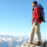
View from top of Gubałówka


Former railway track

Sanctuary in Ludźmierz

Nowy Targ

White Dunajec and Black Dunajec merging into Dunajec

Dunajec river

Church in Łopuszna

Steep climb to Czorsztyn castle

The Czorsztyn Castle


Białka's Gorge

Dunajec Gorge

Dunajec Gorge

Dunajec Gorge

Krościenko


Bridge over Poprad river, connecting Poland and Slovakia

Szczawnica, suspended pedestrian brigde

A bridge over a bridge


Stary Sącz
Recent Trips
 Peter Dunsby
Three Rocky Peaks
2013-02-02
3.8 km2.4 mi
4h:10m
29 photos
Peter Dunsby
Three Rocky Peaks
2013-02-02
3.8 km2.4 mi
4h:10m
29 photos


If you like scrambling and exploring nooks and crannies, this one is for you. There are also breathtaking views over Constantia Nek and Orange Kloof, making the bushwhacking efforts worthwhile.
Peter Dunsby
Hole in the wall
2013-01-27
8.9 km5.5 mi
5h:07m
48 photos


A walk that has everything from magnificent views over Orange Kloof, to squeezing through a "Hole in the Wall" to emerge in a hidden indigenous forest.
 timo_harris13
Newberry Hill Heritage Park: Blue Gate-Old Timber-Wolf Ridge-Beaver Loop
2013-01-26
3.8 km2.4 mi
0h:58m
4 photos
timo_harris13
Newberry Hill Heritage Park: Blue Gate-Old Timber-Wolf Ridge-Beaver Loop
2013-01-26
3.8 km2.4 mi
0h:58m
4 photos


Stringing together another route on the north end of the park... There are a lot of combos and variety for shorter hikes on the north end. One of these days I'll have time to start hiking the south end (the loops are much longer in that section).
 Karol Szklarski
The frozen lake
2013-01-25
32.8 km20.4 mi
3h:36m
20 photos
Karol Szklarski
The frozen lake
2013-01-25
32.8 km20.4 mi
3h:36m
20 photos


A beautiful sunny weather, about -7 C. Friday, a day off, and a winter bike trip to post some pictures on Facebook and irritate friends at work :-)
The lake makes funny noises when a bike rides over the ice.
Experience gained: the best snow to ride is in the woods, on rarely visited paths. The worst is ex aequo fresh virgin snow and a city snow, mixed with sand.
Peter Dunsby
Three firs, Tranquility and a Skeleton
2013-01-20
11.4 km7.1 mi
5h:48m
44 photos


A lovely hike across the mountain, starting with a stroll along the Pipe Track and then making a rapid assent up the Three Firs route. From the top, we crossed Slangolie ravine and made a detour to the subterranean cracks which shelter a number of ancient yellowood trees, and out onto a marvellous breakfast deck with a magnificent views of Camps Bay and Lion's Head below.
Karol Szklarski
Zimowo do Gdyni i z powrotem
2013-01-13
52.9 km32.9 mi
6h:13m
9 photos


Ambitny plan był taki, żeby wziąć udział w przejeździe Mikołajów na rowerach z Gdyni do Gdańska z okazji WOŚP.
https://www.facebook.com/events/442271012505347/
W praktyce mimo że się strasznie spieszyłem to spóźniłem się jakieś 15-20 minut i na miejscu nie napotkałem żadnego rowerzysty.
 Manuel Menezes de Sequeira
Halfway through the old railroad from Évora to Arraiolos
2013-01-01
32.7 km20.3 mi
5h:10m
39 photos
Manuel Menezes de Sequeira
Halfway through the old railroad from Évora to Arraiolos
2013-01-01
32.7 km20.3 mi
5h:10m
39 photos


New Year. We started from my in-laws for rent apartment. The beginning of the "ecovia" is ugly. Disheveled backyards, trash, a stream turned sewer, barking, little, irritating dogs everywhere. Soon, though, we left the outskirts of Évora and started cycling through beautiful, flowery fields, egrets, eagles, magpies, crows, and lots of other birds flying by.
 Neal Pinder-Packard
Soggy Nostell Priory
2012-12-31
3.2 km2 mi
1h:31m
8 photos
Neal Pinder-Packard
Soggy Nostell Priory
2012-12-31
3.2 km2 mi
1h:31m
8 photos


New Year's Eve wander around the Parkland. Weather was awful, especially when walking up to the obelisk, which is why we cut across to the path coming back down.
 Joe McDougall
GoPro Test1 - Rocky Peak Fire Rd
2012-12-28
7.6 km4.7 mi
1h:56m
29 photos
Joe McDougall
GoPro Test1 - Rocky Peak Fire Rd
2012-12-28
7.6 km4.7 mi
1h:56m
29 photos


This was a test of my GoPro Hero2 to see how the non-geocoded time-lapse photos registered with my Everytrail track. Once uploaded, it took me a few attempts to place the photos. The problem was that I couldn't tell which end point was the beginning and which was the end. The result was that all of my photos kept clustering in one location.
Karol Szklarski
Most wantowy nocą
2012-11-30
21.2 km13.2 mi
1h:52m
6 photos


Mała wycieczka po pracy. Ostatnio tak mi łatwiej niż w weekendy :)
Dojazd ścieżką z betonowych płyt od wschodniej strony mostu. Trzeba jadąc siódemką przekroczyć oś mostu i skręcić w lewo. Trafiłem w odpowiednią ścieżkę posiłkując się gps-em i widokiem satelitarnym google maps. Trochę mokro, ale bez błota.
Podświetlony most robi wrażenie.