- Join and explore over 7600 trips and over 97300 photos
- Record a gps trail of your hike, bicycle journey or vacation. Take photos during your trip
- Share the map and photos presentation with your family and friends
- Create Facebook album or embed the presentation on your blog
Map
Photos
Recent Trips
 Peter Rathmann
Dublin - Alamo
2016-07-18
41.1 km25.5 mi
3h:11m
7 photos


Valley Spokesmen club ride held on Monday and Thursday mornings leaving from the Dublin location of Livermore Cyclery and using various routes. Today we rode up to the Peet's Coffee in Alamo Plaza.
 Peter Rathmann
Danville - Manning Rd. loop
2016-07-16
82.2 km51.1 mi
4h:12m
16 photos


Ride by the Feather Pedals group of the Valley Spokesmen club. Starting at the Park&Ride lot on Sycamore and I-680, we rode east on Camino Tassajara to Highland and then up Collier Canyon to Carneal and Manning. Our return on Highland back to Tassajara added a number of out-and-backs on dead-end roads: Victorine, Marciel, Johnson, and Finley.
 Skator
do Książek i z powrotem
2016-07-16
104.2 km64.8 mi
7h:06m
88 photos


Jak zwykle drogami bocznymi lub wręcz polnymi. Tym razem nadmiar nieoczekiwanych i niezwykłych "atrakcji". W drugiej części drogi jedna guma a potem... znowu guma. W nowej dętce.
 Karol Szklarski
Marzęcino
2016-07-16
76 km47.2 mi
9h:19m
28 photos


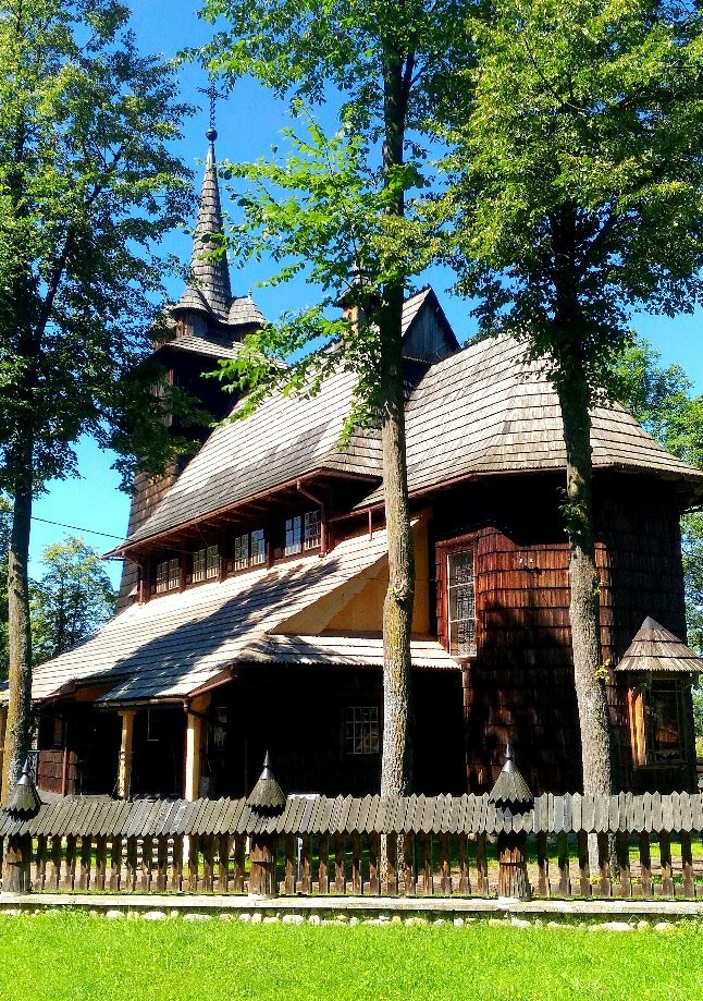
W Tragaminie skręciłem jakoś za wcześnie i potem przez godzinę czy półtorej łaziłem po jakichś miedzach. Potem na szczęście było już lepiej. Fajny kościółek w Myszewie i drugi imponujący w Kmiecinie. Zwłaszcza drewniana wieża robi wrażenie - dobudowana obok kościoła a nie na nim, z zadaszeniami po bokach i z ośmiokątną izbą w połowie wieży.
 Peter Rathmann
Briones Regional Park Hike
2016-07-10
16.7 km10.4 mi
3h:57m
24 photos


East Bay Casual Hikers outing in Briones Regional Park. Starting at the parking lot near the entrance kiosk off Bear Creek rd. we hiked up the Crescent Ridge, Sunrise, and Buckeye Ranch trails to Russel Peak. After a short snack stop there we made a loop using the Mariposa trail and back on the Russel Peak trail before returning on the Seaborg and Bear Creek trails.
 Peter Rathmann
South San Francisco - Union City (BART-BART Ride)
2016-07-09
75.9 km47.2 mi
5h:40m
34 photos


Valley Spokesmen club ride starting from the South San Francisco BART station and heading south on the peninsula past the San Andreas, Lower & Upper Crystal Springs Reservoirs, and the Pulgas Water Temple to Woodside. We then turned east and had a refreshment stop in Menlo Park before crossing the Dumbarton Bridge and ending our ride at the Union City BART station.
 Karol Szklarski
Szymankowo - Prabuty
2016-07-09
69.9 km43.4 mi
8h:19m
32 photos


Wycieczka półżuławska. Ale po opuszczeniu doliny Wisły mało już ciekawych rzeczy.
W nocy padał deszcz i było jeszcze mokro. W trakcie wycieczki też kilka razy padało, ale krótko. Można było przeczekać w kościele albo pod jakimś daszkiem albo drzewem, od biedy po prostu jechać w gęstej mżawce.
Spora część kościołów po drodze była otwarta.
 Skator
Toruń - Włocławek - Toruń
2016-07-08
135.5 km84.2 mi
10h:43m
123 photos


W końcu się odważyliśmy na trasę 140 km (i tyle wyszło wg licznika na "kole"). Z kąpielą w jeziorze i paroma innymi odpoczynkami wyszło ok. 10 godzin.
 Peter Rathmann
Augustin Bernal Park hike
2016-07-07
10.3 km6.4 mi
2h:33m
17 photos


Outing of the East Bay Casual Hikers in Augustin Bernal Park in Pleasanton. This park adjoins the East Bay Pleasanton Ridge Park. We started at the trail head at the end of Longview Dr. off Foothill Blvd. and hiked up to the ridgeline.
 Peter Rathmann
Lake Chabot Hike
2016-07-06
12.4 km7.7 mi
3h:59m
21 photos


Hike by Wilma's Wednesday Hikers led today by Pamela. We started at the Marina, headed around the lake on the East Shore trail, then up the Cameron and Proctor trails to the Willow Golf Course where we had a refreshment break. Our return was Ten Hills to Indian Cove and back to the East Shore.
