Petroglyph Canyon
Map Explore
Photos
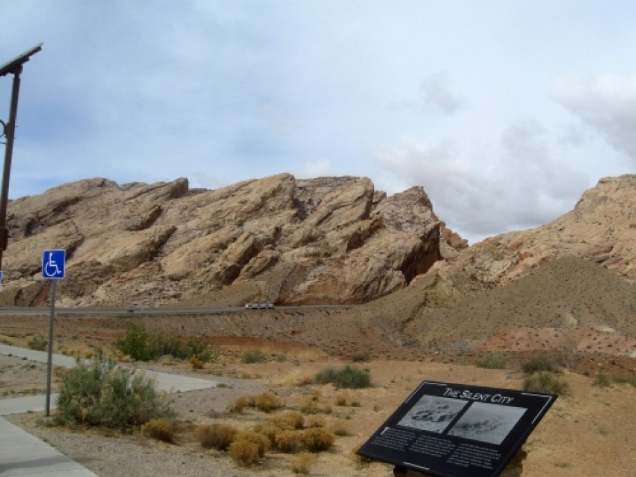
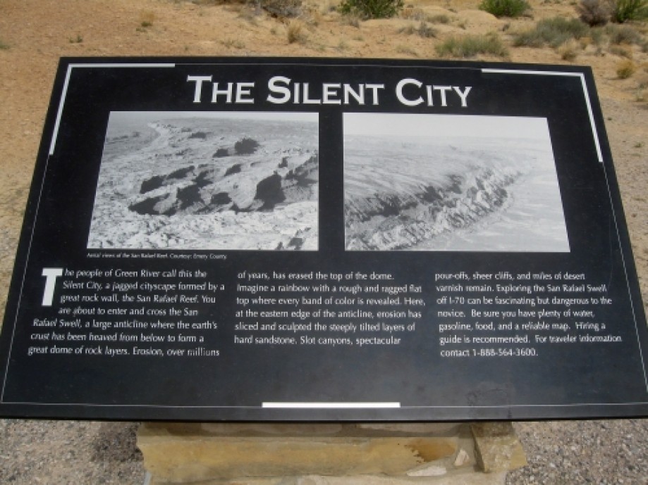
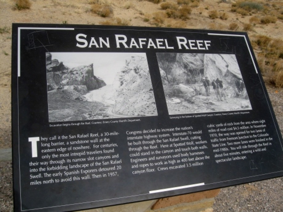
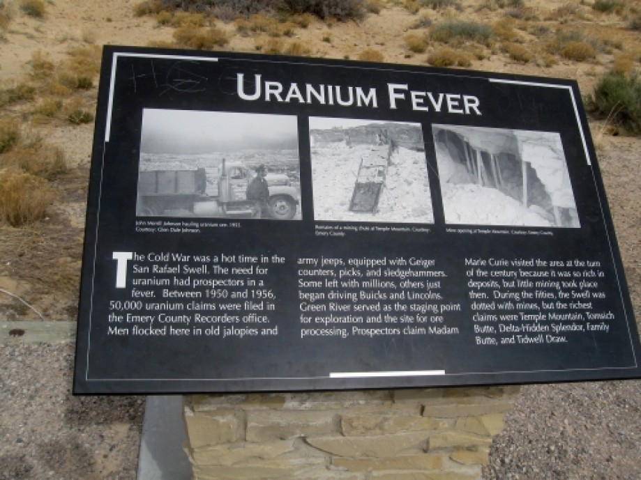
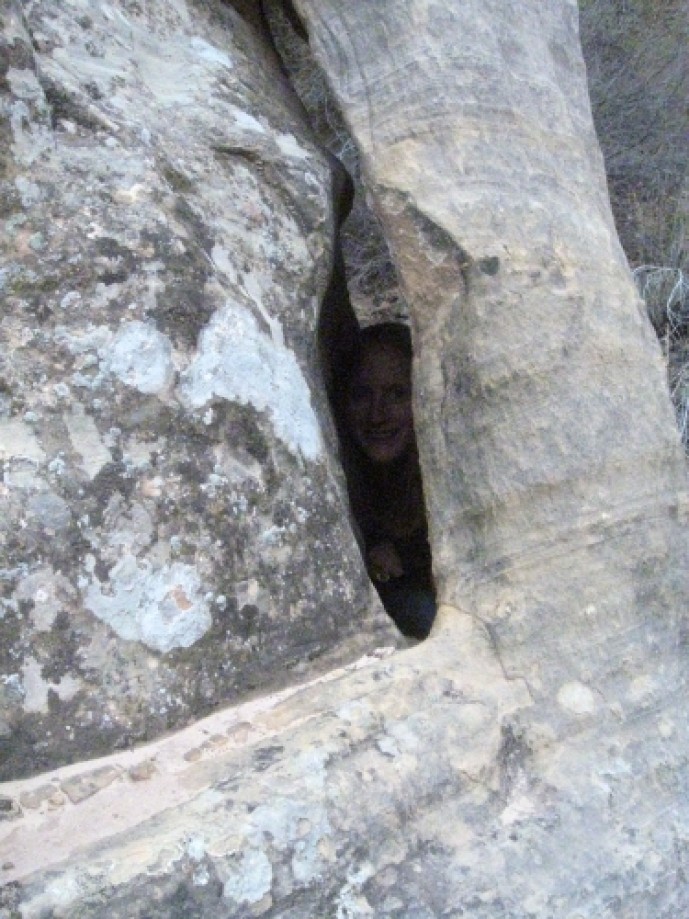
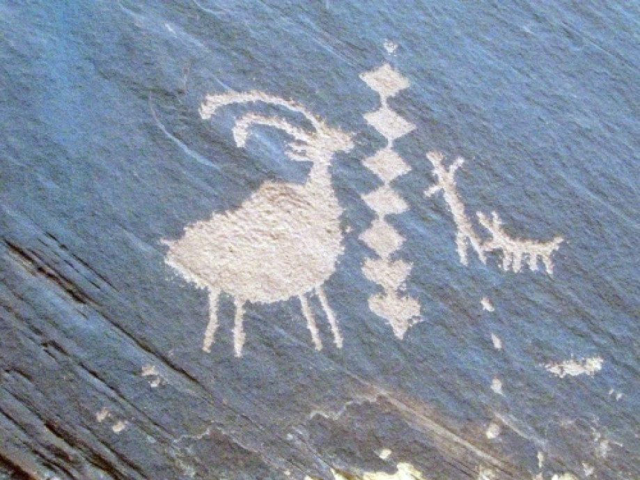
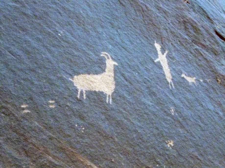
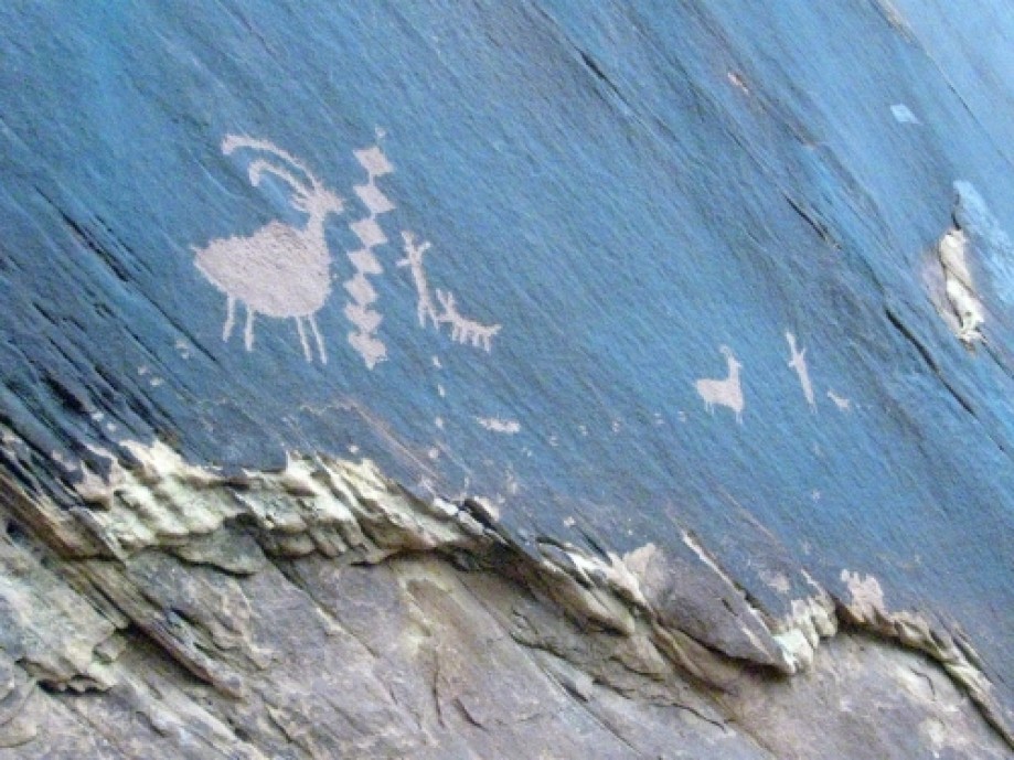
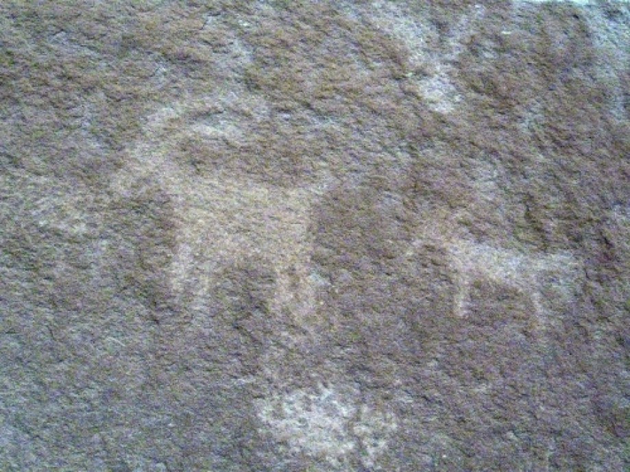
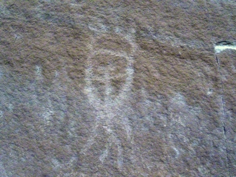
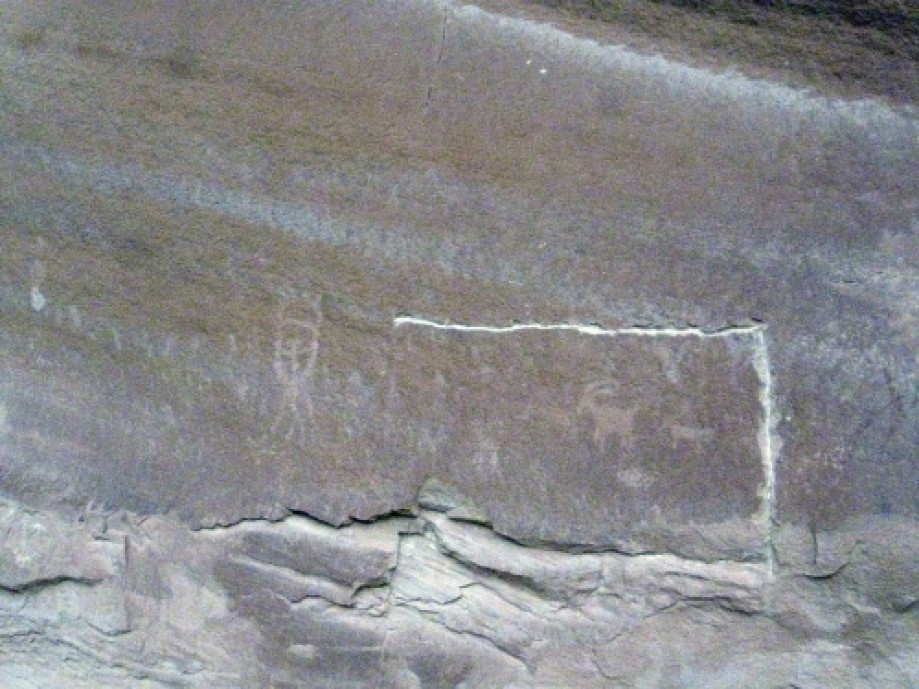
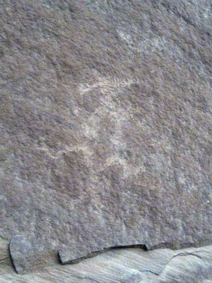
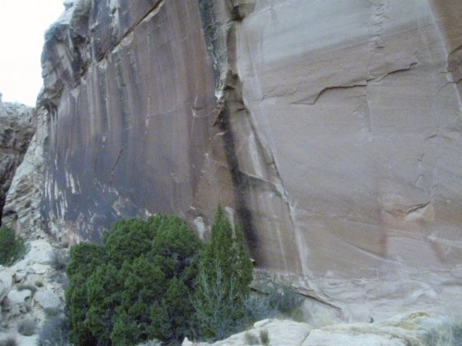
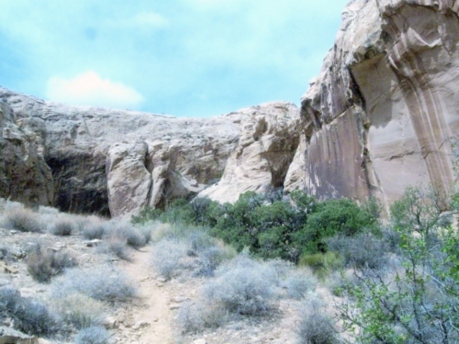
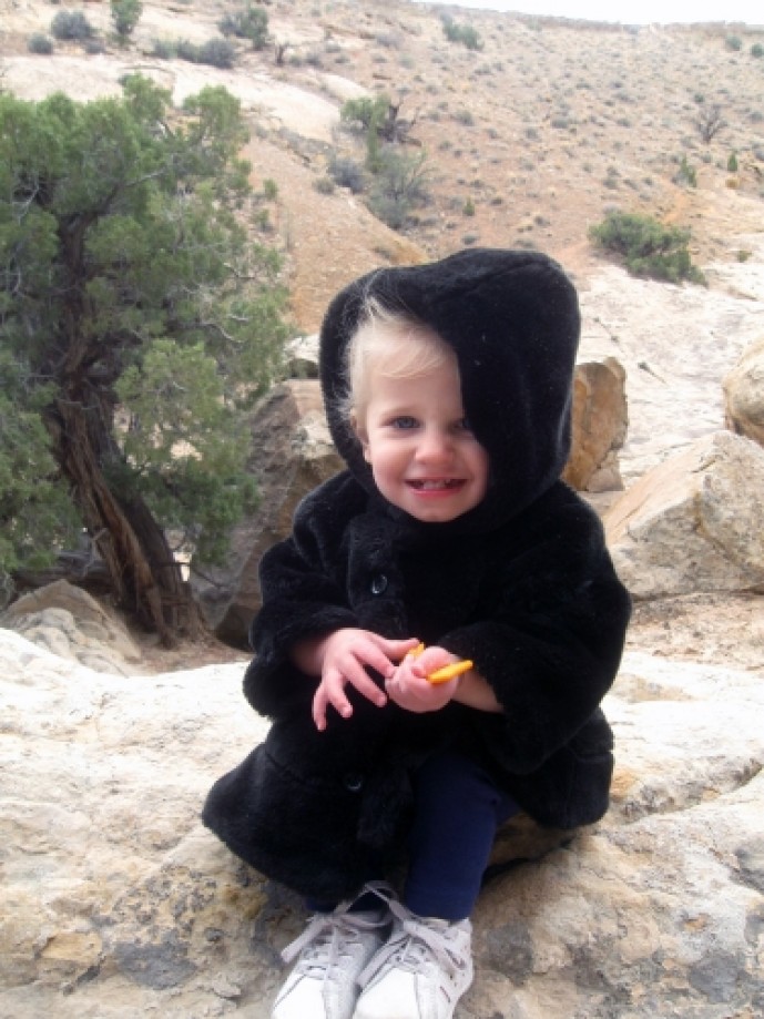
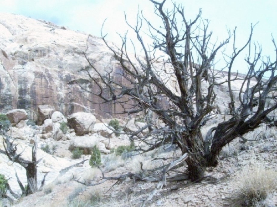
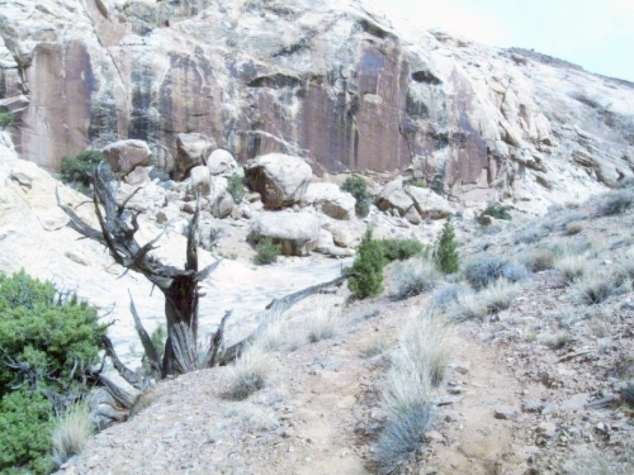
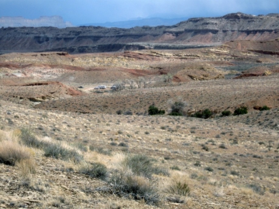
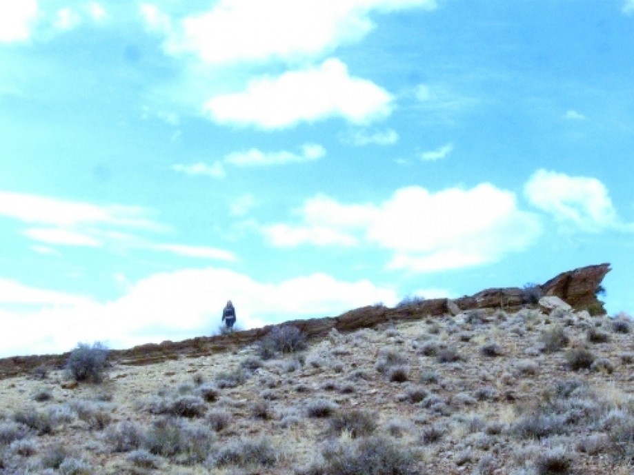
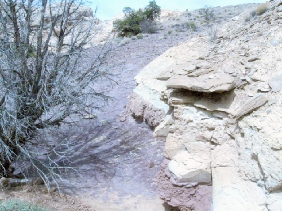
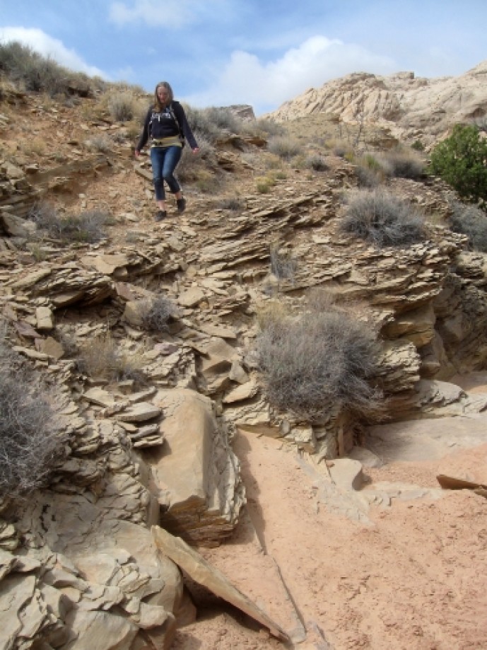
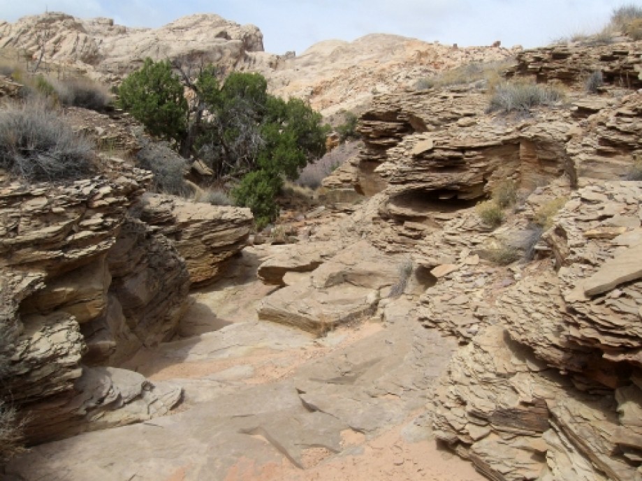
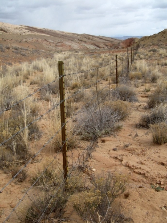
Chart (Mouse wheel zooms in)
Story
The hike to Petroglyph Canyon begins at a rest stop along I-70. There are several signs explaining about the San Rafael Reef.The Silent CityThe people of Green River call this the Silent City, a jagged cityscape formed by a great rock wall, the San Rafael Reef. You are about to enter and cross the San Rafael Swell, a large anticline where the earth’s crust has been heaved from below to form a great dome of rock layers. Erosion, over millions of years, has erased the top of the dome. Imagine a rainbow with a rough and ragged flat top where every band of color is revealed. Here, at the eastern edge of the anticline, erosion has sliced and sculpted the steeply tilted layers of hard sandstone. Slot canyons, spectacular pour-offs, sheer cliffs, and miles of desert varnish remain. Exploring the San Rafael Swell off I-70 can be fascinating but dangerous to the novice. Be sure you have plenty of water, gasoline, food, and a reliable map. Hiring a guide is recommended. For traveler information contact 1-888-654-3600.San Rafael ReefThey call it the San Rafael Reef, a 30-mile-long barrier, a sandstone wall at the eastern edge of nowhere. For centuries, only the most intrepid travelers found their way through its narrow slot canyons and into the forbidding landscape of the San Rafael Swell. The early Spanish Explorers detoured 20 miles north to avoid this wall. Then in 1957, Congress decided to increase the nation’s interstate highway system. Interstate-70 would be built through the San Rafael Swell, cutting through the reef. Here at Spotted Wolf, workers could stand in the canyon and touch both walls. Engineers and surveyors used body harnesses and ropes to work as high as 400 feet above the canyon floor. Crews excavated 3.5 million cubic yards of rock from the area where eight miles of road cost $4.5 million. In November 1970, the way was opened for two lanes of traffic from Fremont Junction to the Colorado State Line. Two more lanes were finished in the mid-1980s. You will ride through the Reef in about 5 minutes, entering a wild and spectacular landscape.Uranium FeverThe Cold War was a hot time in the San Rafael Swell. The need for uranium had prospectors in a fever. Between 1950 and 1956, 50,000 uranium claims were filed in the Emery County Recorders office. Men flocked here in old jalopies and army jeeps, equipped with Geiger counters, picks, and sledgehammers. Some left with millions, others just began driving Buicks and Lincolns. Green River served as the staging point for exploration and the site for ore processing. Prospectors claim Madam Marie Curie visited the area at the turn of the century because it was so rich in deposits, but little mining took place then. During the fifties, the Swell was dotted with mines, but the riches claims were Temple Mountain, Tomsich Butte, Delta-Hidden Splendor, Family Butte, and Tidwell Draw.Trail BetaThe traditional trail to Petroglyph Canyon begins at a parking area at the end of a dirt road that spurs off from I-70 around pile post 147. However, we were not aware of this until after the fact. So instead, we parked at the rest stop and made our own trail. The only hiccup was that we had to cross a barbed-wire fence. It wasn't too bed because there were plent of places to squeeze through.We dropped down into the main wash then climbed over a small hill into another wash.This wash was really cool because it was full of layered slate.At the top of the wash was a large slab of very purple rock. Maybe it was because our eyes were so used ot the red rock, but this rock looked really purple; it was cool.Zac and Bryce were supposed to be hiking with us, but they wandered off on their own, so we ditched them. This is Tara at the top of the ridge seeing if she can spot them.From here, we intersected a small trail that led us to the mouth of Petroglyph Canyon. Our camera white balance got really messed up, so sorry about the pictures.We wandered around the canyon for a bit looking for Spirit Arch, which we didn't find because we were in the wrong canyon.We did find this little arch though. It's located at the top of the canyon on the left.The prtroglyphs in Petroglyphs canyon:The petroglyph panel is small and features two bighorn sheep, a person being bitten by a wolf, and another person next to a small animal.What's unusual about this panel is that all the people and animals have footprints.About 100 feet to the right of the main panel, there is a faded petroglyph panel featuring some bighorn sheep and an anthropomorph.At some point, someone tried to remove a portion of the rock. Tactless.This picture shows both panels. The faded panel is in the lower right, and the good panel is to the left of the trees.Here's Savannah taking a rest from her baby backpack.On our way back, we noticed the parking lot where most people start hiking. Maybe next time...
This trip report is from:
http://dyeclan.com/outdooractivities/hiking/petroglyphcanyon/Other trips at: http://dyeclan.com/outdooractivities/
This trip report is from:
http://dyeclan.com/outdooractivities/hiking/petroglyphcanyon/Other trips at: http://dyeclan.com/outdooractivities/