White Rim Trail
Map Explore
Photos
Beginning of Shafer Trail off Island in the Sky Road
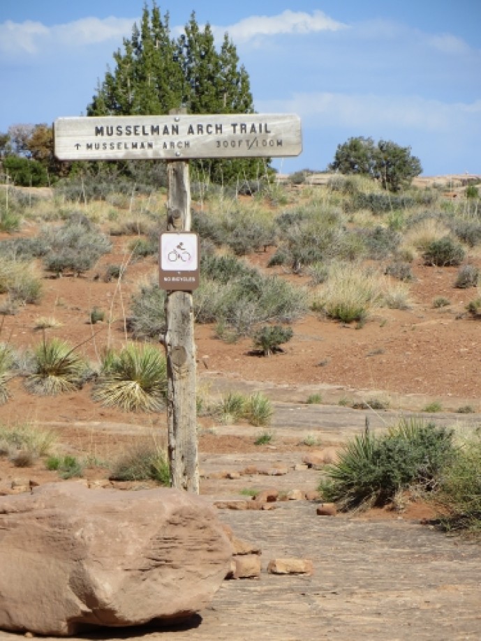
Musselman Arch Trailhead
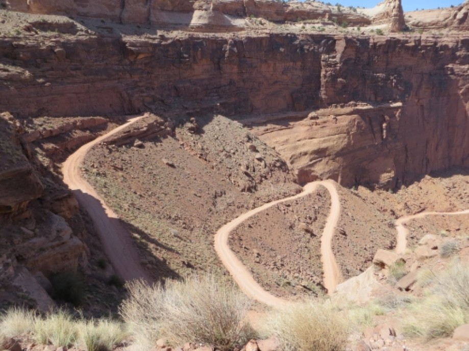
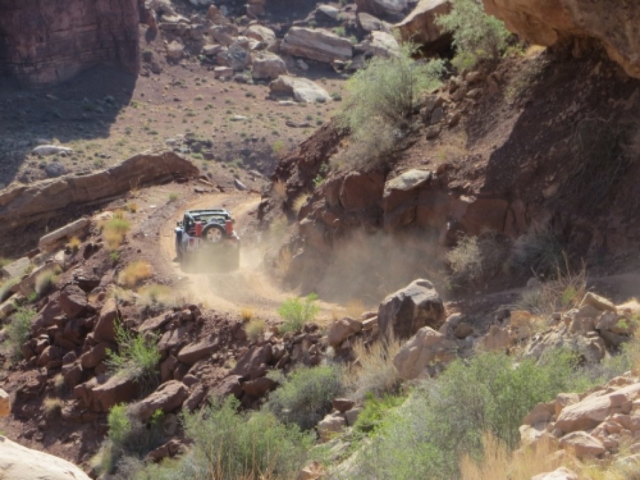
Looking down the Shafer switchbacks
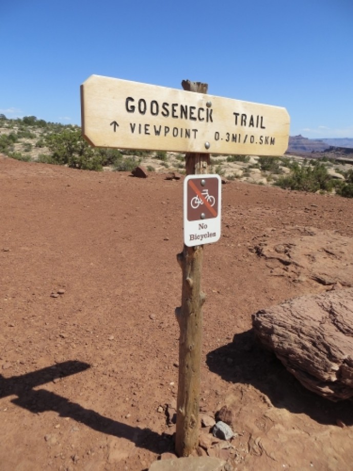
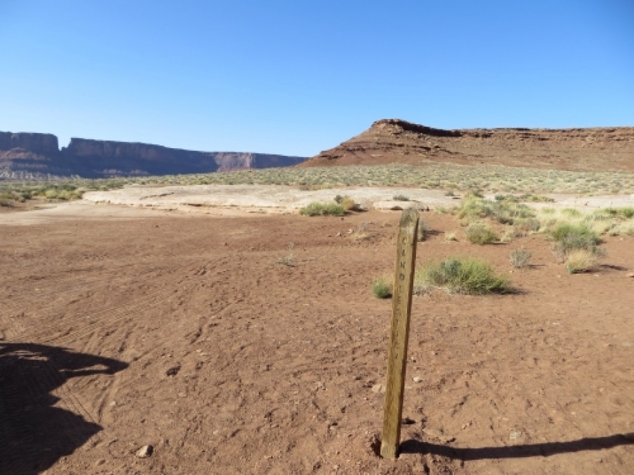
Gooseneck Trailhead
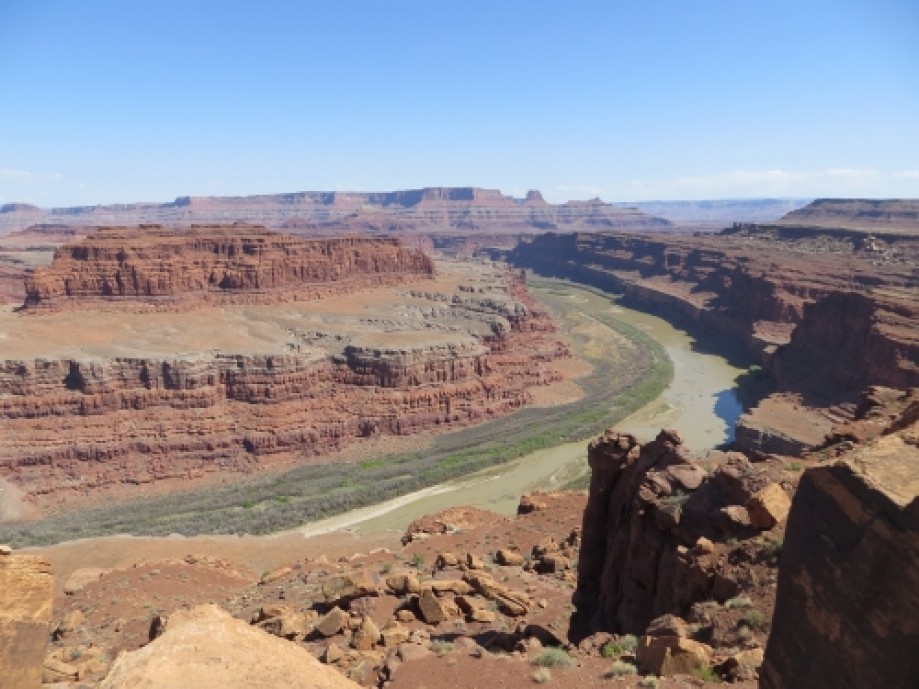
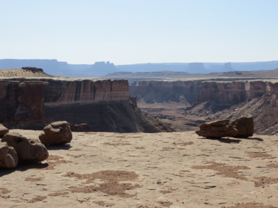
Gooseneck Overlook
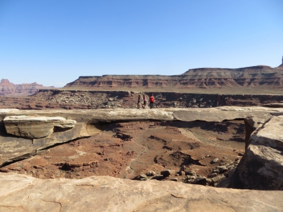
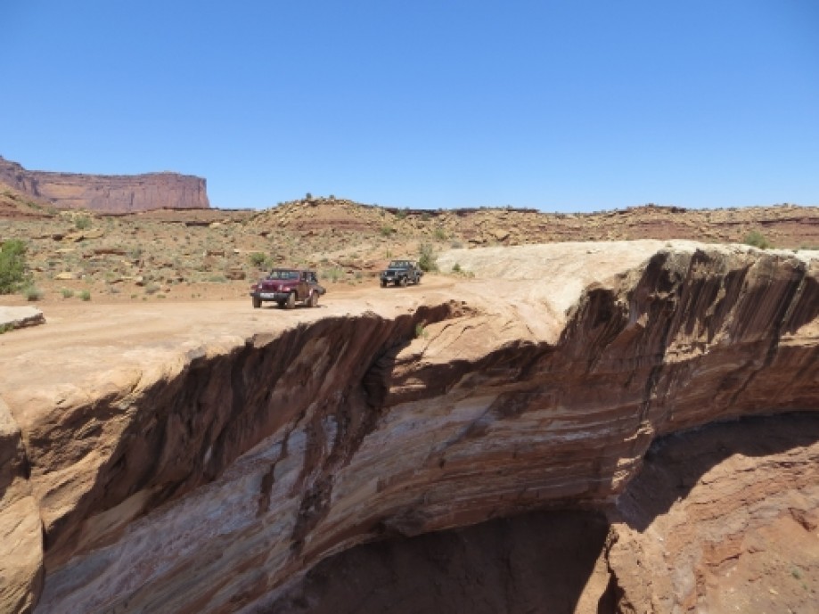
Musselman Arch
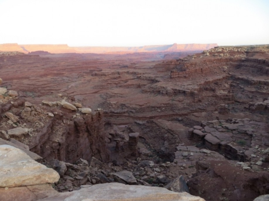
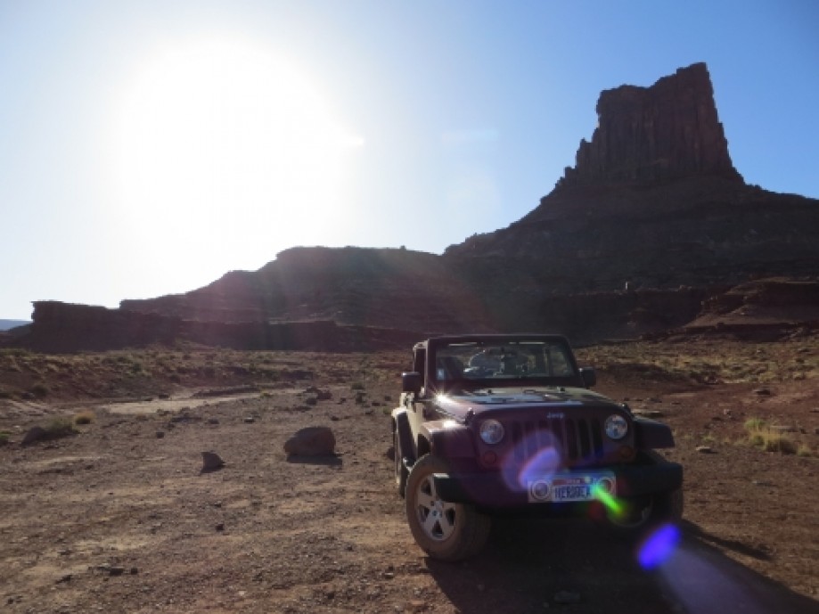
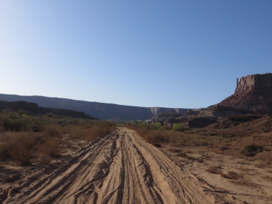
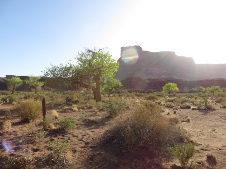
View from White Rim at Airport Campsite
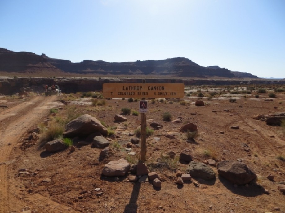
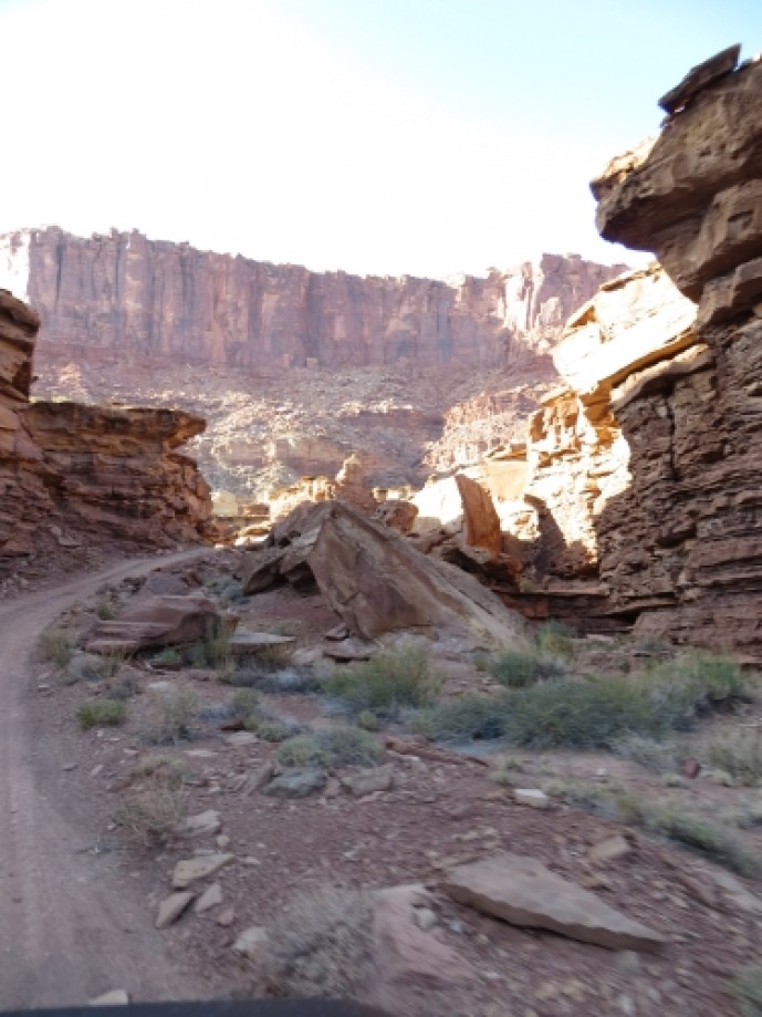
Top of Lathrop Canyon
Descending Lathrop Canyon
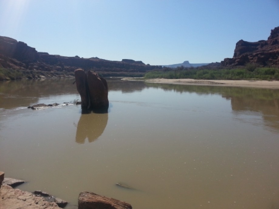
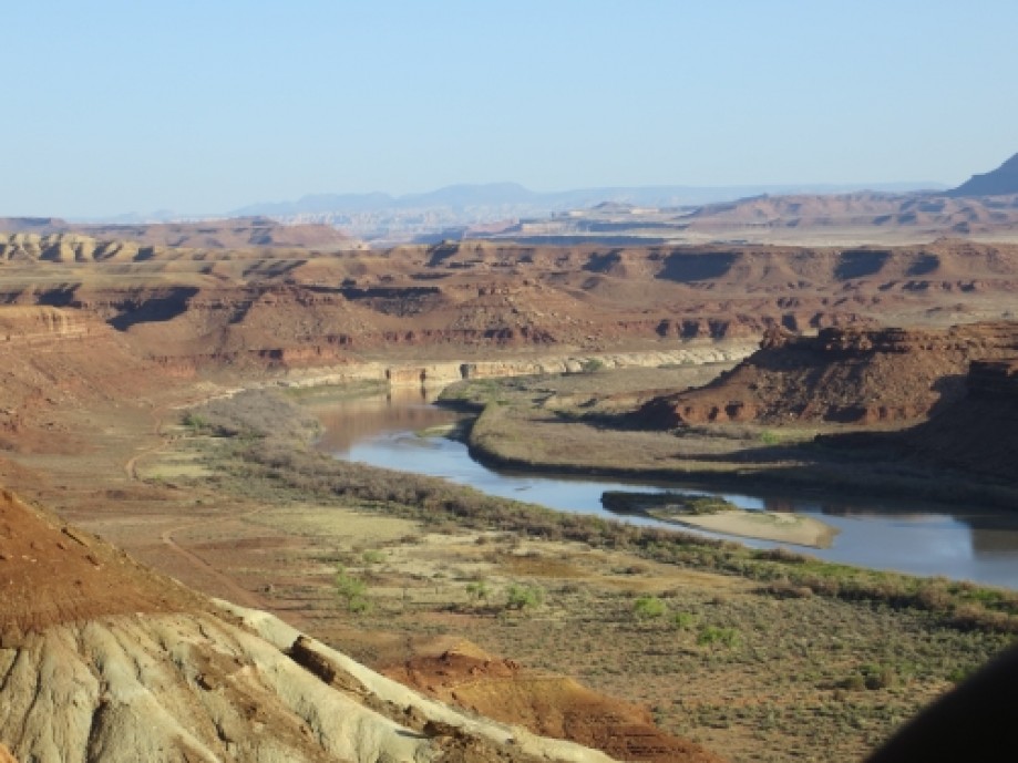
Colorado River at bottom of Lathrop Canyon
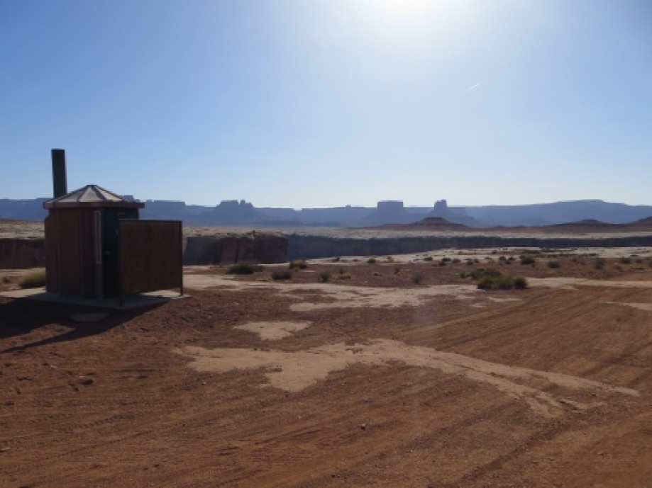
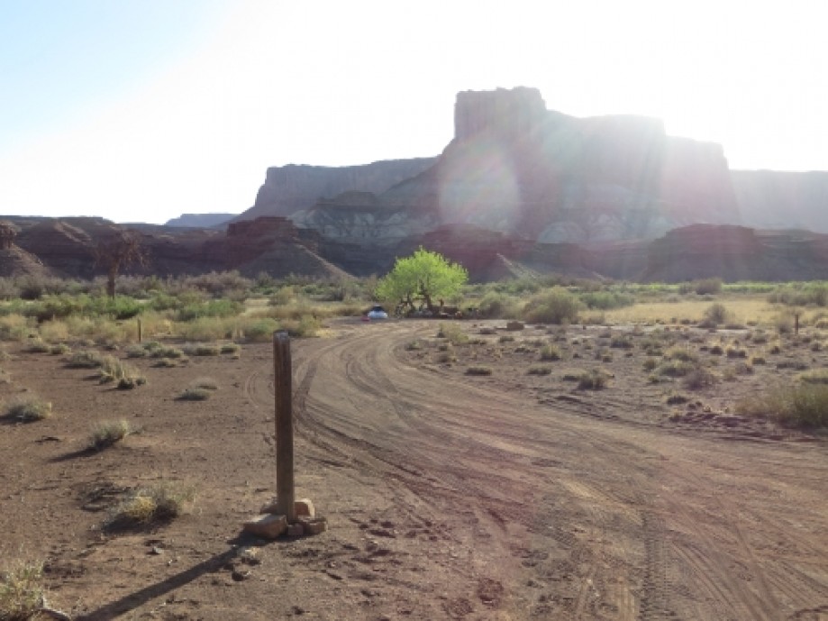
Airport C Campsite
Living on the edge . . .
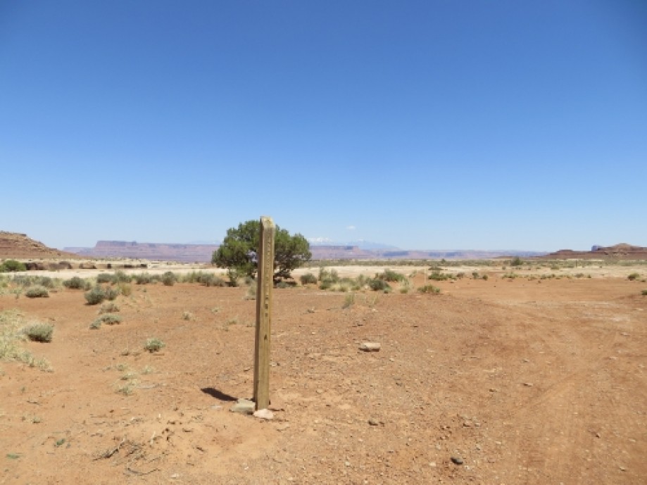
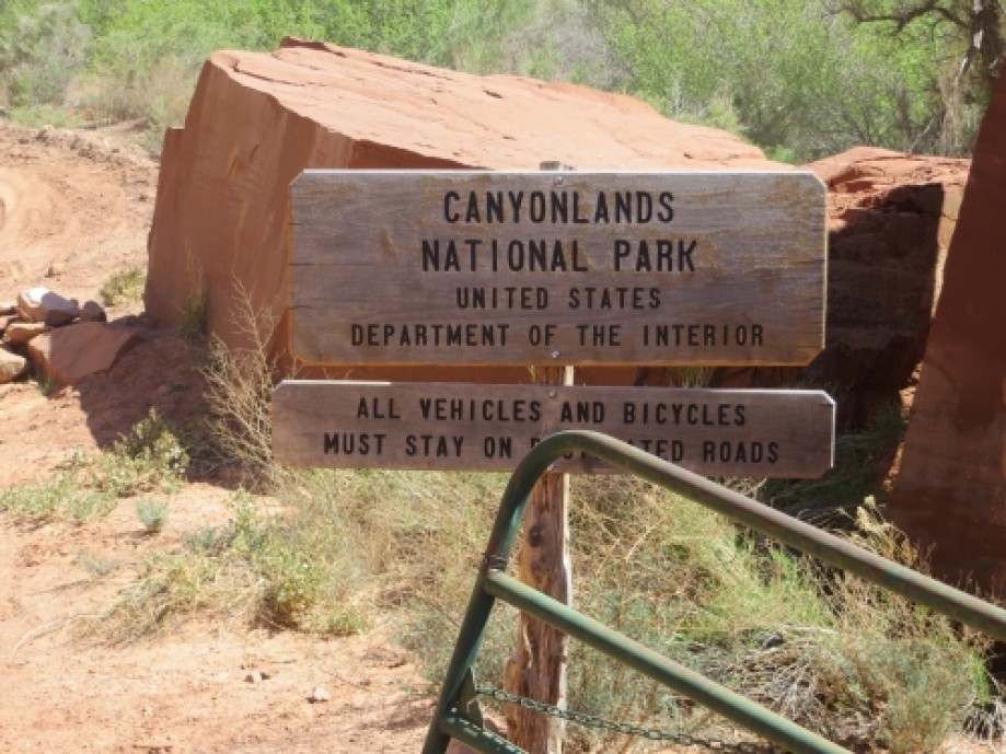
Trailhead
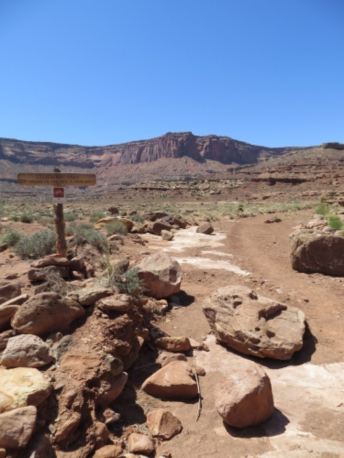
Gooseberry Campsites
Gooseberry Campsites
Spur road to White Crack Campsite
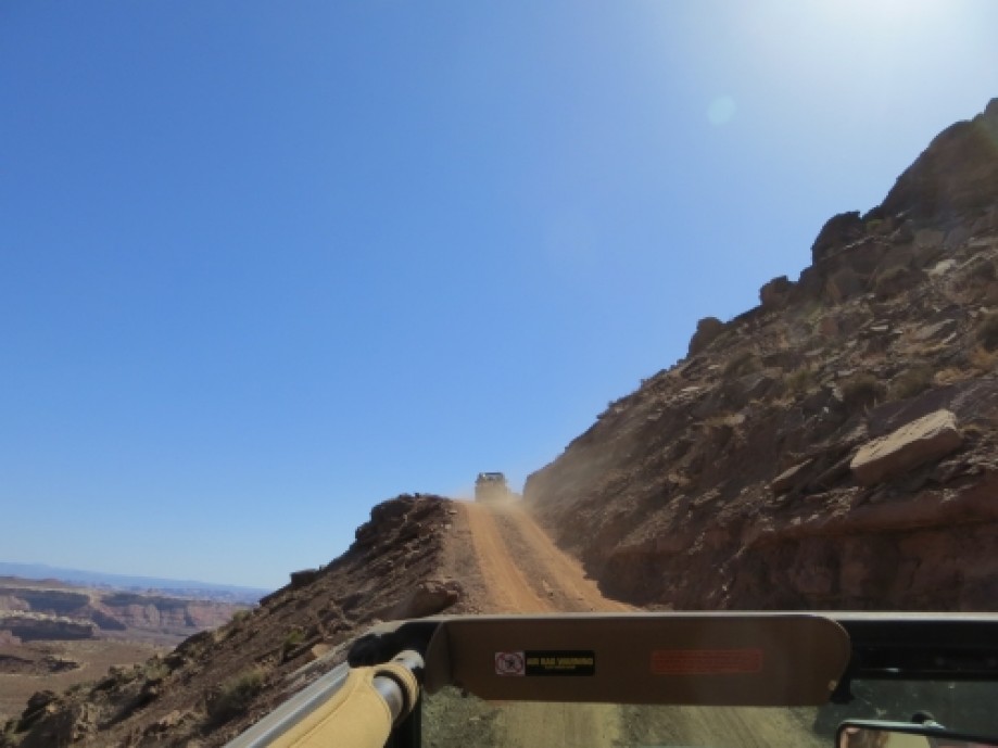
Climbing Murphy's Hogback
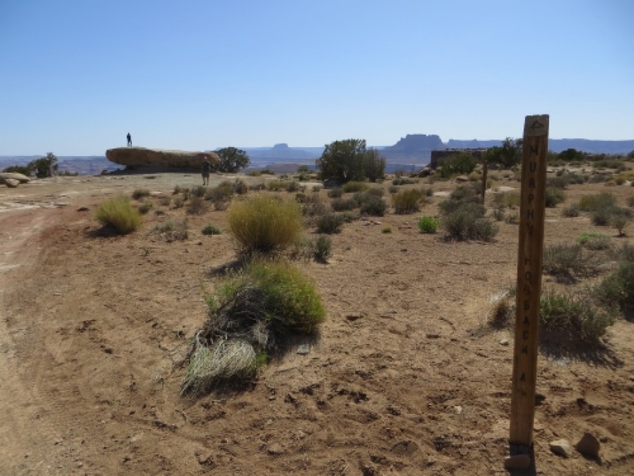
Murphy Campsite A
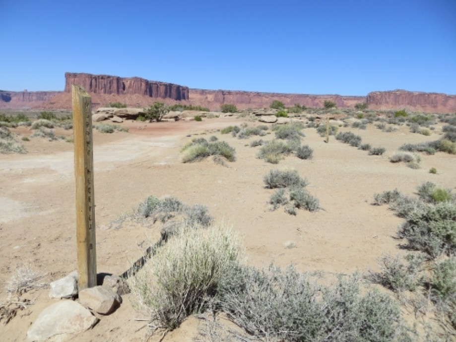
Murphy Campsite B
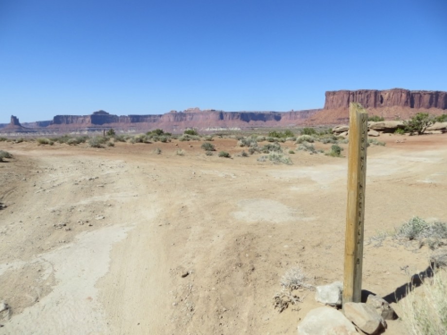
Murphy Campsite C
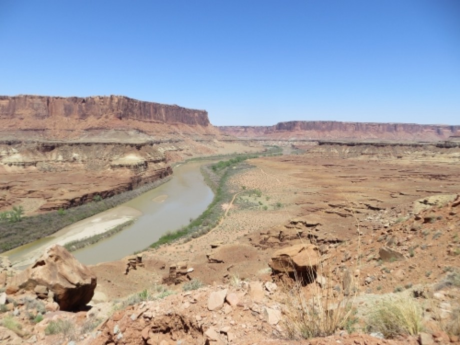
Looking out toward the Green River
Candlestick Campsite
View from Candlestick
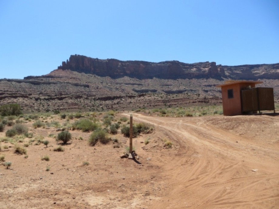
Trailhead
Sandy section of road near Potato Bottom
Potato Bottom Campsite
Potato Bottom Campsite
Beginning of Hardscrabble Hill
View from top of Hardscrabble
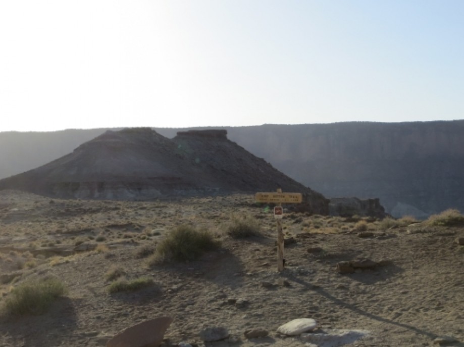
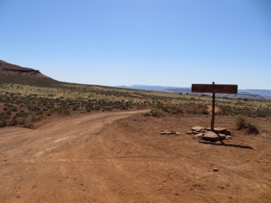
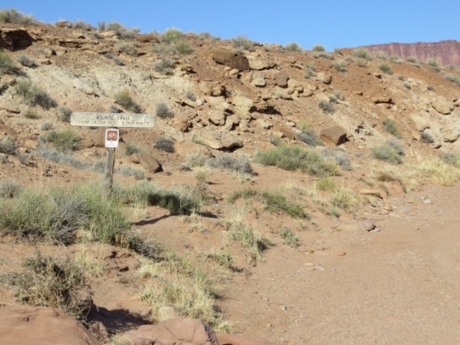
Fort Bottom Trailhead
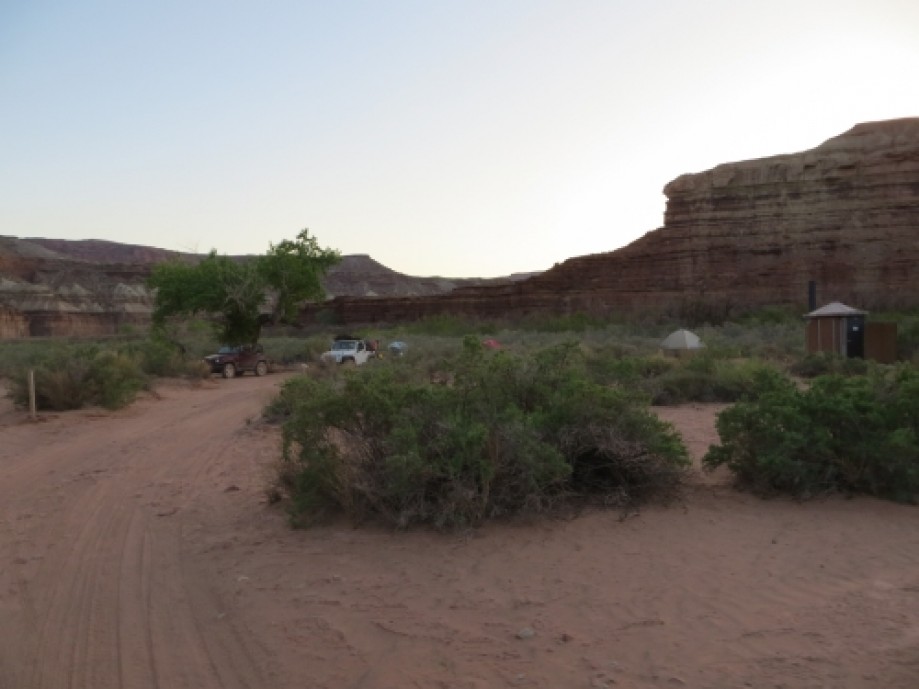
Hardscrabble A Campsite
View looking down at Hardscrabble Campsites
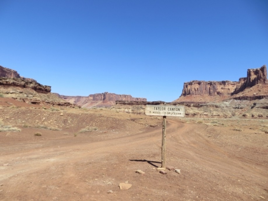
Taylor Canyon
Labyrinth Campsites
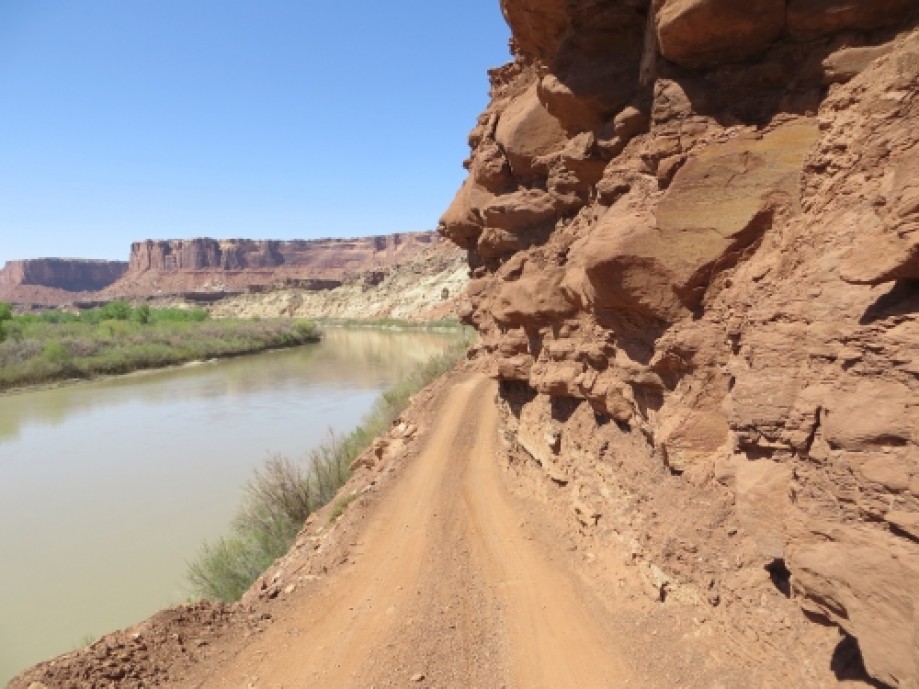
Narrow road along Green River
End of jeep road on Green River side
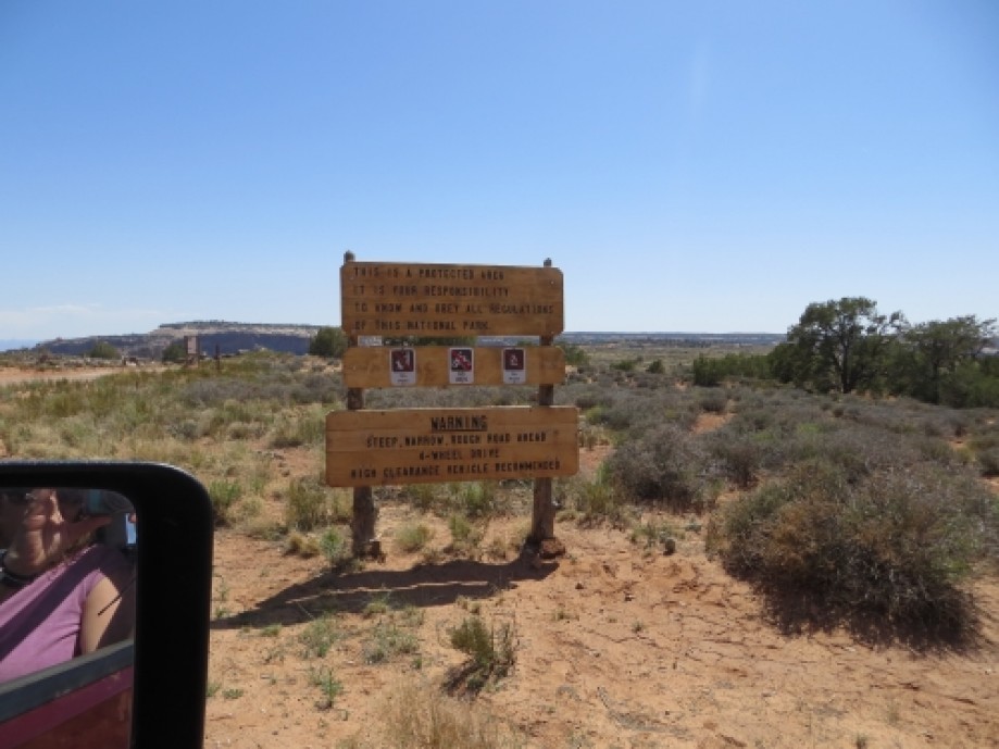
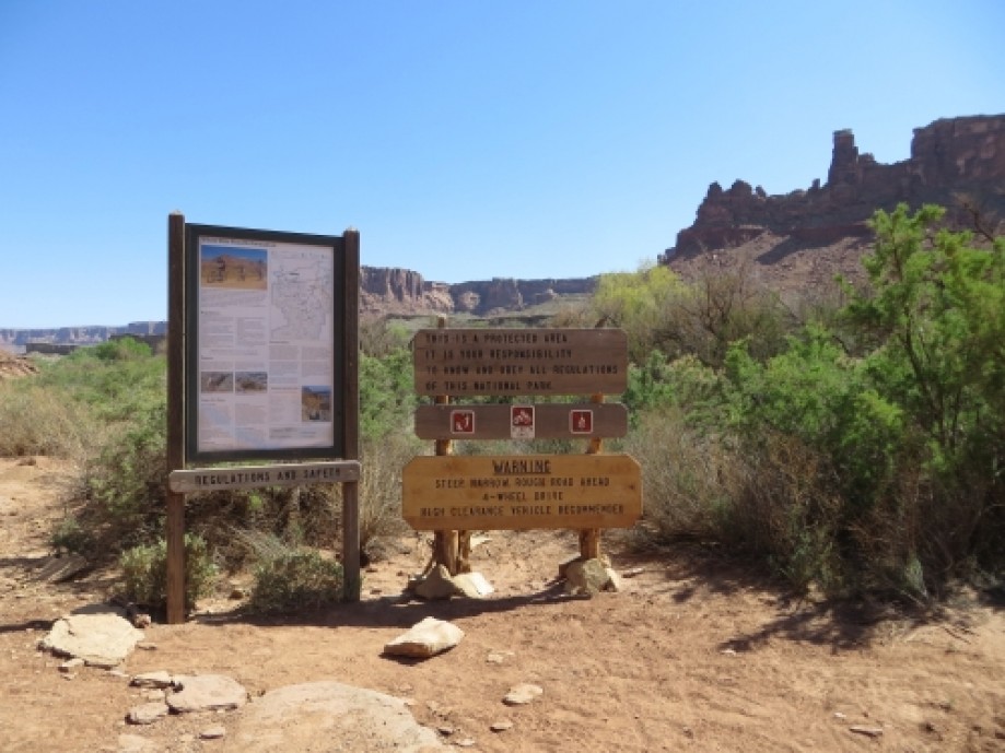
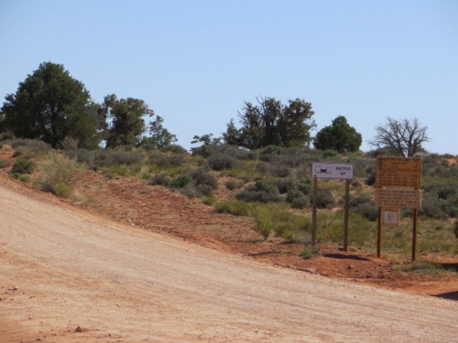
National Park Boundary
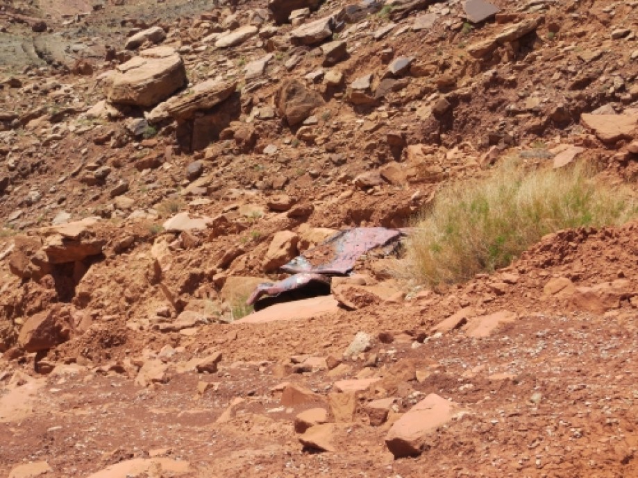
Car wreckage on switchbacks above Mineral Bottom
End of road at Highway 313
Chart (Mouse wheel zooms in)
Story
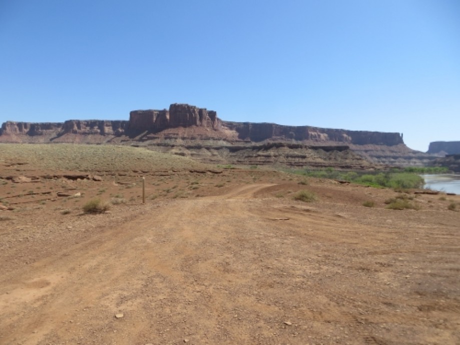
The White Rim Trail has been one of those "bucket list" items for me for years, particularly since owning a jeep. When we moved back to Utah in the summer of 2012, we put this trip high on our priority list. When my in-laws expressed interest in coming, I hurried and secured permits for April 26 & 27, 2013.Words and photos cannot describe the wonder and beauty of this place. It's one thing to view Canyonlands from the Island in the Sky Road or from Dead Horse Point--it's quite another to be halfway down the canyons on the White Rim, with gorgeous views above and below in all directions. The White Rim Trail is approximately 96 miles of gravel and jeep roads, mostly the latter. While some parts of the road are graded and in good condition, other parts are very rocky, bumpy, and rough. Total driving time is about 10-12 hours, depending on conditions. While possible to do the trip in one day, three days or more is the best way to casually work your way along the trail and take in the beauty and wonder that surrounds. We planned our trip in the clockwise direction, starting at the Shafer Road just north of the Island in the Sky Visitor Center. This worked well since we had to go to the Visitor Center to pick up our permit. Almost as soon as the road leaves the pavement, the road begins the steep descent down the Shafer switchbacks. Looking down the steep cliff face to the bottom, one can't help but wonder how in the world a road could be built in such a place. This was an awe-inspiring start of the trip as we descended over 1,500 feet to the White Rim.At the bottom of the switchbacks, the road forks. To the left is the Potash Road, which can be driven all the way along the Colorado River to Moab. The fork on the right is the beginning of the White Rim Trail. The road soon makes its way out to the edge of the White Rim.During the first few miles on the trail we stopped for a quick hike to a viewpoint of the river, and then a short walk out to Musselman Arch. It was quite an experience to walk across the narrow arch.We spent our first night at the Airport C campsite. There are four sites at Airport. The first two, A&B, are very close together and there is not much privacy between sites. Each pair of campsites shares a pit toilet. Sites C&D had a small ridge between the two, which provided some privacy and separation between the two sites. We were hardly aware that we had neighbors, even though their site was only about 50 yards away.The views from the Airport sites are outstanding. Directly above the site is the beautiful formation called "Airport Tower." Just 50 yards from the site is the edge of the White Rim. Looking down and out from the rim you see an incredible maze of canyons below, with glimpses of the Colorado River as it winds its way through the canyons. In the distance is a beautiful view of the La Sal mountain range and more red-rock formations on the other side of the canyon. The lighting at sunset was incredible.The following morning we made a slight backtrack to the Lathrop Canyon Road. This 3-mile road descends steeply through the canyon and ends at the Colorado River. This road was less maintained than the White Rim, but was a fun adventure in our jeeps. Parts of the road follow a sandy wash that leads into the Colorado. This was definitely a worthwhile side trip, and is the only part of the trail that provides access to the Colorado River.After driving back out of Lathrop Canyon, we broke camp and continued our journey down the White Rim. The road weaves in and around the various side canyons. It was interesting to drive for several miles and look back at the Airport Tower to see that we had only traveled about a mile or two as the crow flies. We stopped for lunch near the Gooseberry campsite group. The views here were similar to Airport, although I think the campsites at Airport were better. Eventually, the road reaches the apex of the White Rim. A spur road leads about 1.5 miles to the White Crack campsite. We did not take this side trip, but a gentleman we talked to on the road said the views from White Crack were oustanding, looking in one direction down into the Needles District, and the other direction into the Maze District.The road and scenery on the Green River side were different, but still beautiful. The White Rim is less pronounced, and the road has much more elevation change as it follows some of the gentle ups and downs along the canyon rim. The canyons below the road were not quite as intricate and intense as on the Colorado side, but had their own unique beauty.After several miles, we arrived at Murphy's Hogback. The road makes a steep climb over a difficult hill. We had no problem getting up the hill, but I can imagine it would be a challenge in wet conditions. At the top of Murphy's, there are three campsites. Campsite A was a real gem. The campsite went right to the canyon rim, with beautiful views down into the river and across into the Maze. The other sites were on there side of the road and not quite as scenic. The road continues to meander up and down along the terrain for several miles. The women in our group appreciated the access to pit toilets at each campsite, which seemed to be strategically placed every 10-20 miles. The next campsite was Candlestick, and this was certainly the least desirable site we saw along the entire road. The terrain was very barren and the scenery wasn't great compared to other parts of the road (although I'm sure if you independently stumbled upon Candlestick it would be very beautiful.)We continued on from Candlestick, gradually descending lower toward the Green River. We were excited that our next campsite would be close to the river, as we were all covered head-to-toe in dirt and dust by this time. The road eventually descends into Potato Bottom, where two nice campsites are near the river. From Potato Bottom we reached my personal favorite part of the trip, Hardscrabble Hill. The road makes a steep, winding ascent before reaching the Fort Bottom Trail at the top. After descending the other side, we arrived at our second camp, Hardscrabble A. This was a lovely campsite with a nice tree, shrubbery, and welcomed shade (quite a change from the scenery of the past two days. The river was just a stone's throw away from the campsite, but was difficult to access due to the thick overgrowth. About 100 yards beyond our site was Hardscrabble B, which, in my opinion, is the best campsite along the entire trail. It is tucked away against Hardscrabble Hill with direct access to the Green River. Our neighbors were kind enough to let us use their river access to take a quick dip. It was cold and refreshing--a perfect ending to a hot, dusty day.The next morning we drove back up Hardscrabble Hill to the Fort Bottom Trail. The trail follows a narrow outcropping for 1.5 miles to some old Indian ruins. The ruins were nothing spectacular, but the hike was a nice change of pace and a good opportunity to stretch our legs. The views were nice up the canyon toward Hardscrabble and down toward Potato Bottom.After the hike we broke camp and continued on for the last stretch of the journey. This stretch of the road had some very sandy spots as it followed the along the path of the river. Taylor Canyon is a 4-mile spur road that goes up toward the rock formations of Moses and Zeus. We were running short on time, so we weren't able to take this side trip. It looked like a fun road, though. A few miles later the road leaves the national park. The road itself continues to improve until it meets up with the Horsethief Road at Mineral Bottom. From there, the remainder of the road is a nice, graded gravel road. From the river the road ascends up some more steep switchbacks until it arrives once more on the plateau. The road continues through the desert landscape on the plateau for several miles until it meets up with the highway only a few miles up from where the journey began.After three long days, we were hot, sweaty, dirty, dusty, and exhausted, but couldn't help but look back and ponder on the incredible journey we had just finished. This will certainly be a trip that is worth repeating.
NOTE: Permits required for all overnight stays on the White Rim. The best and highest demand times are in the spring and fall. Late April was perfect. Permits are available one year in advance. We secured our permit in September, but there were limited sites and dates available even that far in advance.The trail is suitable for any stock, high-clearance 4-wheel drive vehicle. There are a few tight spots on the switchbacks that may require a three-point turn for vehicles with a longer wheelbase, but nothing that would cause problems.While possible to do the road in one day, I wouldn't recommend it. Two days would be okay, but I would recommend at least three days to really be able to take your time and enjoy it. The second day was about 50 miles for us, and by the end of it everybody was pretty tired of being jostled around in a jeep. If we were to do it again, we would try to do it in four days to ensure we had plenty of time to do all the side trips, and to have time to relax in the mornings and evenings at camp.If I were to do a four-day trip, I would stay at Airport C or D, White Crack, and Hardscrabble B for my three nights. I like the clockwise direction because we enjoyed camping by the river for our last night. Also, the Shafer switchbacks is a memorable way to begin a trip. Otherwise, I don't see a significant difference in the direction of travel.Bring lots and lots of water. We brought over 30 gallons for 8 people for 3 days and had plenty, but it was nice to be able to share with some bikers who were making the journey without a support vehicle.
NOTE: Permits required for all overnight stays on the White Rim. The best and highest demand times are in the spring and fall. Late April was perfect. Permits are available one year in advance. We secured our permit in September, but there were limited sites and dates available even that far in advance.The trail is suitable for any stock, high-clearance 4-wheel drive vehicle. There are a few tight spots on the switchbacks that may require a three-point turn for vehicles with a longer wheelbase, but nothing that would cause problems.While possible to do the road in one day, I wouldn't recommend it. Two days would be okay, but I would recommend at least three days to really be able to take your time and enjoy it. The second day was about 50 miles for us, and by the end of it everybody was pretty tired of being jostled around in a jeep. If we were to do it again, we would try to do it in four days to ensure we had plenty of time to do all the side trips, and to have time to relax in the mornings and evenings at camp.If I were to do a four-day trip, I would stay at Airport C or D, White Crack, and Hardscrabble B for my three nights. I like the clockwise direction because we enjoyed camping by the river for our last night. Also, the Shafer switchbacks is a memorable way to begin a trip. Otherwise, I don't see a significant difference in the direction of travel.Bring lots and lots of water. We brought over 30 gallons for 8 people for 3 days and had plenty, but it was nice to be able to share with some bikers who were making the journey without a support vehicle.