Inca Trail
| Date | 2012-05-18 |
| Distance | 37.4 km23.2 mi |
| Duration | 1 day 9h:53m |
| Photos | 192 |
Map Explore
Photos
DSC06520.JPG
DSC06510.JPG
DSC06514.JPG
DSC06515.JPG
DSC06516.JPG
DSC06519.JPG
DSC06521.JPG
DSC06523.JPG
DSC06524.JPG
DSC06525.JPG
DSC06526.JPG
DSC06527.JPG
DSC06529.JPG
DSC06530.JPG
IMG_0120.JPG
IMG_0122.JPG
IMG_0123.JPG
IMG_0125.JPG
IMG_0126.JPG
IMG_0124.JPG

DSC06531.JPG
DSC06532.JPG
DSC06533.JPG
DSC06534.JPG
DSC06535.JPG
DSC06536.JPG
DSC06538.JPG
DSC06539.JPG
DSC06540.JPG
IMG_0127.JPG
IMG_0128.JPG
IMG_0129.JPG
DSC06544.JPG
DSC06541.JPG
DSC06545.JPG
DSC06546.JPG
DSC06548.JPG
DSC06549.JPG
DSC06550.JPG
IMG_0130.JPG
DSC06551.JPG
DSC06552.JPG
DSC06556.JPG
DSC06557.JPG
DSC06559.JPG
DSC06560.JPG
IMG_0131.JPG
DSC06562.JPG
DSC06565.JPG
DSC06563.JPG
IMG_0132.JPG
IMG_0133.JPG
DSC06566.JPG
DSC06567.JPG
DSC06568.JPG
DSC06569.JPG
DSC06570.JPG
DSC06571.JPG
DSC06572.JPG
IMG_0136.JPG
IMG_0137.JPG
IMG_0134.JPG
IMG_0135.JPG
IMG_0139.JPG
IMG_0140.JPG
IMG_0145.JPG
IMG_0146.JPG
IMG_0147.JPG
IMG_0149.JPG
IMG_0101.JPG
IMG_0158.JPG
DSC06574.JPG
DSC06575.JPG
IMG_0150.JPG
IMG_0151.JPG
IMG_0152.JPG

DSC06576.JPG
DSC06577.JPG
IMG_0162.JPG
IMG_0154.JPG
IMG_0155.JPG
DSC06578.JPG
IMG_0156.JPG
DSC06579.JPG
IMG_0157.JPG
IMG_0102.JPG
IMG_0103.JPG
IMG_0163.JPG
DSC06580.JPG
DSC06581.JPG
IMG_0173.JPG
DSC06584.JPG
DSC06585.JPG
DSC06586.JPG
DSC06587.JPG
DSC06588.JPG
DSC06589.JPG
DSC06590.JPG
IMG_0160.JPG
DSC06591.JPG
IMG_0161.JPG
IMG_0164.JPG
IMG_0165.JPG
IMG_0166.JPG
IMG_0167.JPG
IMG_0168.JPG
DSC06592.JPG
IMG_0170.JPG
IMG_0171.JPG
IMG_0172.JPG
DSC06593.JPG
IMG_0104.JPG
IMG_0185.JPG
IMG_0188.JPG
IMG_0190.JPG
IMG_0192.JPG
IMG_0193.JPG
DSC06594.JPG
DSC06595.JPG
IMG_0174.JPG
DSC06596.JPG
IMG_0175.JPG
IMG_0105.JPG
IMG_0115.JPG
IMG_0116.JPG
DSC06597.JPG
DSC06598.JPG
DSC06599.JPG
IMG_0176.JPG
IMG_0177.JPG

IMG_0178.JPG
IMG_0179.JPG
IMG_0180.JPG
IMG_0106.JPG
IMG_0107.JPG
IMG_0108.JPG
IMG_0109.JPG
IMG_0110.JPG
IMG_0111.JPG
IMG_0181.JPG
IMG_0182.JPG
IMG_0183.JPG
IMG_0184.JPG
IMG_0113.JPG
IMG_0114.JPG
DSC06600.JPG
IMG_0186.JPG
IMG_0187.JPG
IMG_0189.JPG
DSC06601.JPG
DSC06602.JPG
DSC06603.JPG
DSC06604.JPG
DSC06609.JPG
IMG_0202.JPG
IMG_0191.JPG
IMG_0117.JPG
IMG_0118.JPG
DSC06611.JPG
DSC06612.JPG
DSC06613.JPG
IMG_0119.JPG
IMG_0194.JPG
IMG_0195.JPG
IMG_0196.JPG
IMG_0197.JPG
IMG_0198.JPG
IMG_0199.JPG
DSC06614.JPG
DSC06615.JPG
DSC06616.JPG
DSC06617.JPG
IMG_0200.JPG
IMG_0201.JPG
IMG_0203.JPG
IMG_0204.JPG
IMG_0206.JPG
DSC06618.JPG
DSC06619.JPG
DSC06620.JPG

DSC06621.JPG
DSC06622.JPG
IMG_0207.JPG
DSC06623.JPG
DSC06624.JPG
DSC06625.JPG
DSC06626.JPG
DSC06627.JPG
IMG_0121.JPG
DSC06628.JPG
DSC06629.JPG
IMG_0122.JPG
Chart (Mouse wheel zooms in)
Story
We started going on hikes in July 2011 (and discovered EveryTrail) to get in shape for a trip to Peru including a 4 day hike on the Inca Trail to Machu Picchu. 40 hikes later we finally did it!I tracked each day with my Garmin 450 and then merged the 4 gpx tracks into this one. I forgot to change the time zone setting on my camera so those pictures were 2 hours off, while pictures that I took with my iPhone had the correct time. I tried to fix things afterwards so that the pictures would be in order, but I'm not sure I was entirely successful.My wife took notes during the hike, so the following is from her notes.
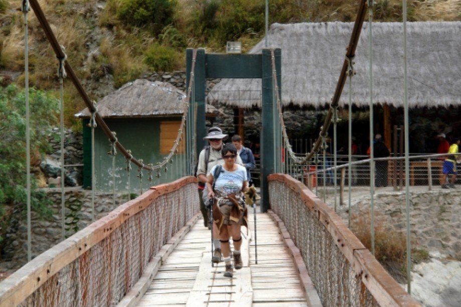
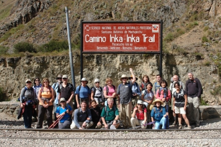
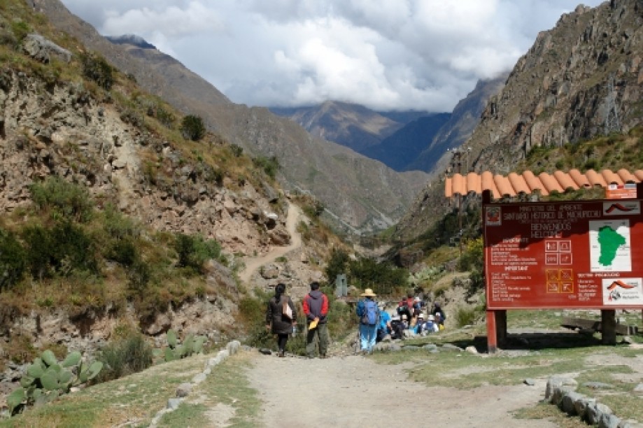
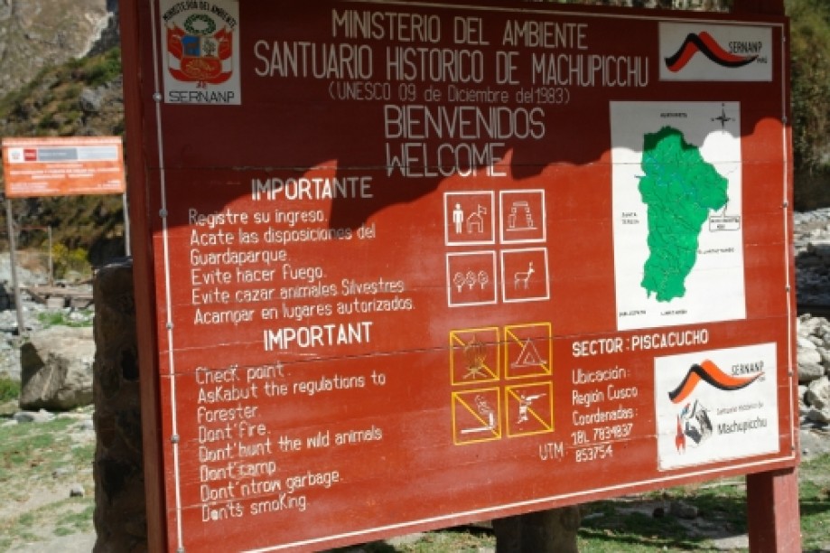
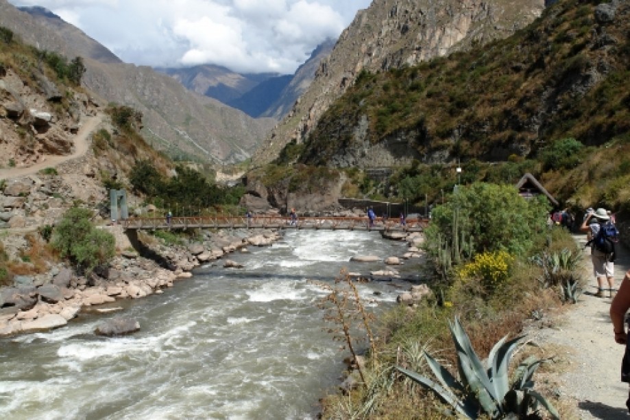
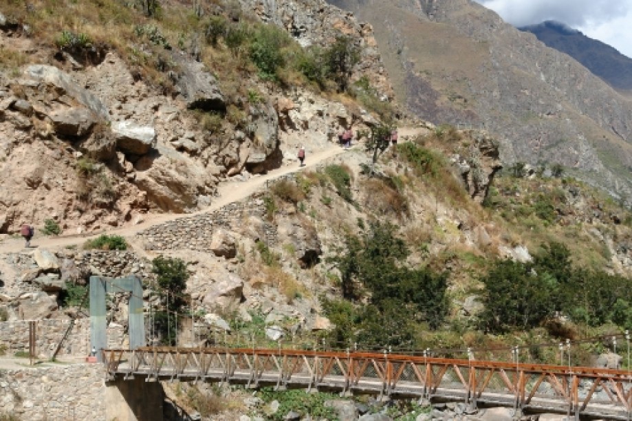
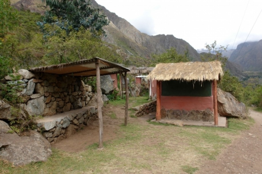
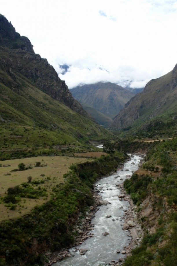
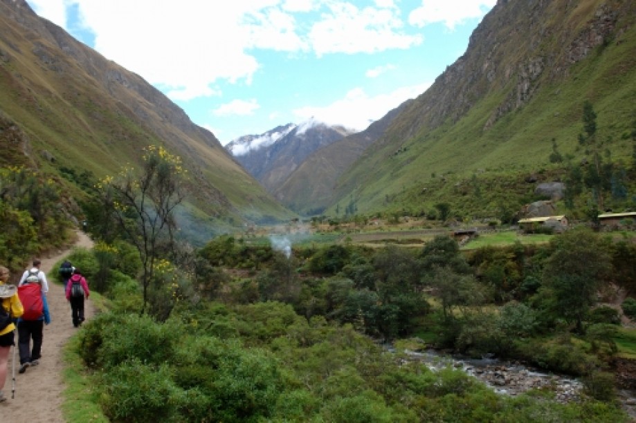
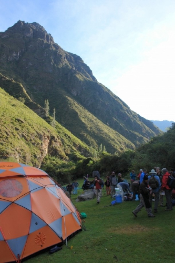
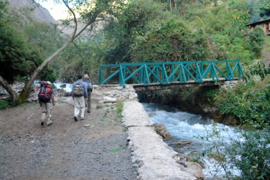
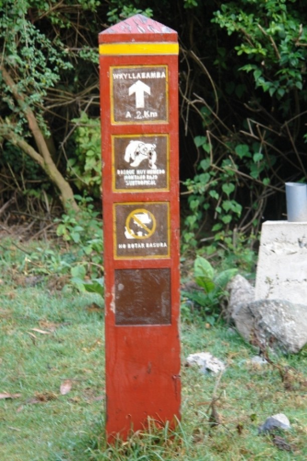
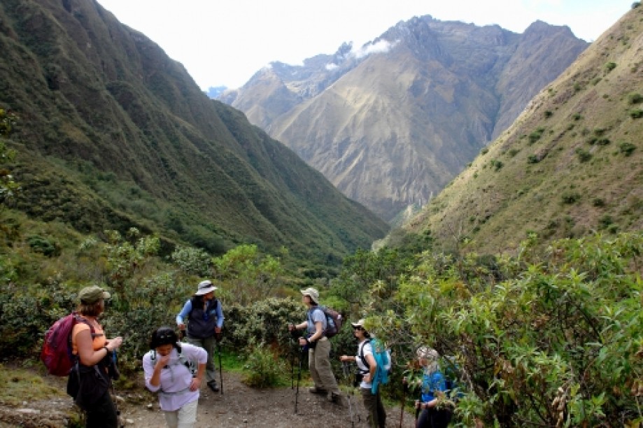
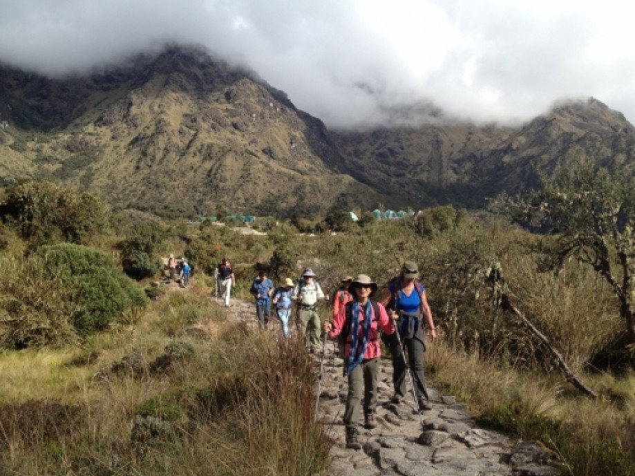
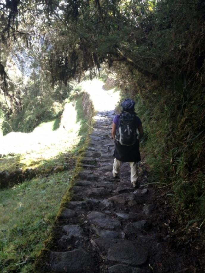
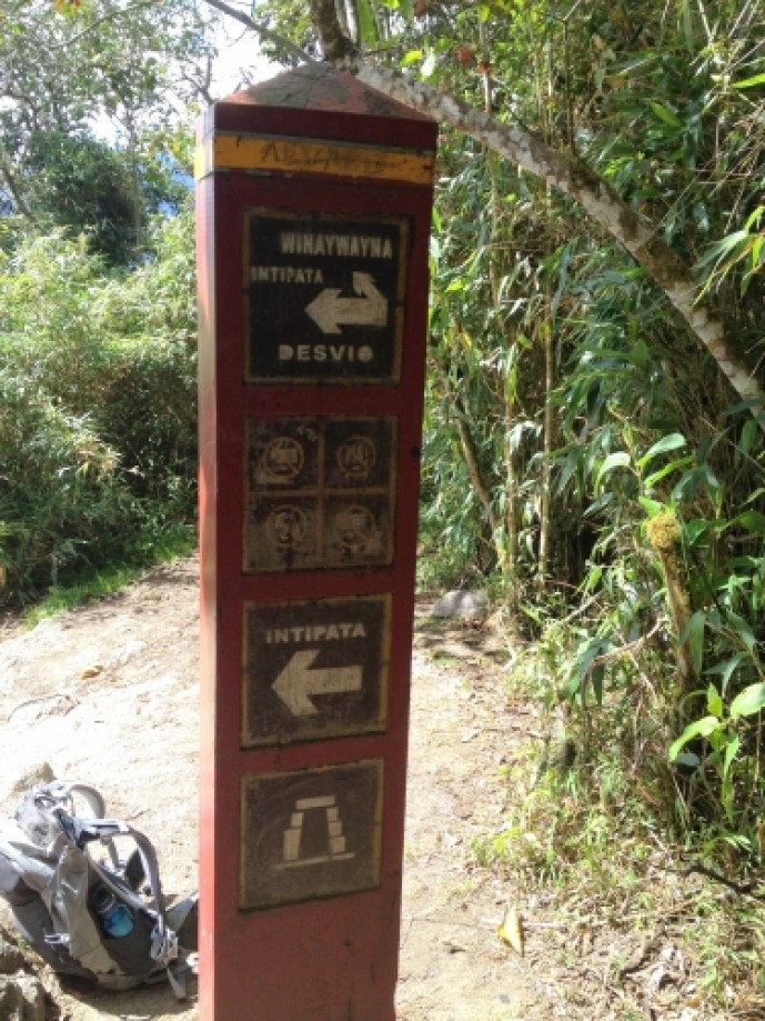
Day 1: We checked in at the control station at Kilometer 82 of the Inca Trail. Had to stand in line for some time while they verified that everyone had a permit to hike the trail. Then we crossed the bridge over the Urubamba river, and off we went.
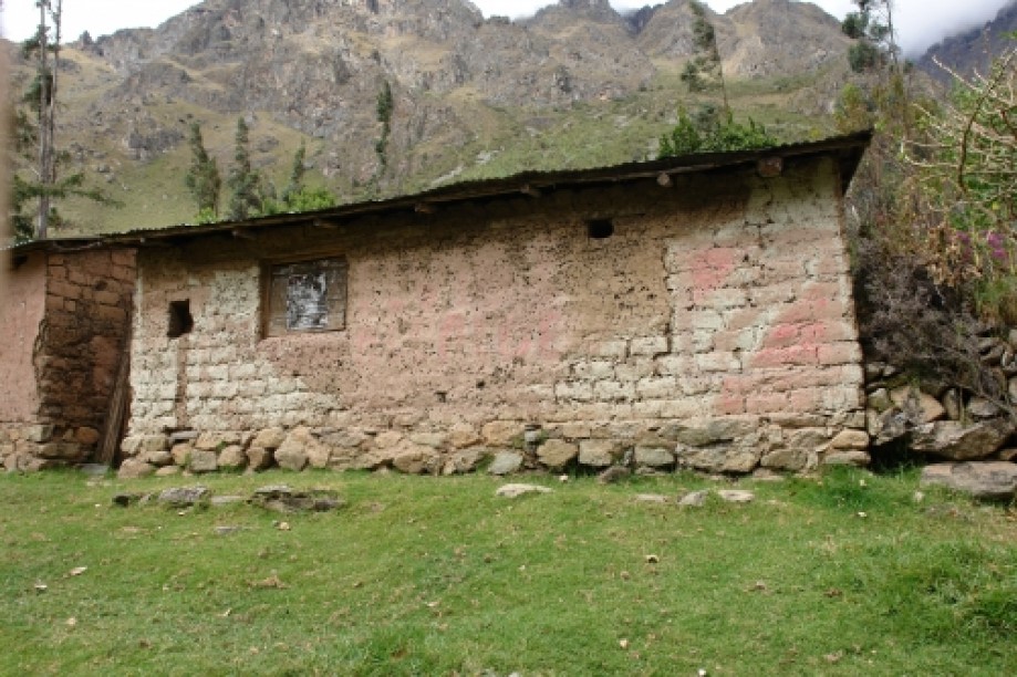
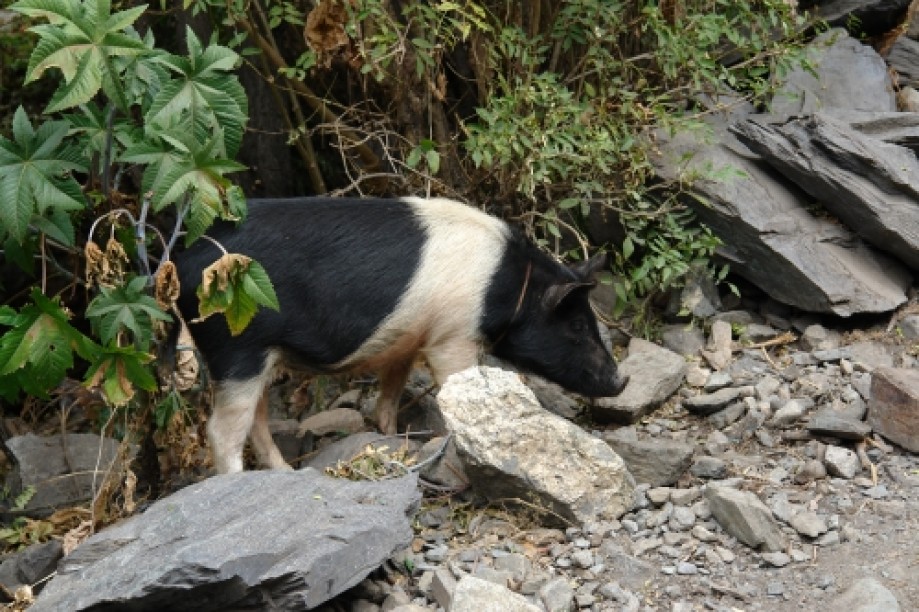
Rain came off and on until midday but never too much. We had our morning snack at a little “village” with a “baño” (we had to pay 1 Peruvian Sol to use the "facilities").
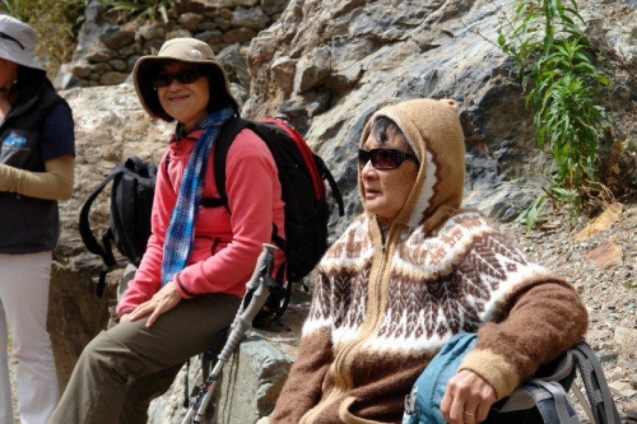
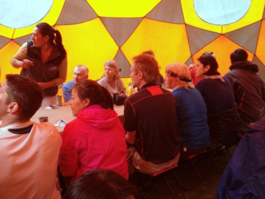
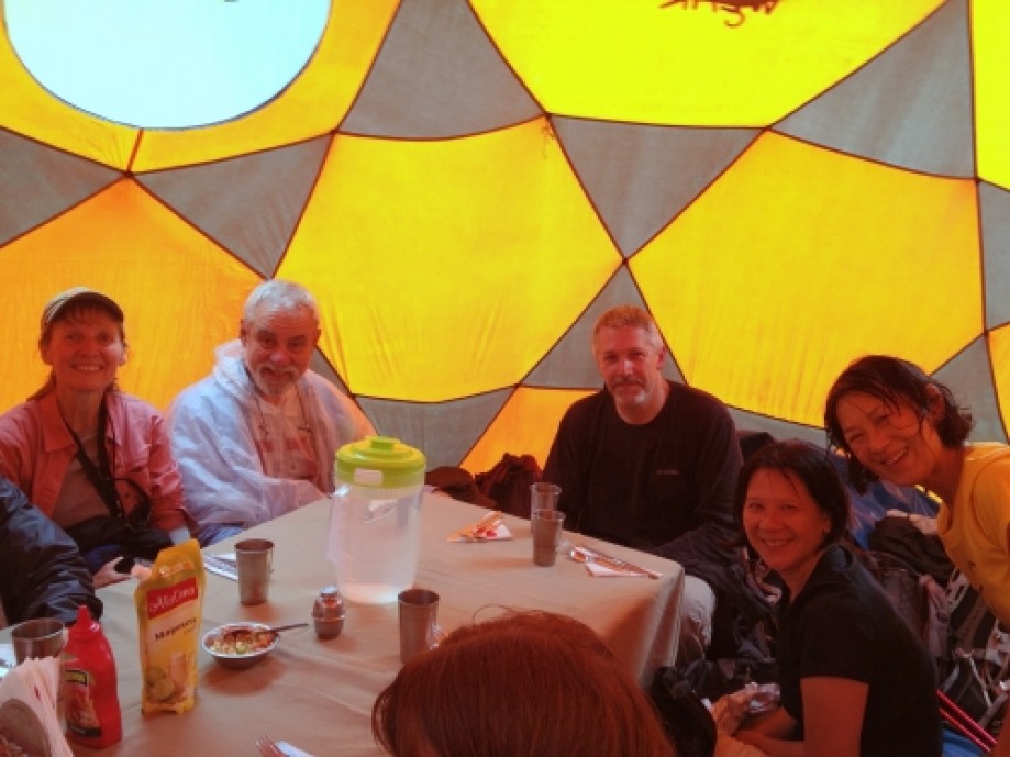
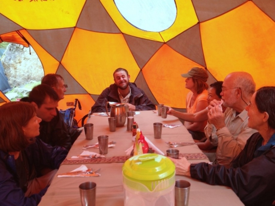
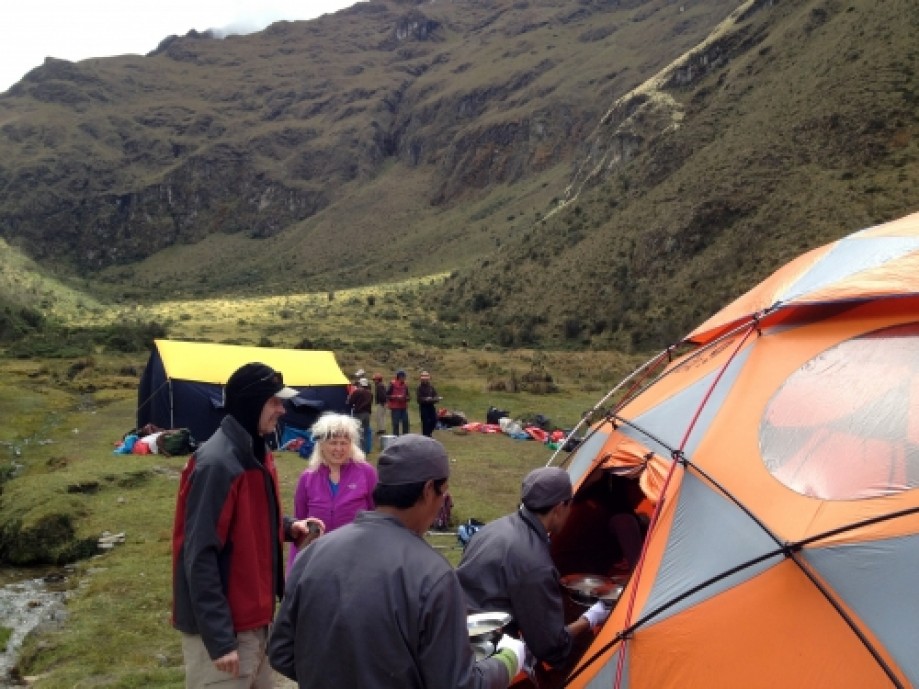
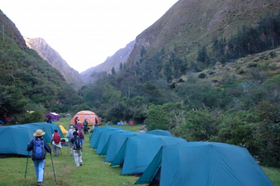
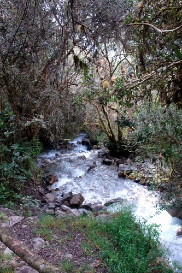
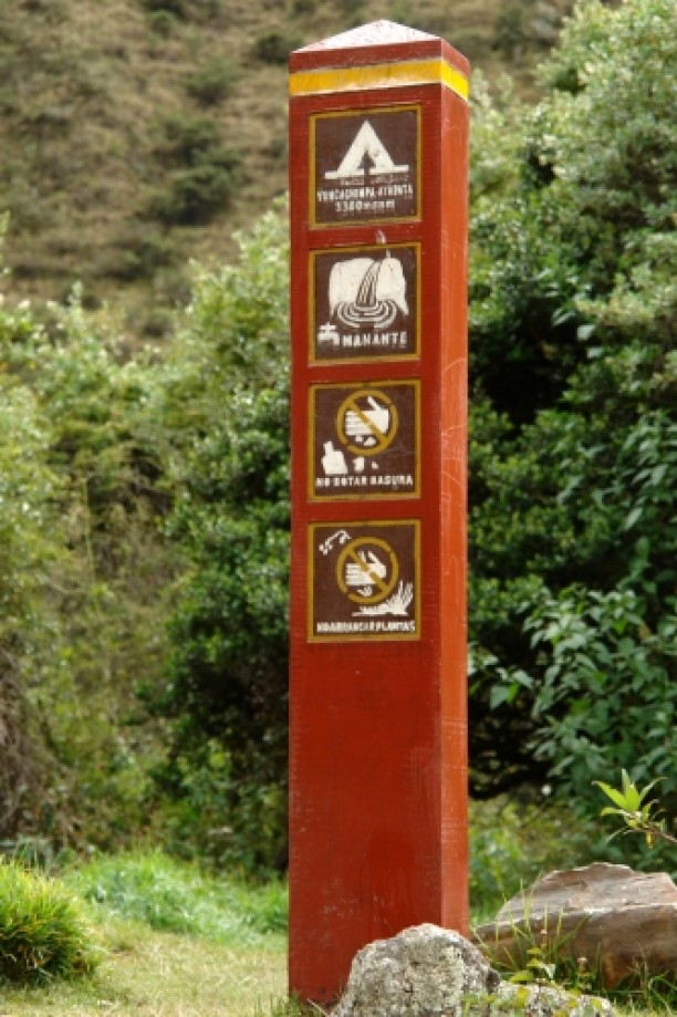
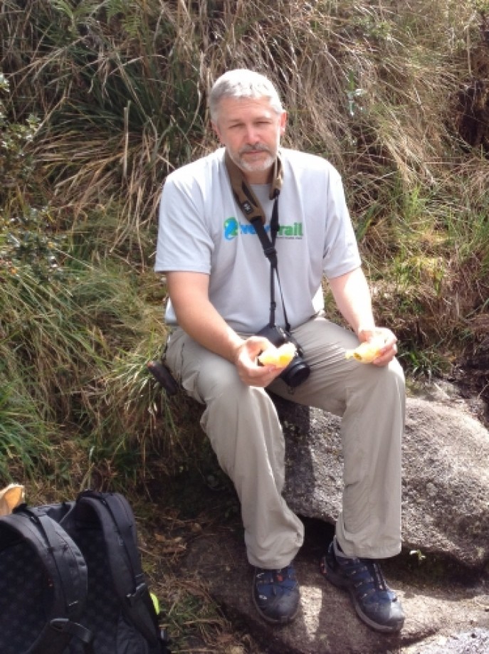
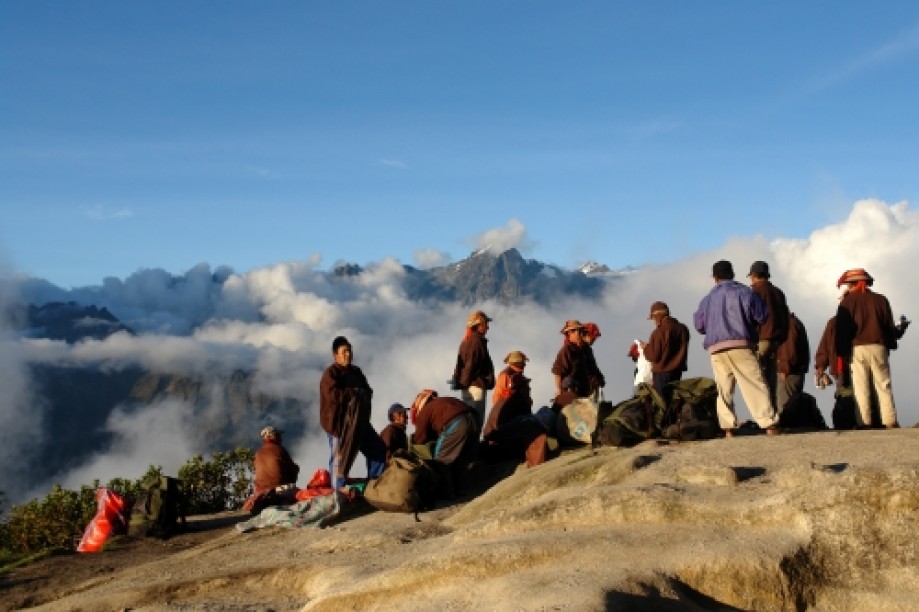
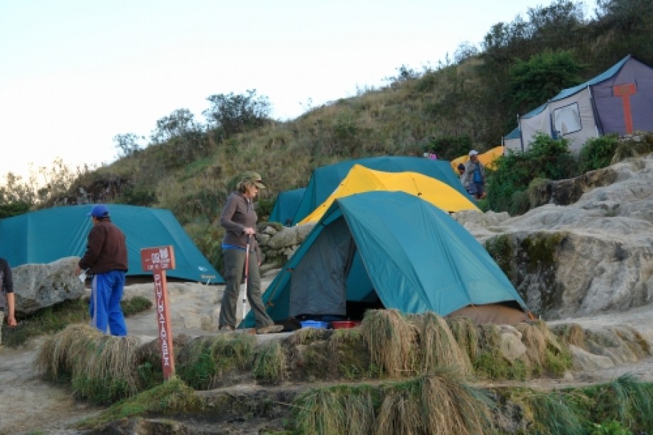
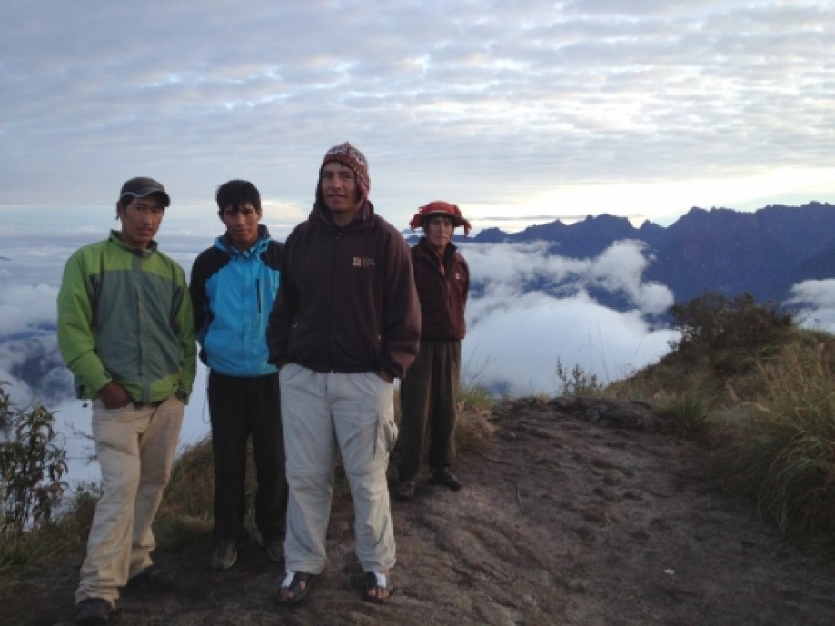
We had lunch in the rain in our cool orange “dining tent”, and learned how to use our portable hand washing stations and pottie tents. We learned to appreciate our porters! They always had lunch ready for us around midday and our tents set up when we got to camp. They would pass us along the trail carrying their heavy loads and on their feet they only wore rubber sandals. As they passed we would say "Sulpayki!", which is Quechuan for thank you. We camped along a rushing river near the Kusichaca bridge. The skies were beautiful and clear and saw two shooting stars.Day 2:
Wake up call with hot (well sort of) water to wash, and a hot drink to your tent. Kinda like room service?
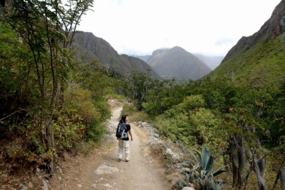
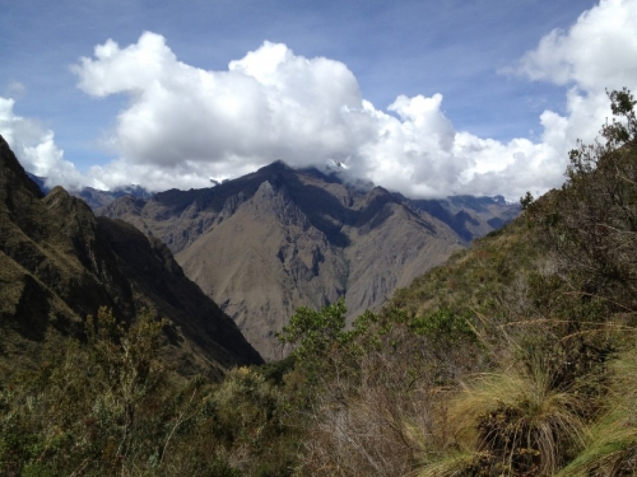
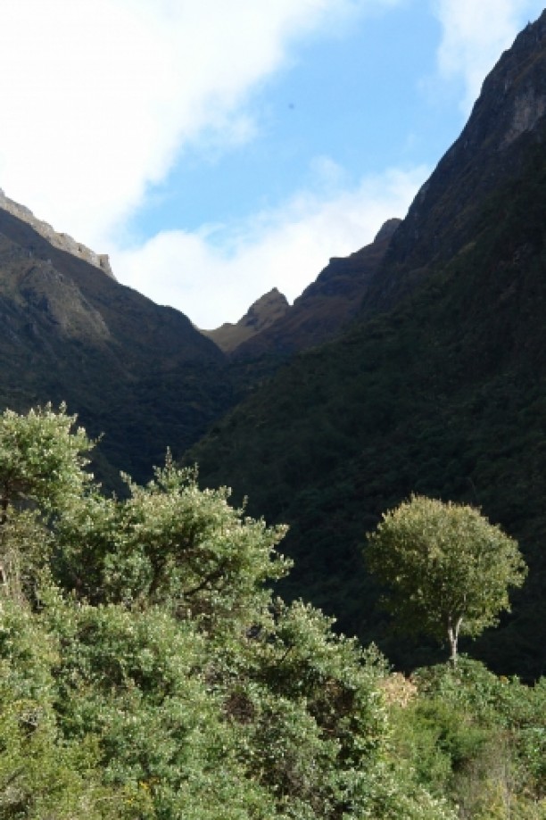
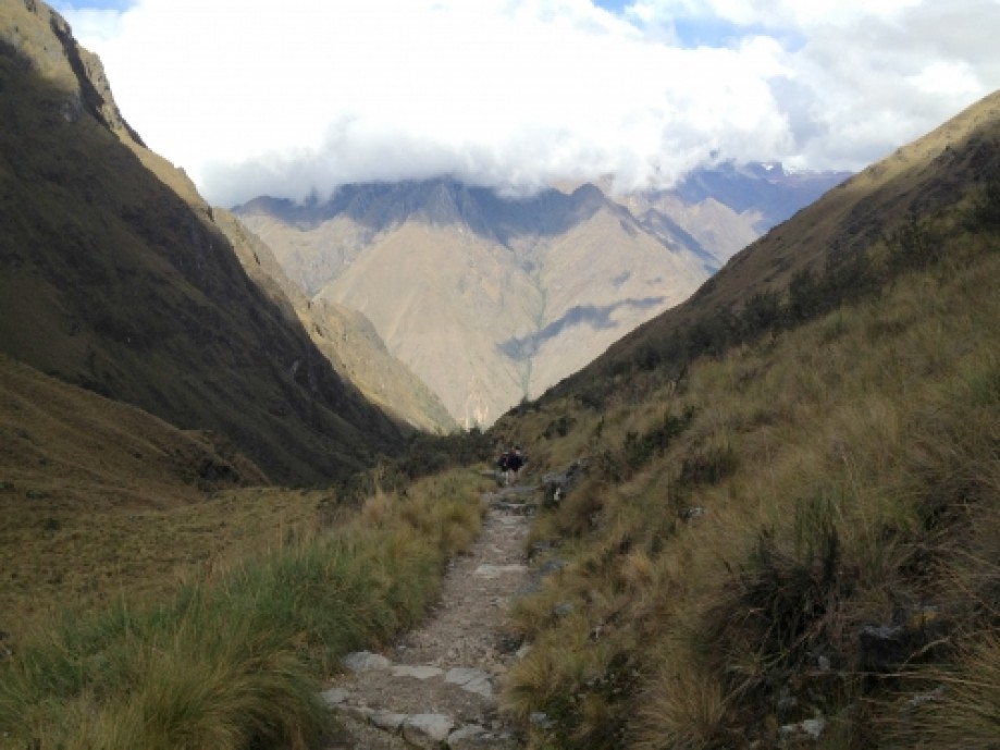
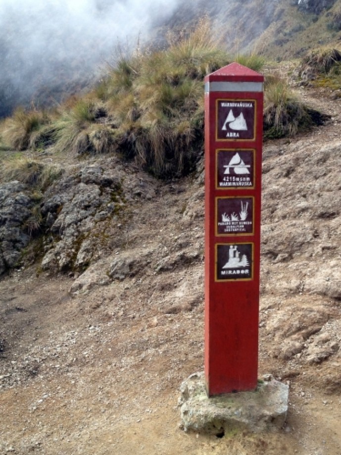
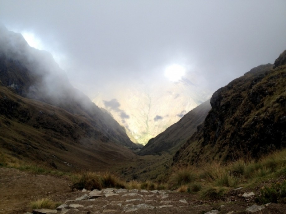
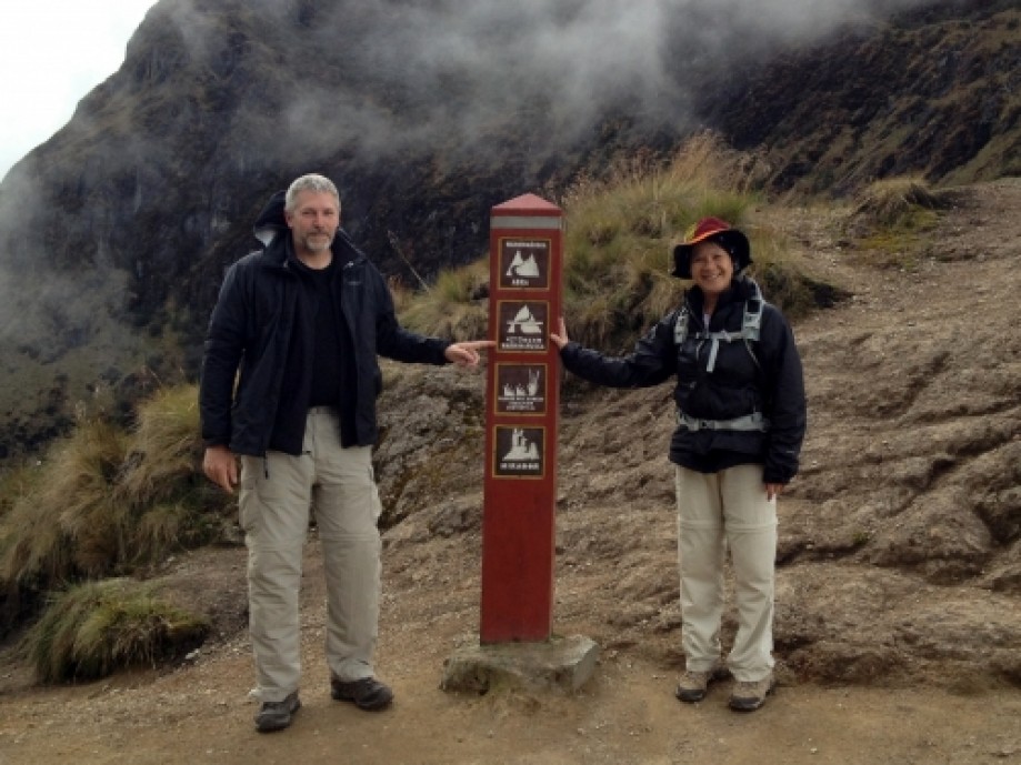
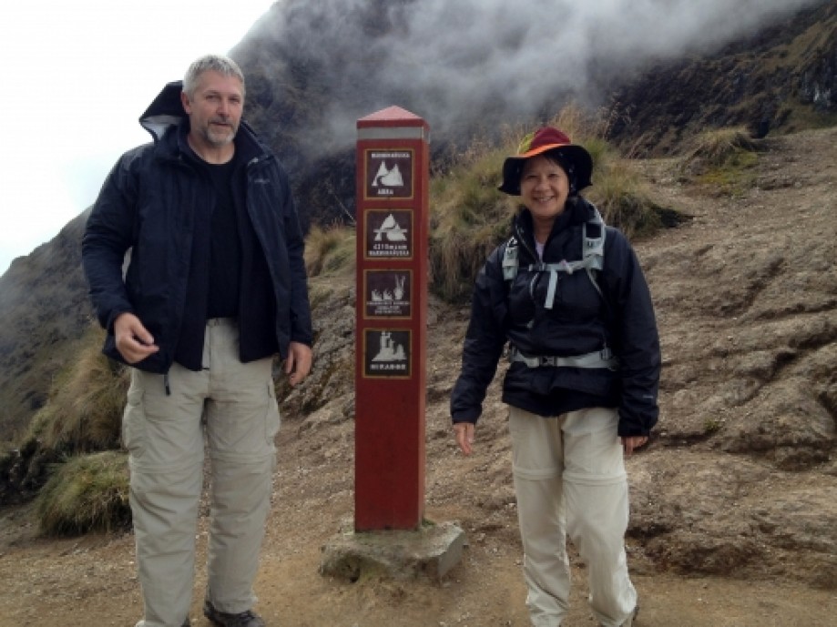
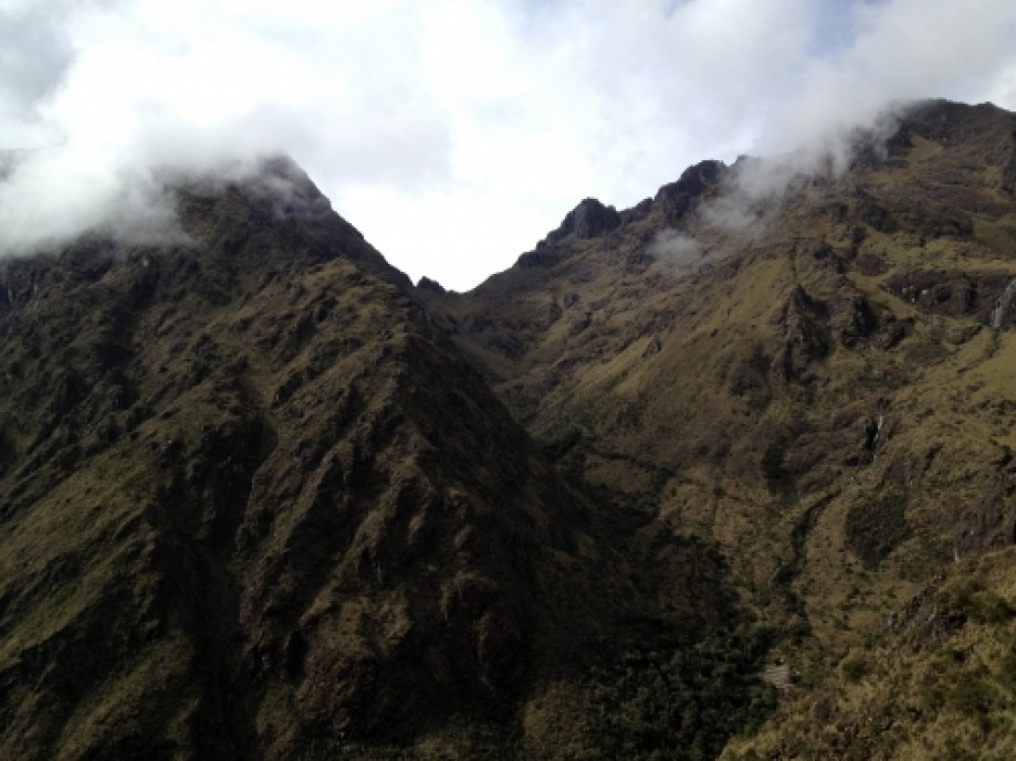
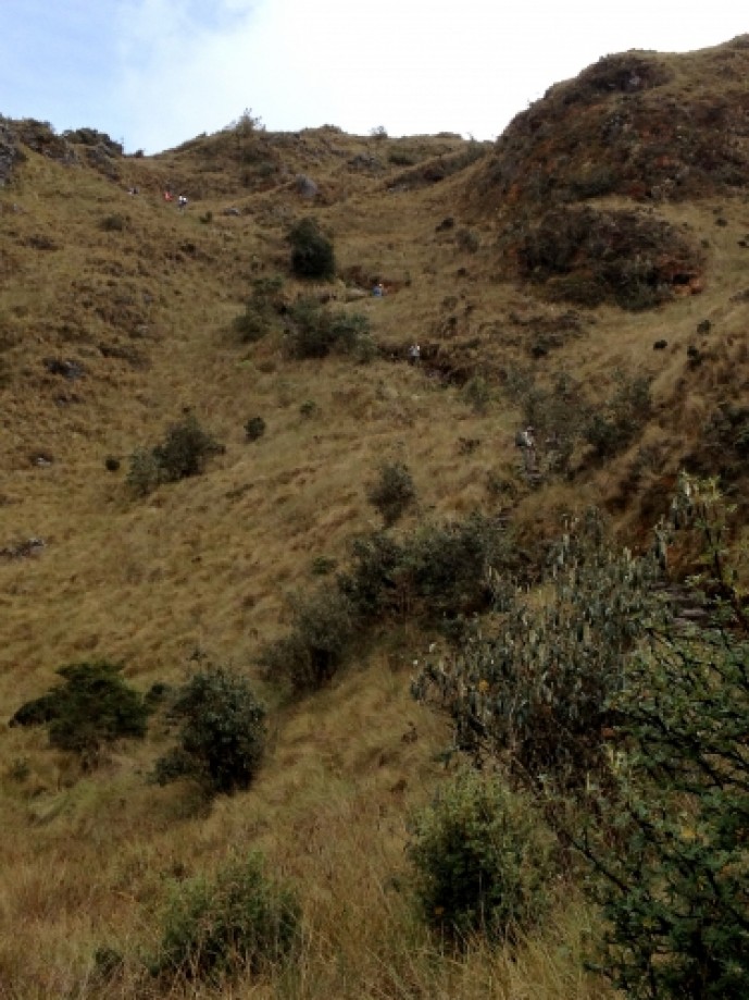
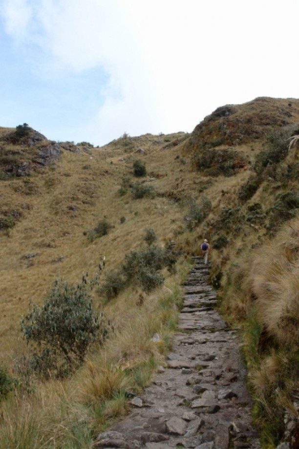
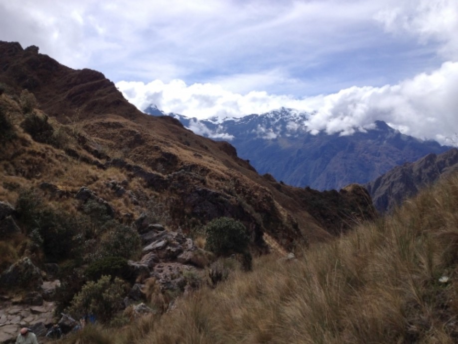
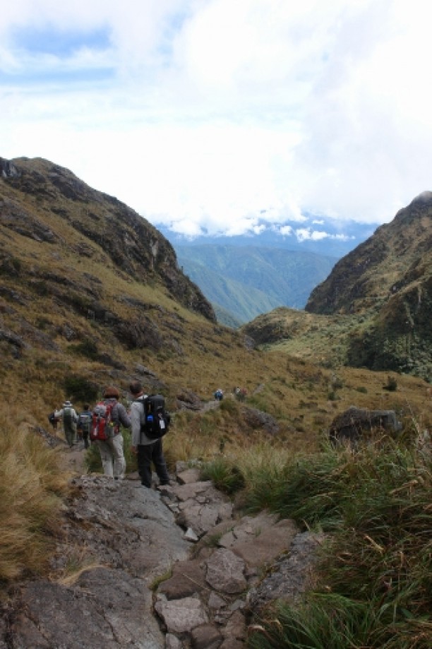
Hiked up nearly 4000 ft to Abra Warmiwanusqa (“Dead Woman’s Pass”). (Most likely named by a man.)
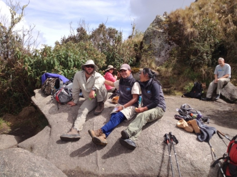
A strenuous hike to say the least!! Took 4 hours to lunch then two more to the pass. Kathy, Yvonne and I were the last up with Jairo looking out for us. (Applause greeted us as we reached the summit – haha). It took another 2 hours down with Claudia guiding us to camp just before dusk.
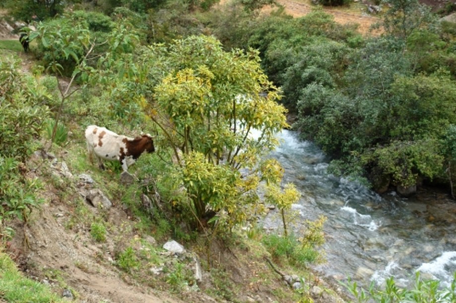
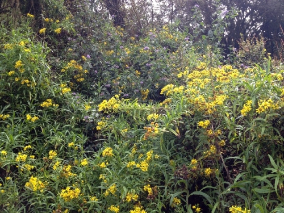
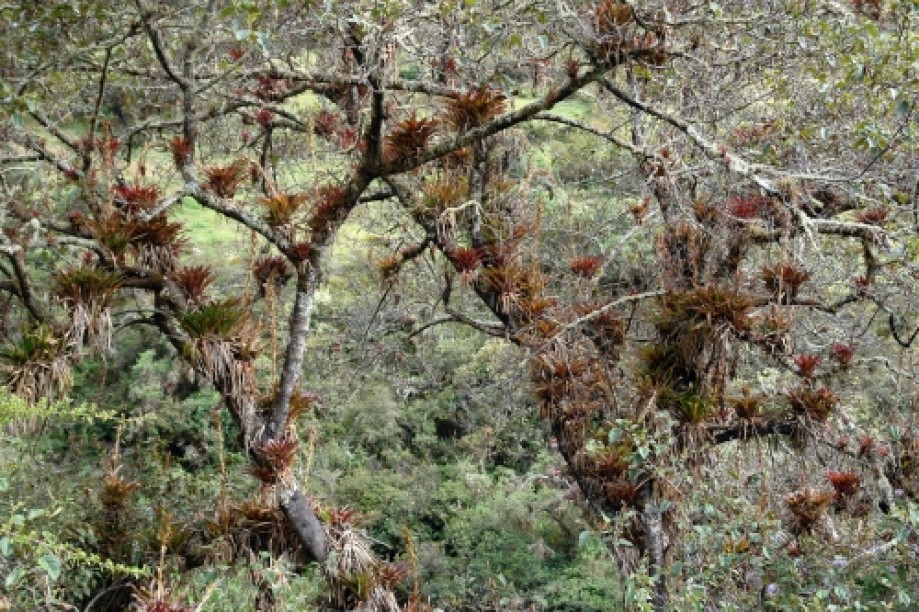
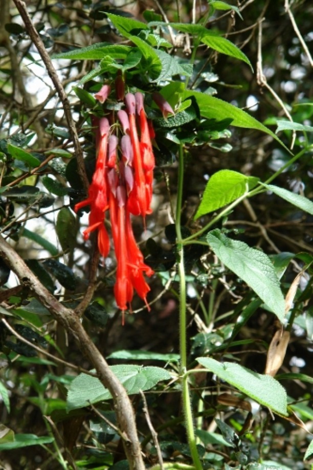
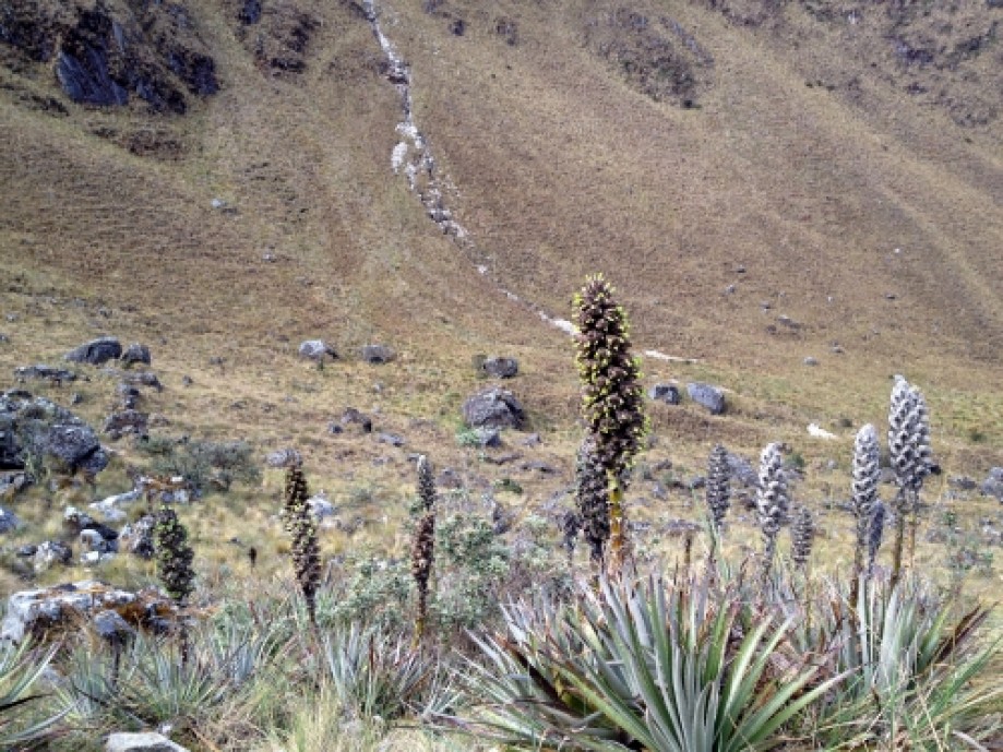
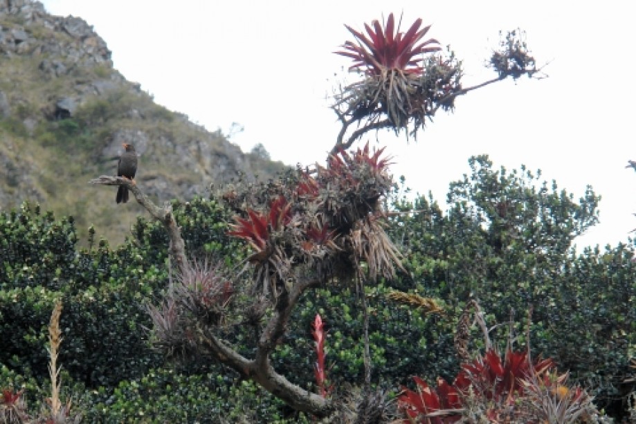
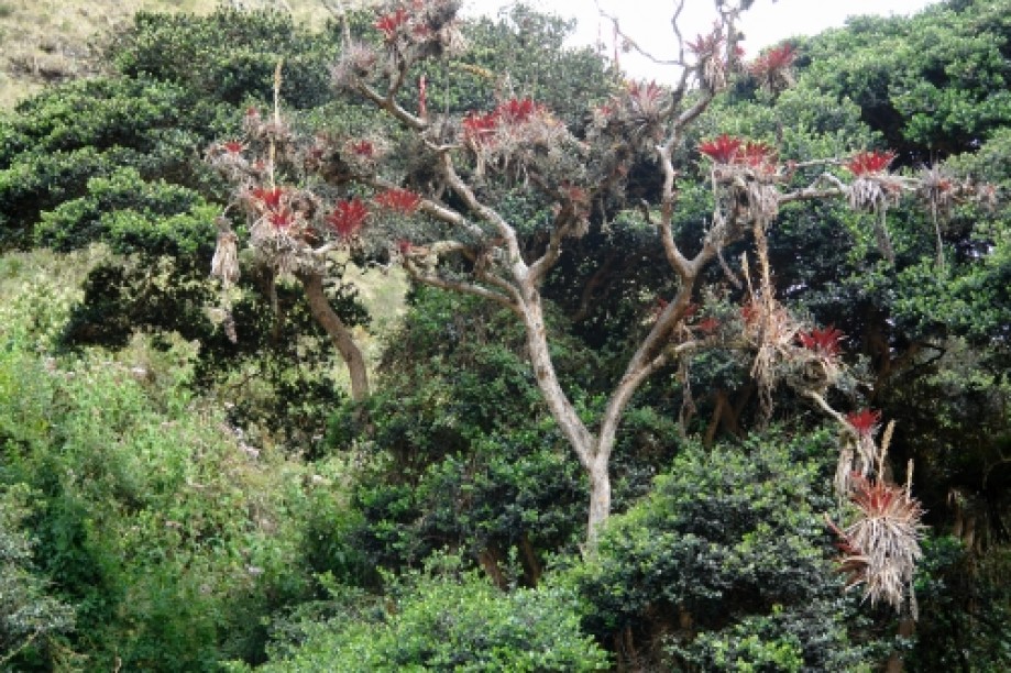
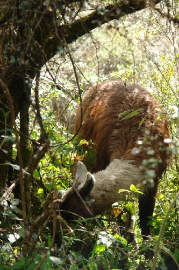
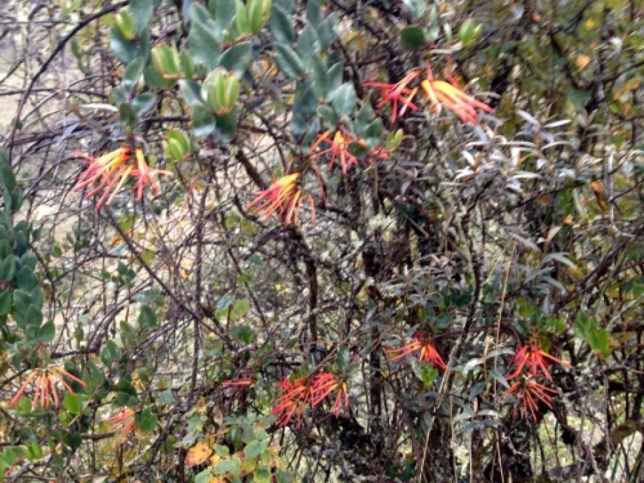
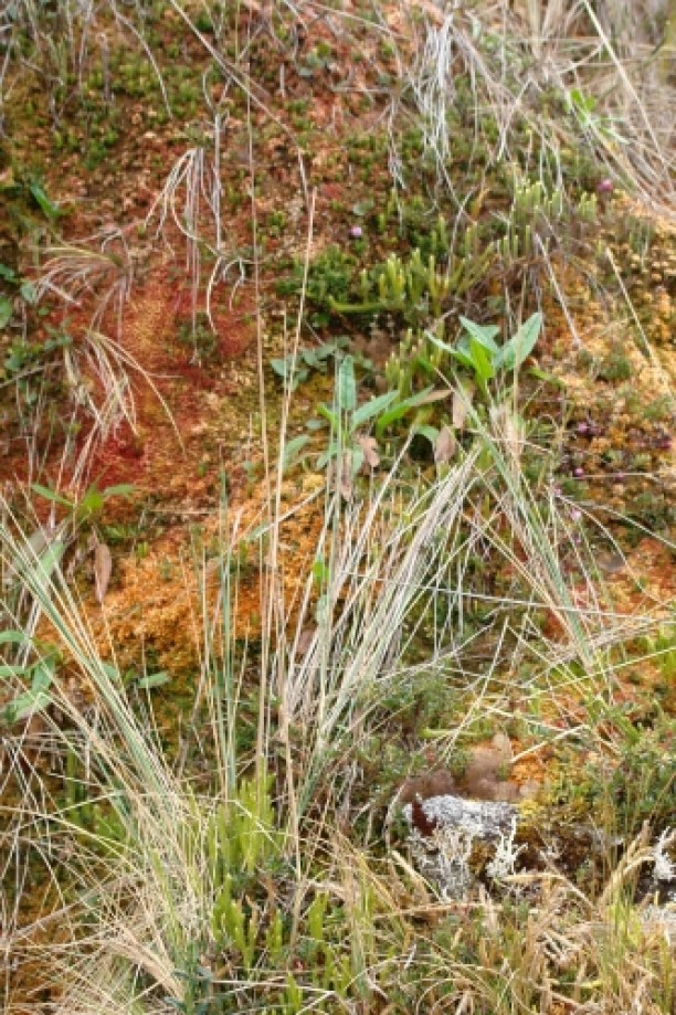
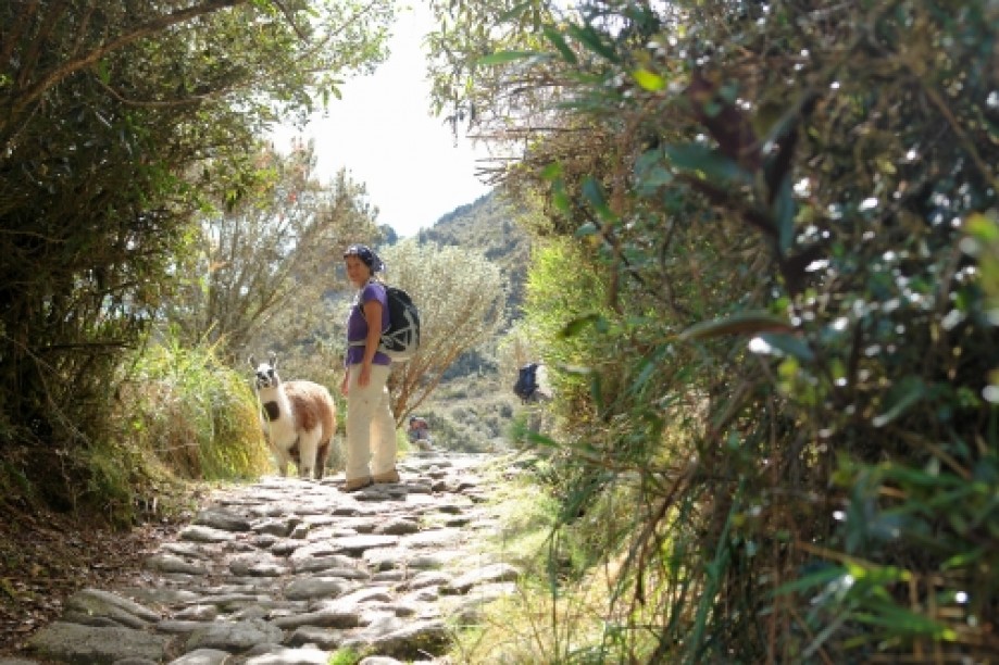
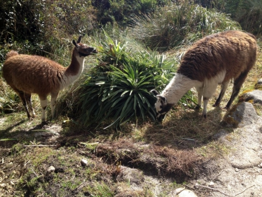
This was the hardest day they said, and we believe it. Another cold and beautiful night for stars along a rushing stream. Saw a large “Giant hummingbird” (the largest hummingbird and only in the Andes), llamas, lots of bromeliads, royal salvias, and unca trees. Learned "kusi" which is Quechuan for "happy" and "ayi" for "yes". "Wasi" is "home" or "house".
Our porter cooks made us Popcorn before dinner!Day 3:
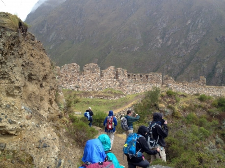
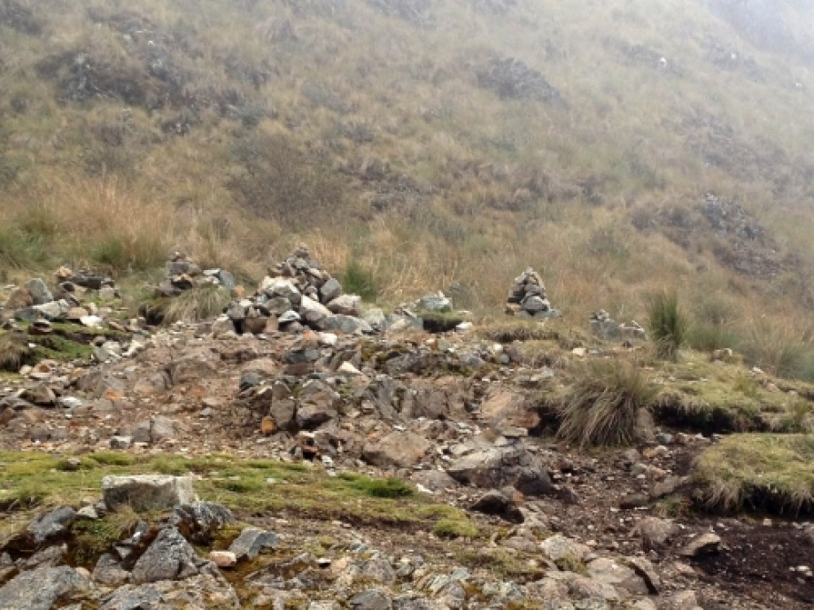
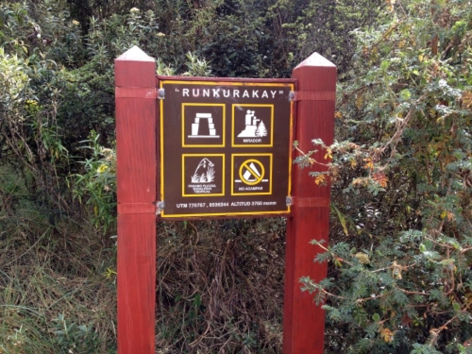
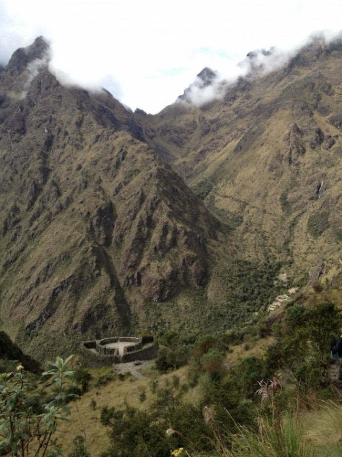
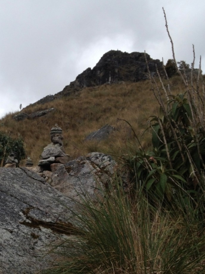
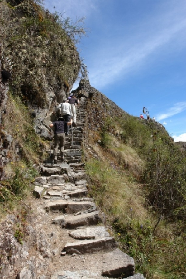
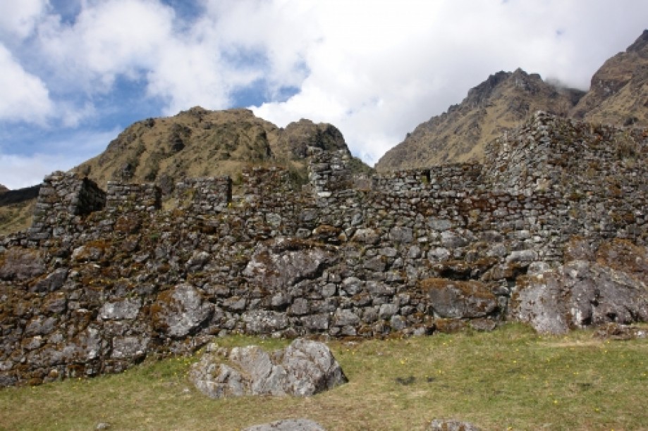
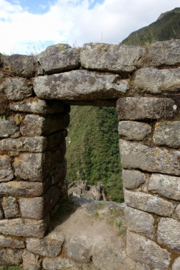
Passed through Abra Runkurakay (the second high pass on the trail at about 13,000 ft (the first yesterday was at 14,000 ft) and snacked at the pass. Cairns abound at the pass but here they are an offering of thanks to Mother Earth (Pachamama).
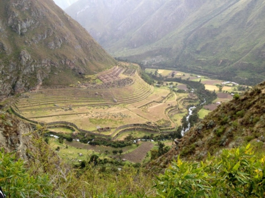
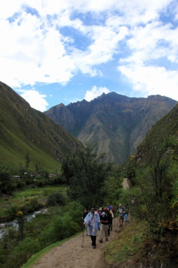
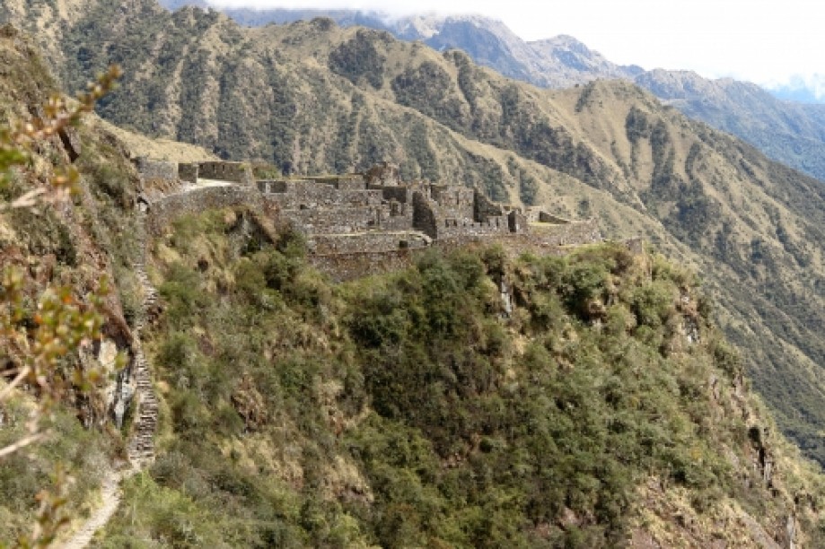
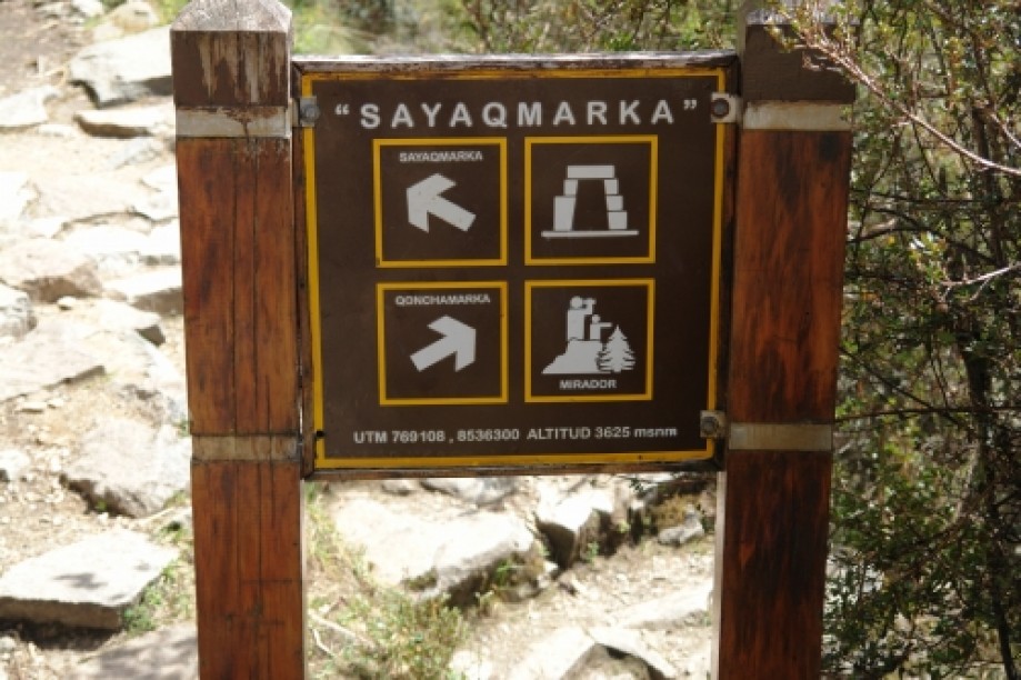
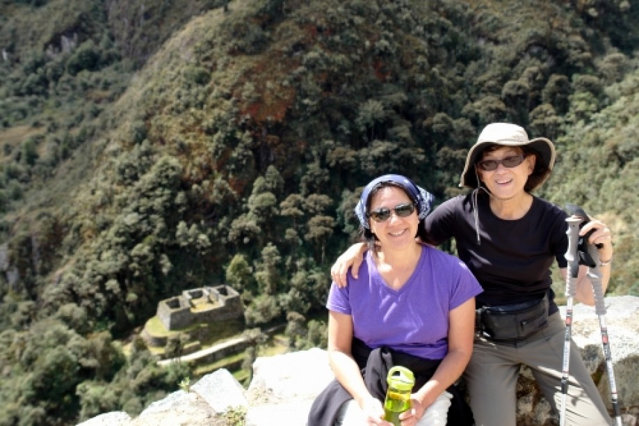
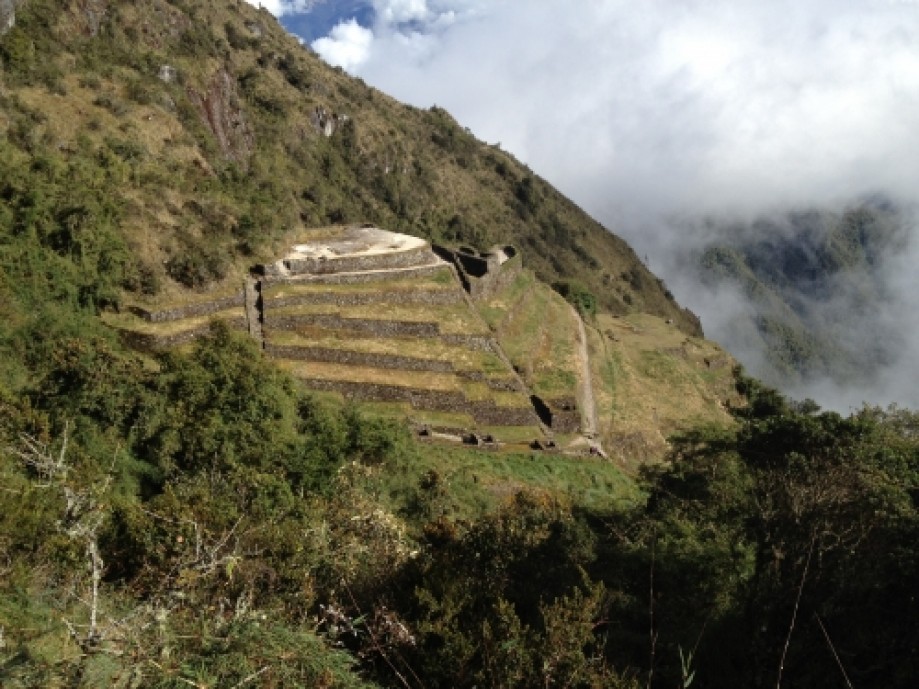
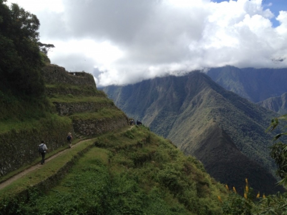
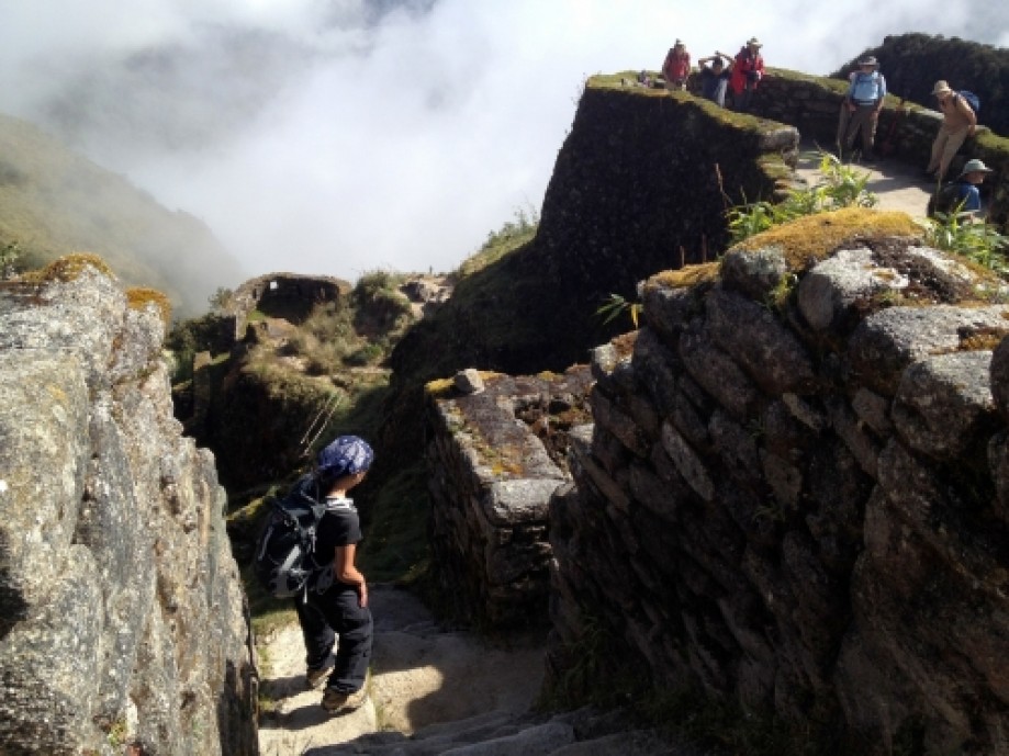
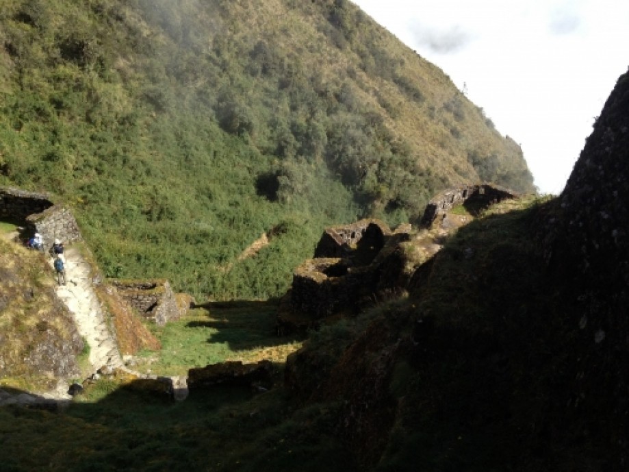
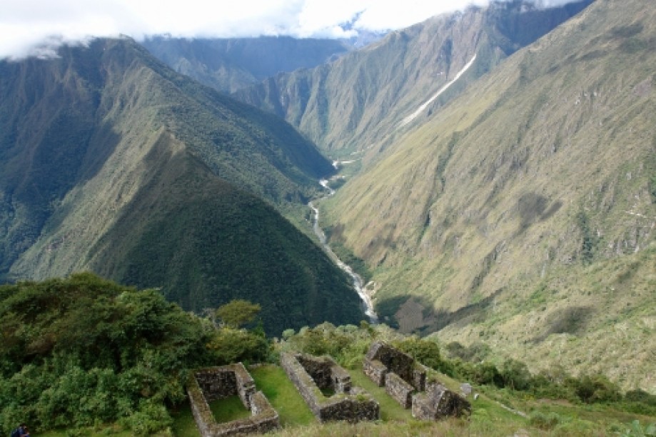
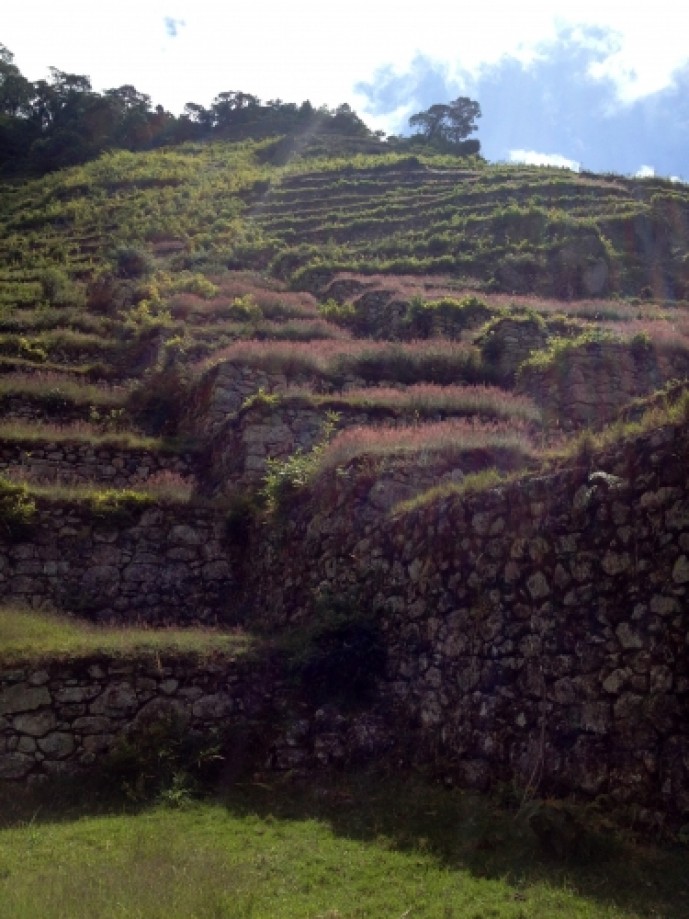
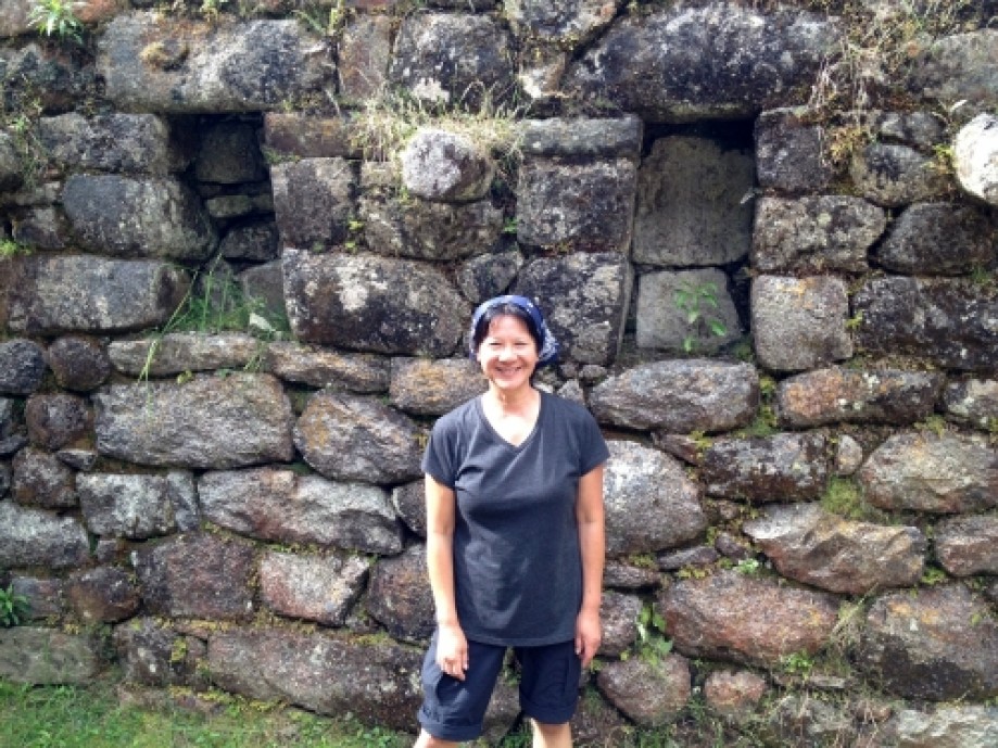
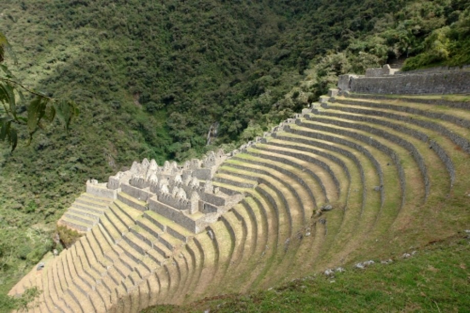
Another beautiful day! Had lunch watching llamas play fighting, and visited Sayaqmarka ruins (means "inaccessible").
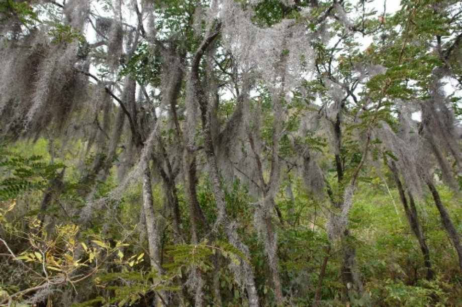
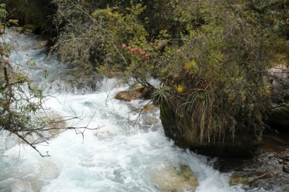
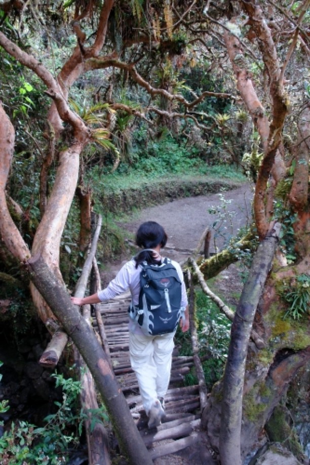
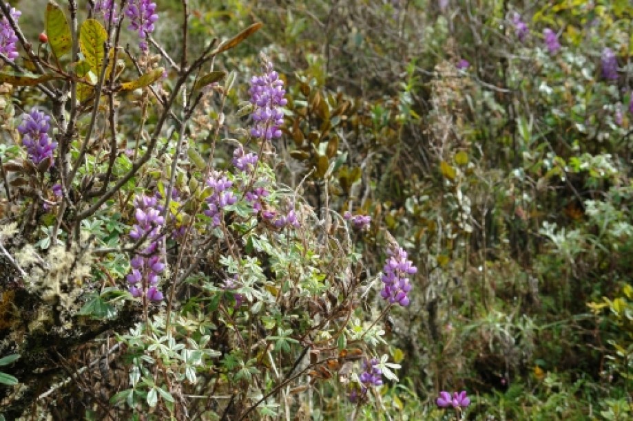
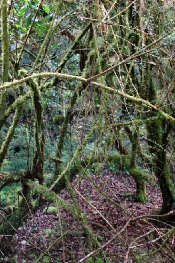
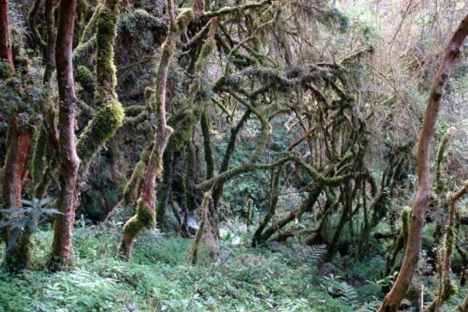
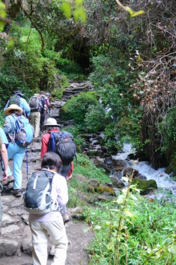
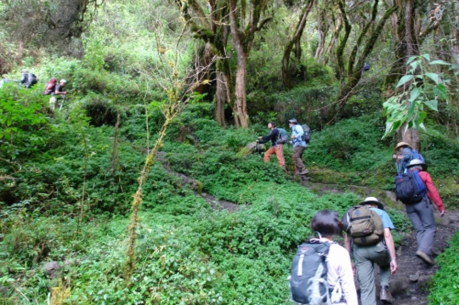
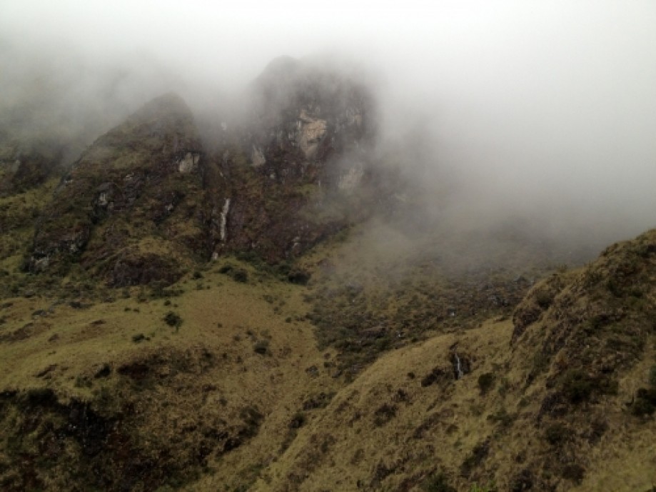
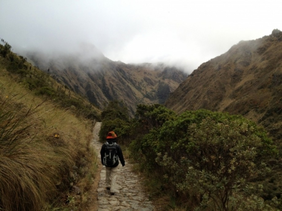
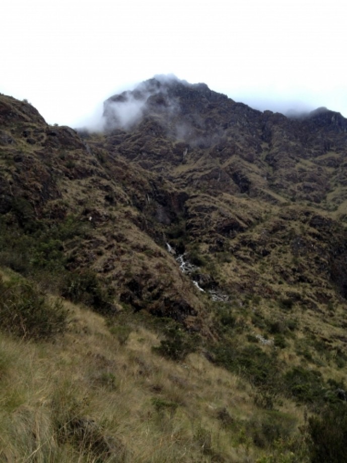
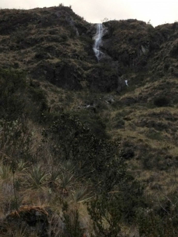
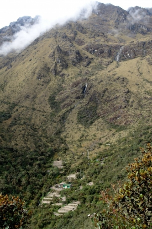
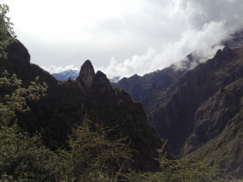
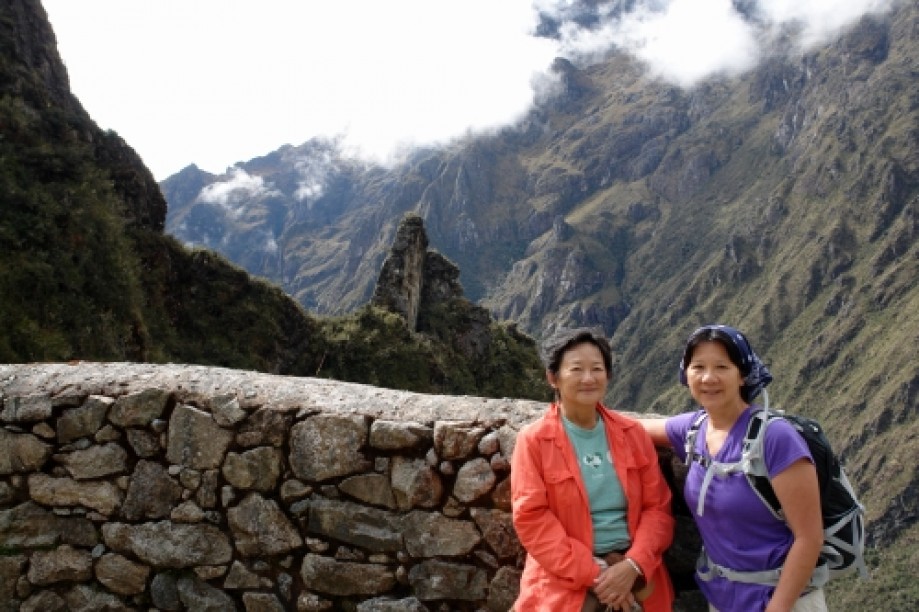
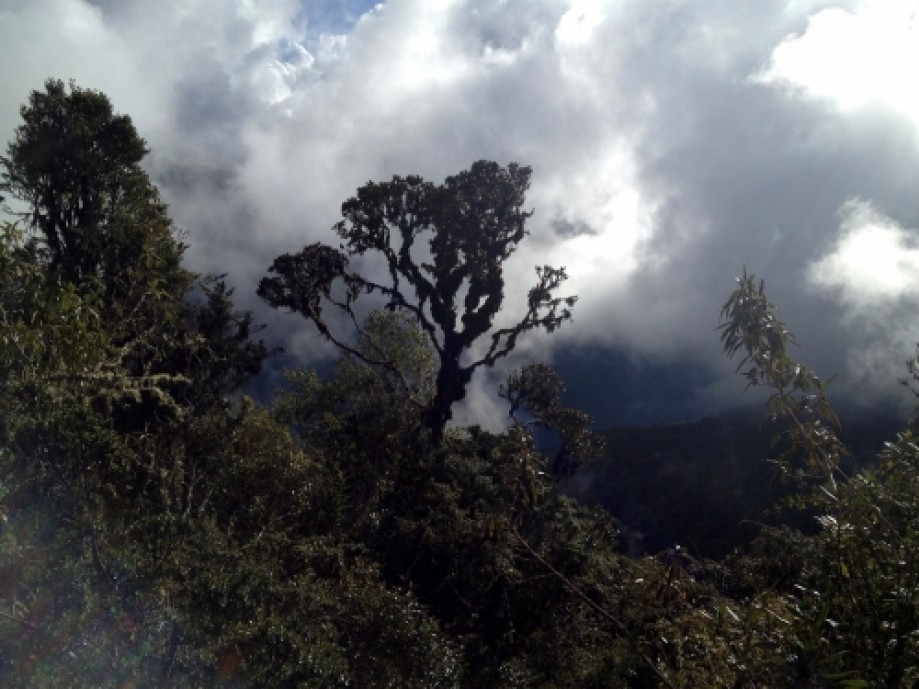
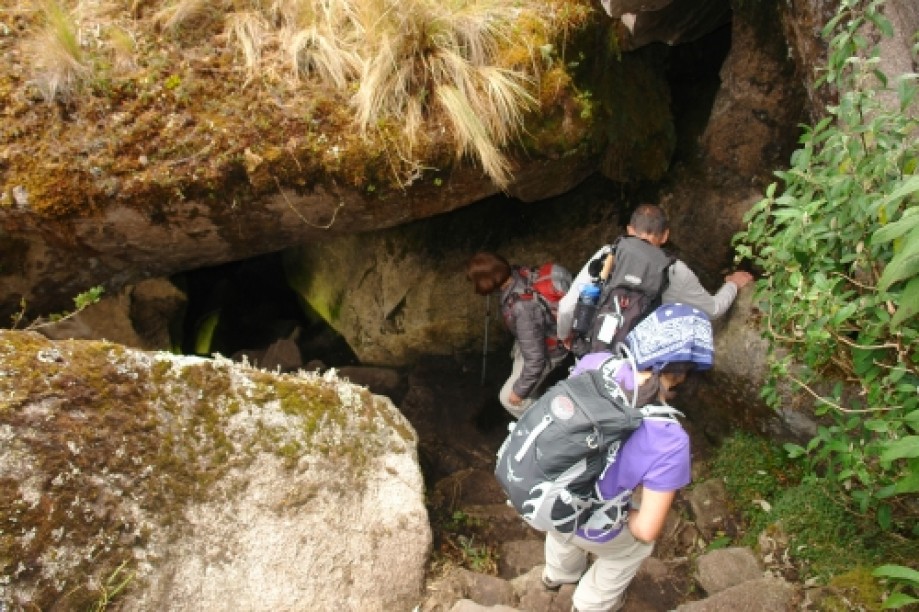
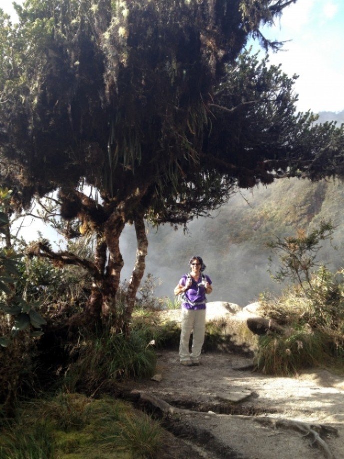
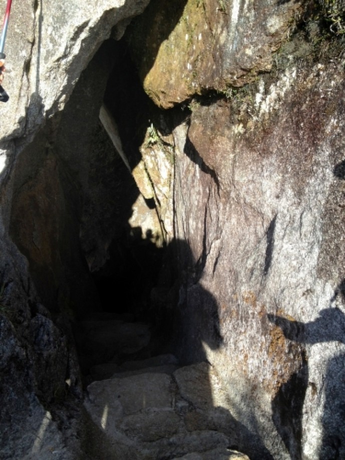
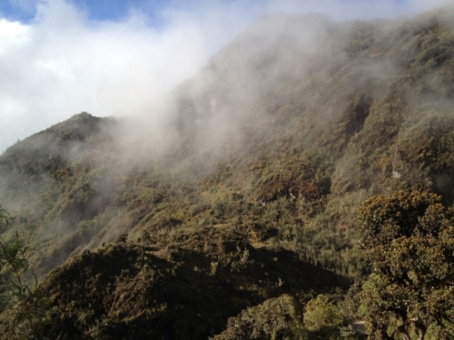
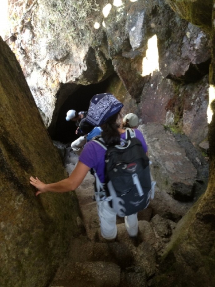
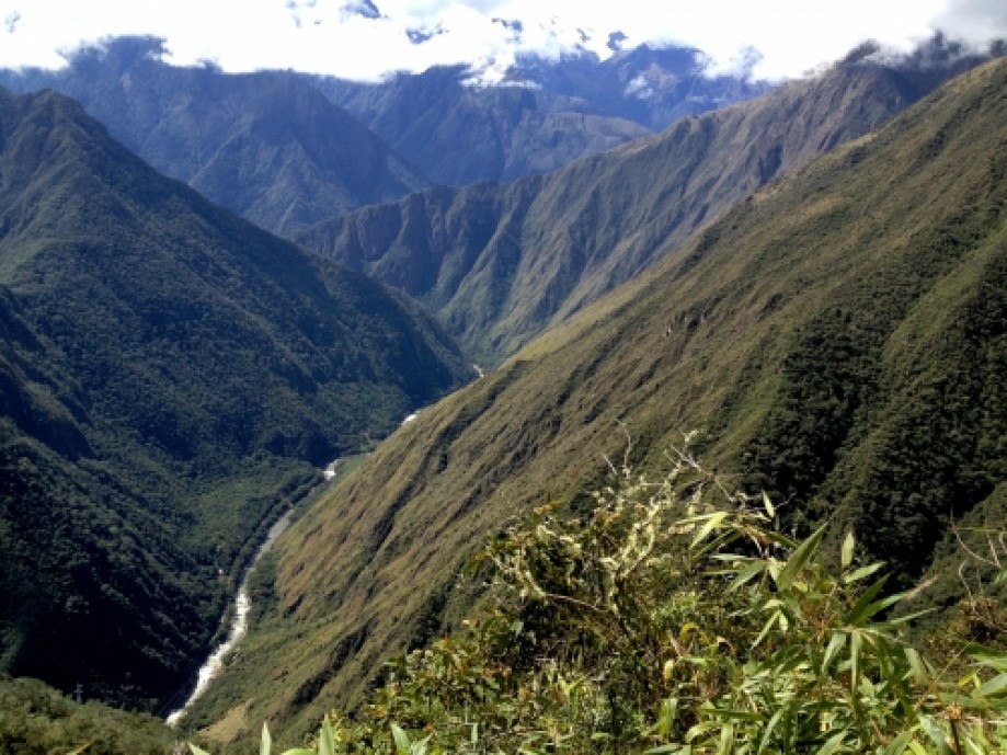
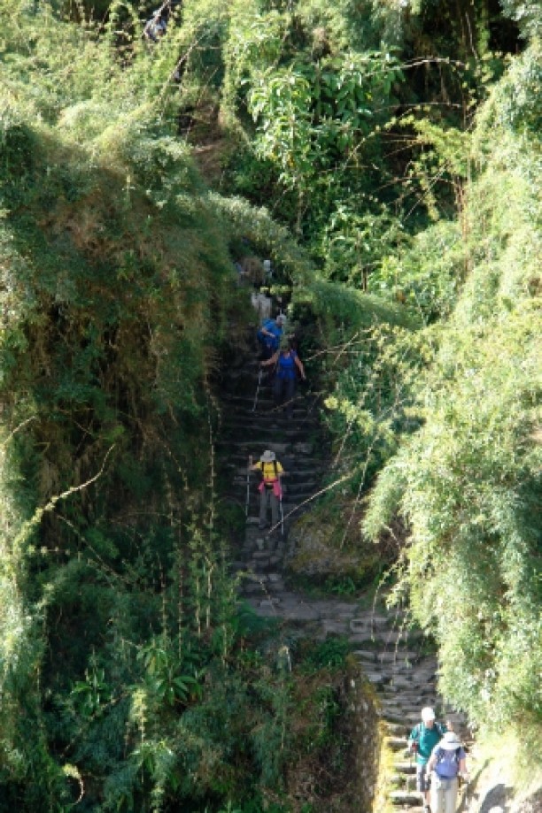
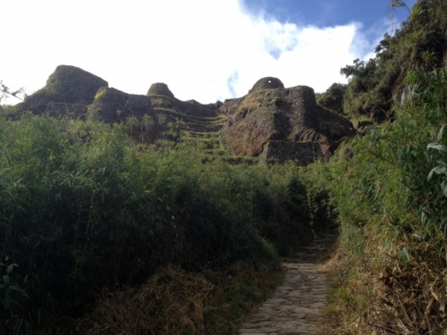
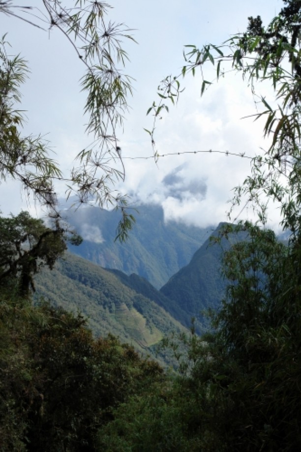
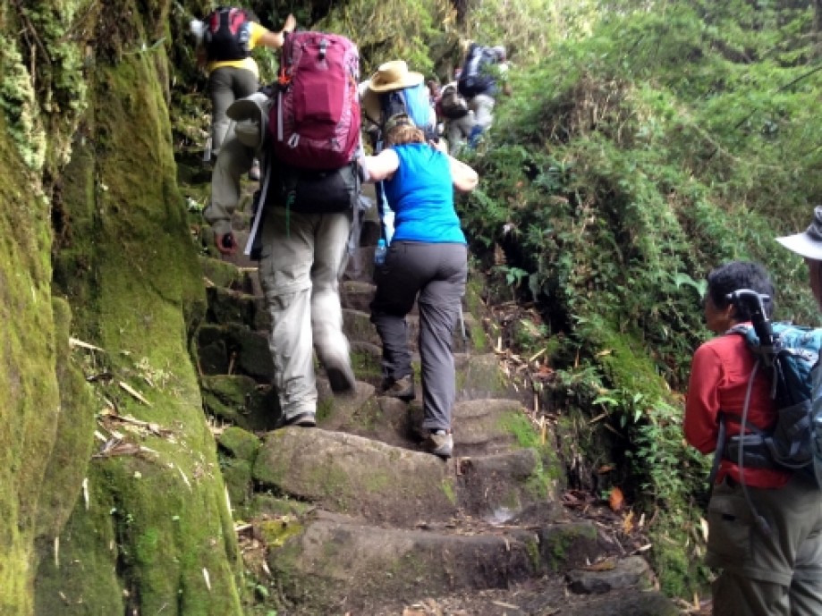
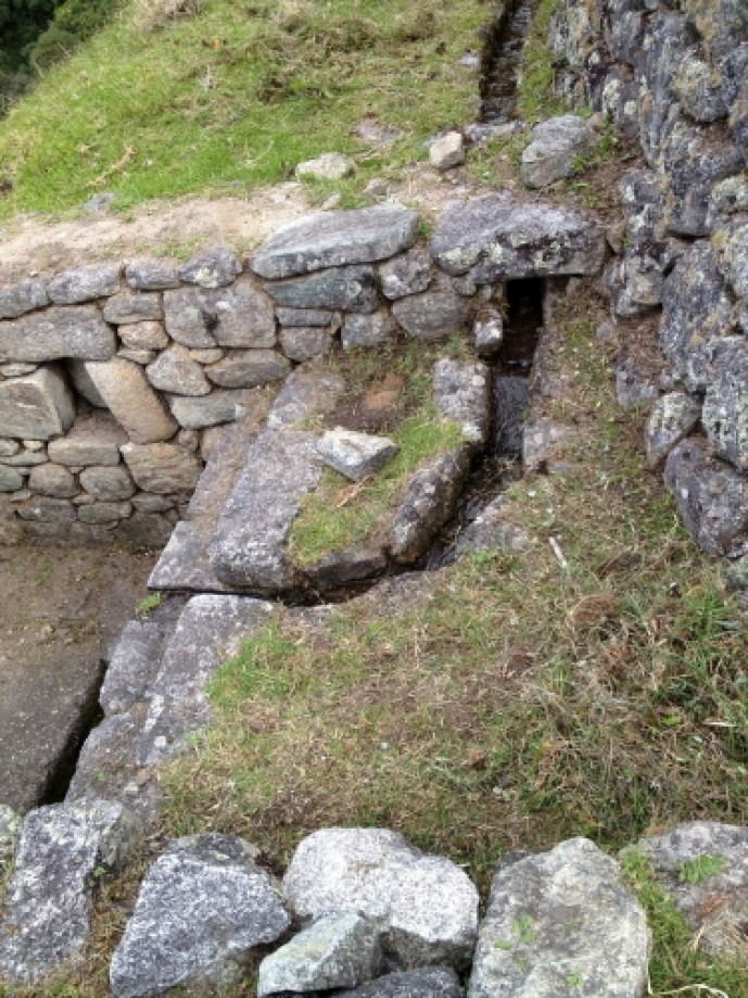
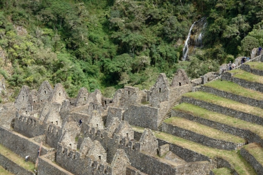
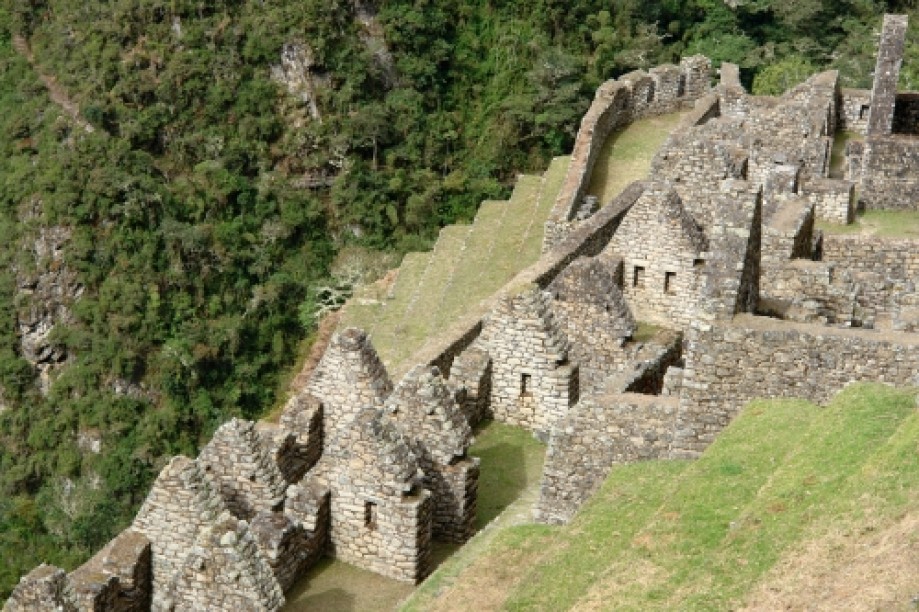
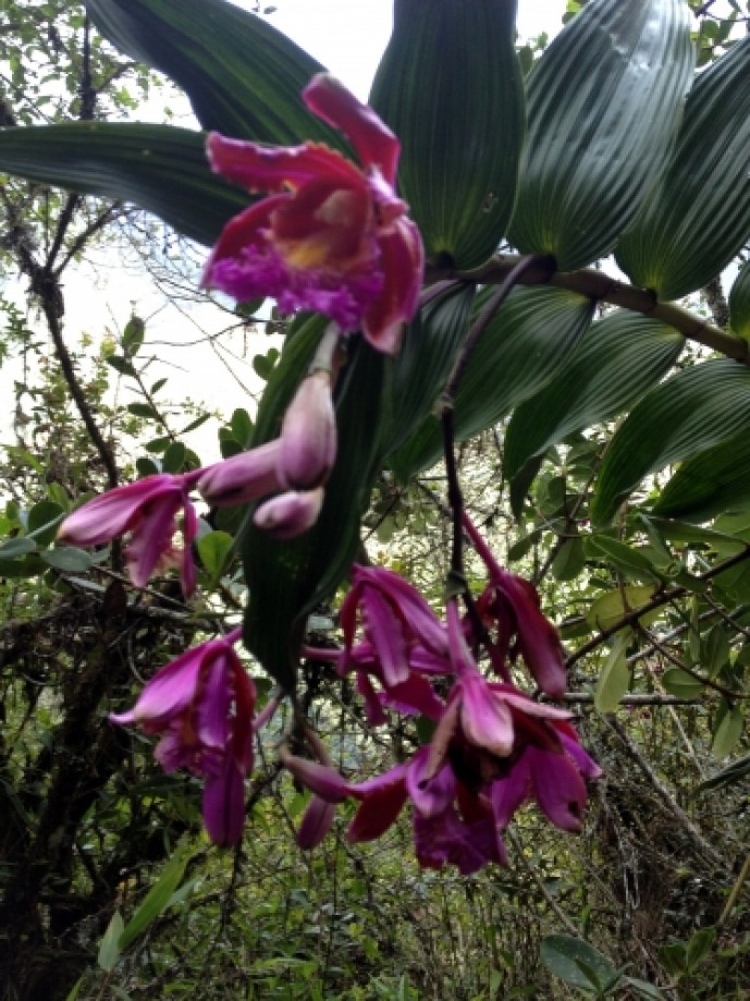
Next part of the hike to camp was through a cloud forest and there was bamboo, wild orchids and prehistoric ferns. The trail goes through some” tunnels” here as well. Several waterfalls could be seen on the mountainsides as we hiked.
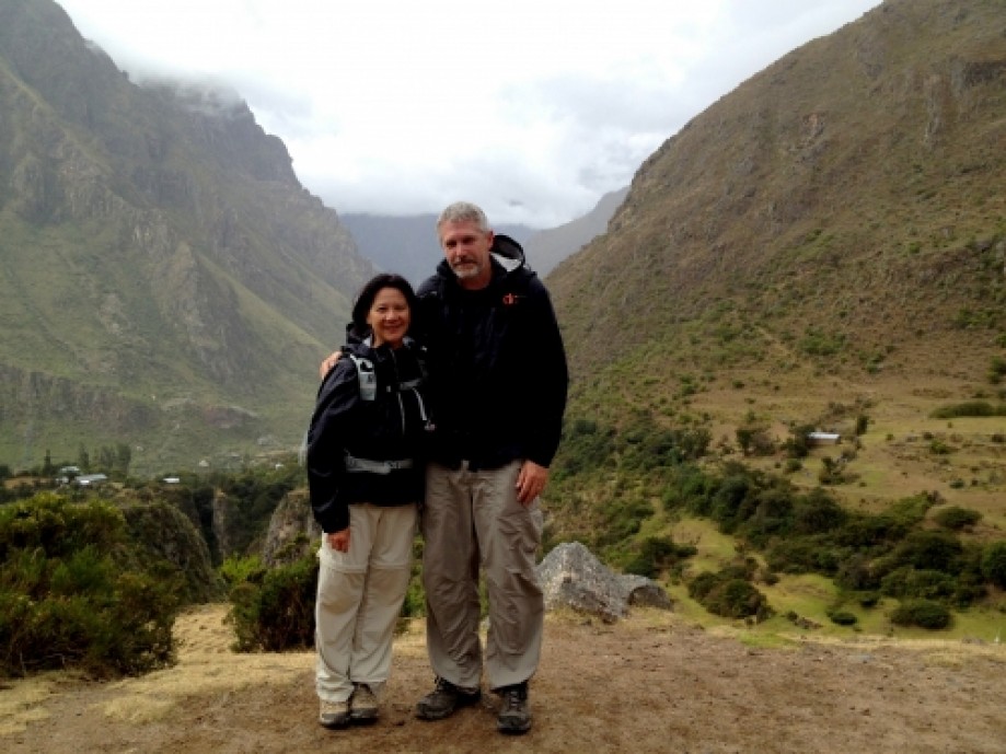
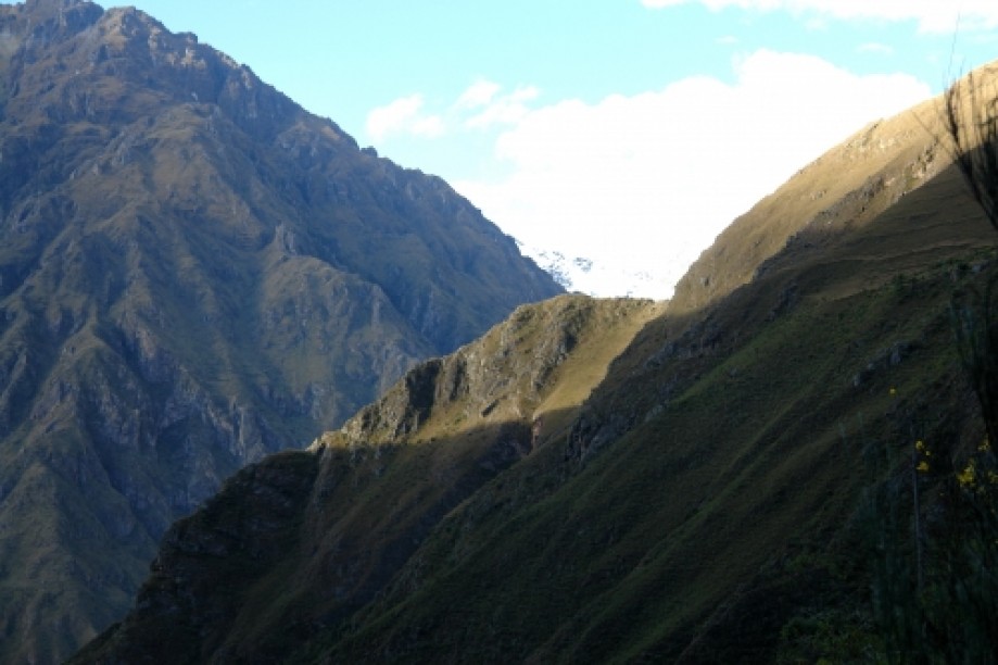
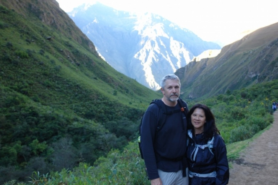
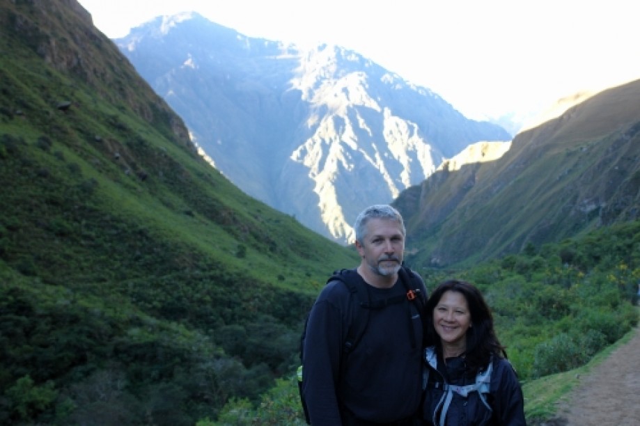
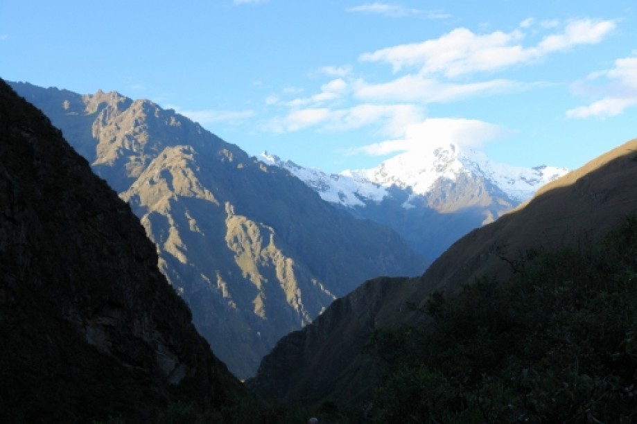
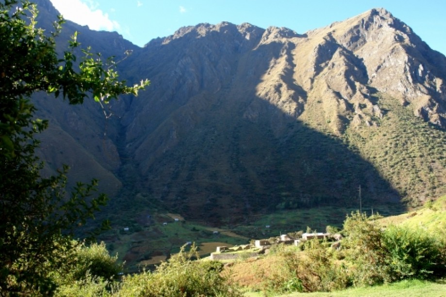
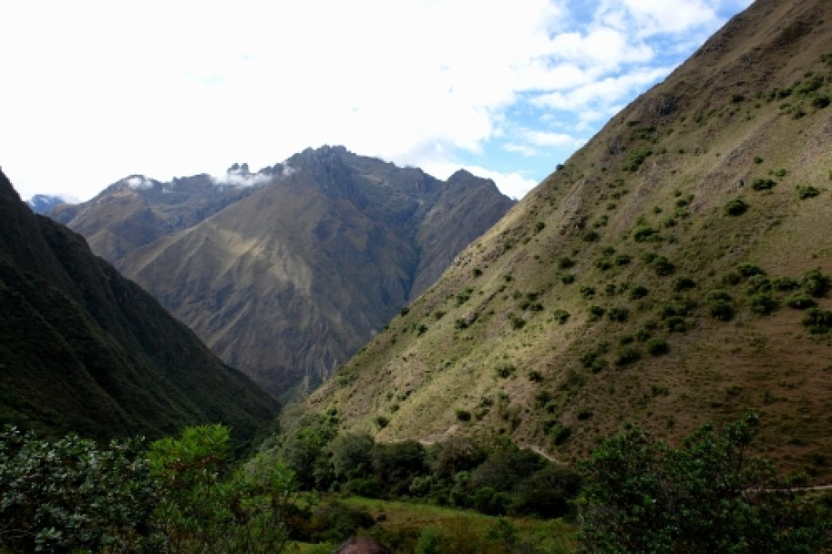
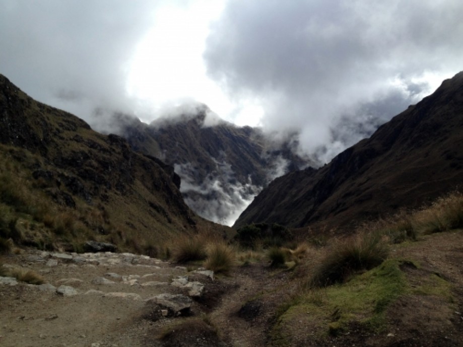
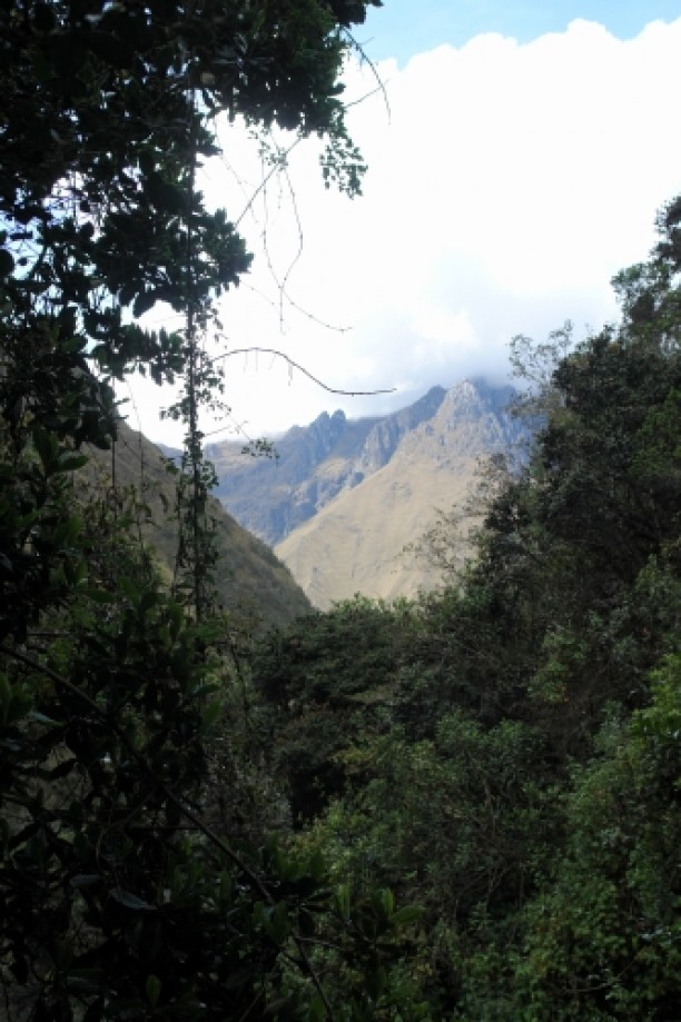
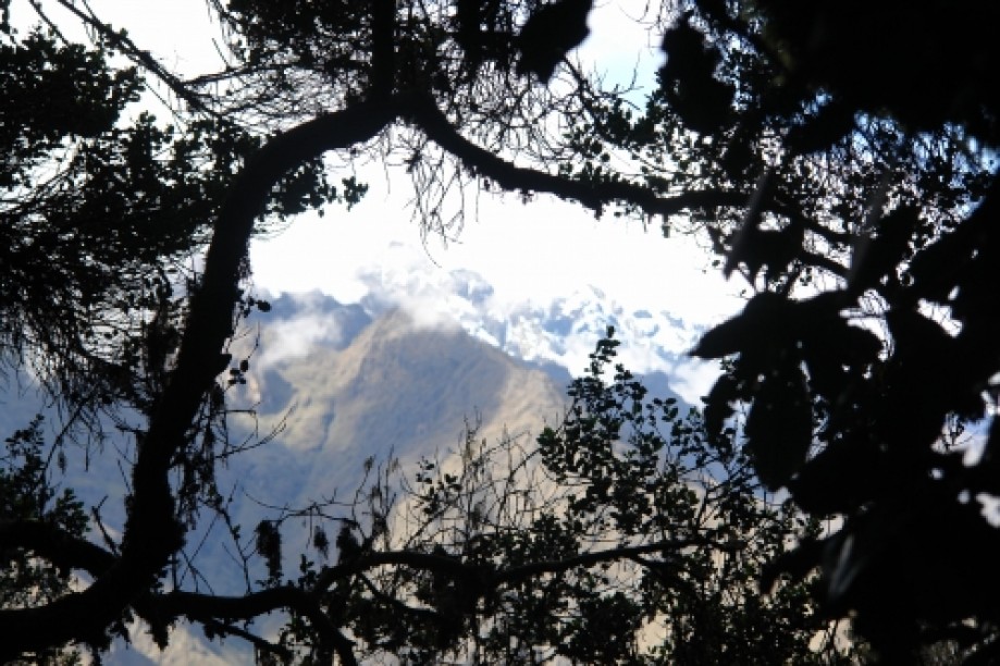
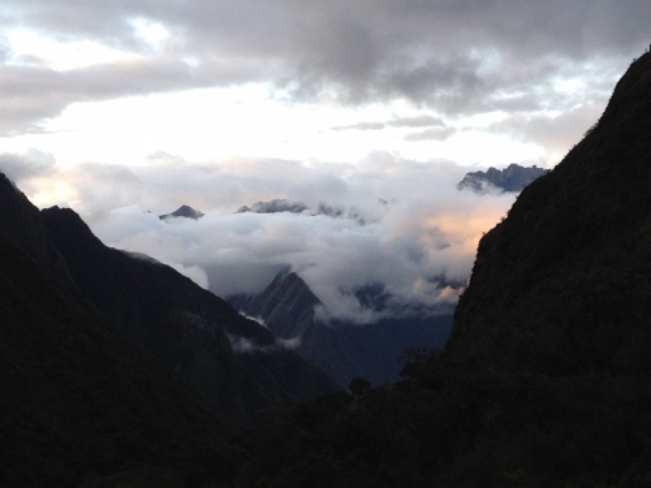
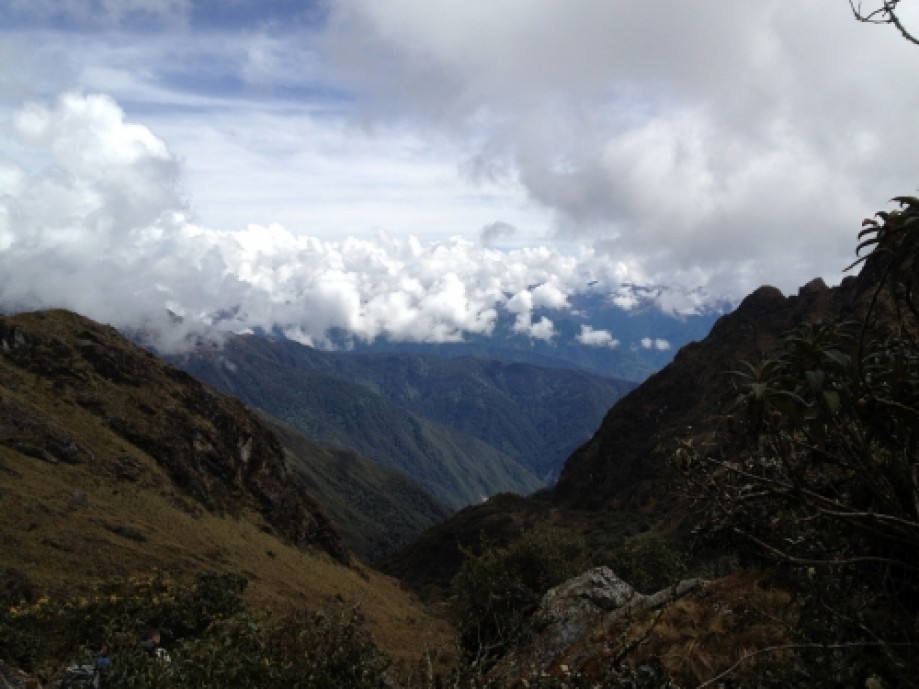
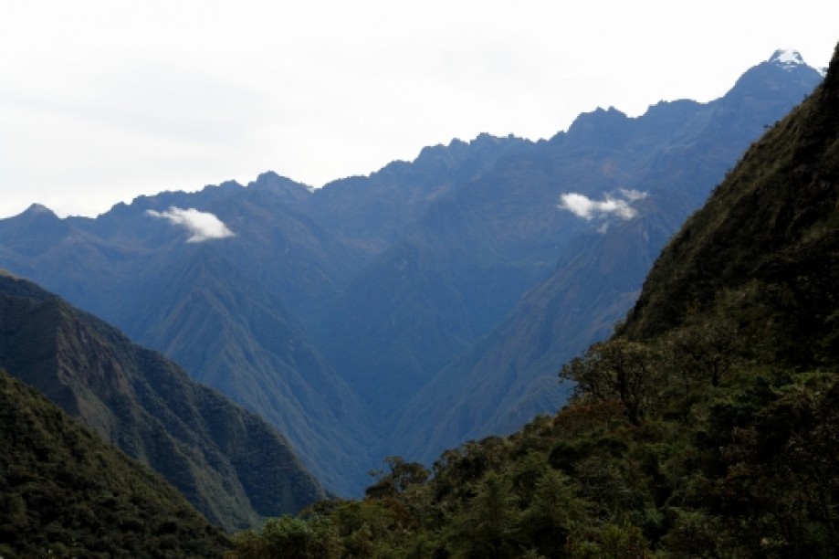
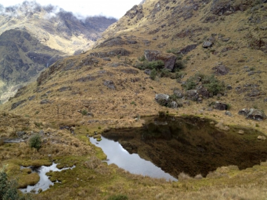
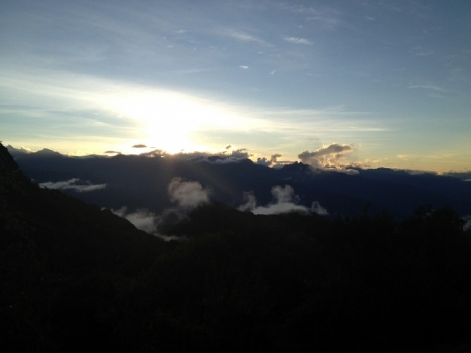
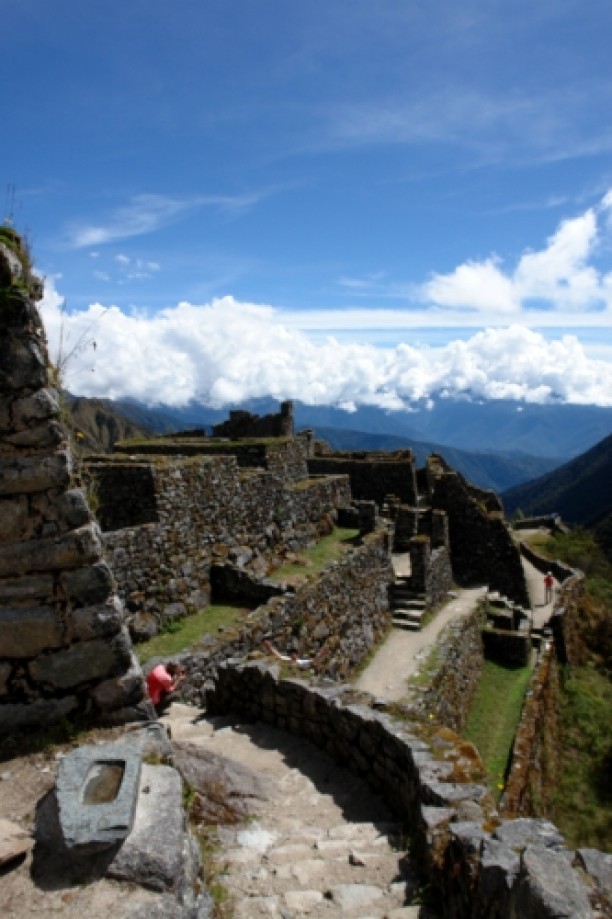
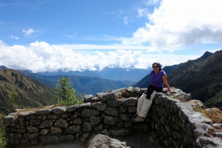
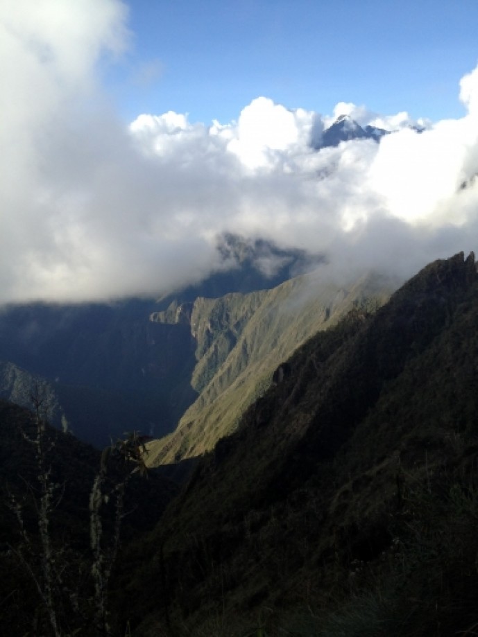
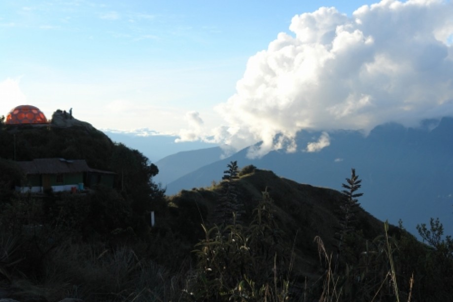
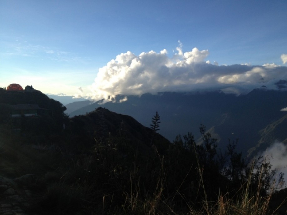
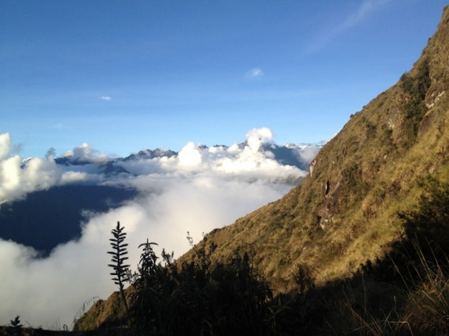
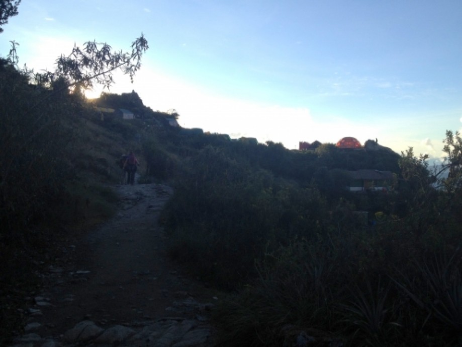
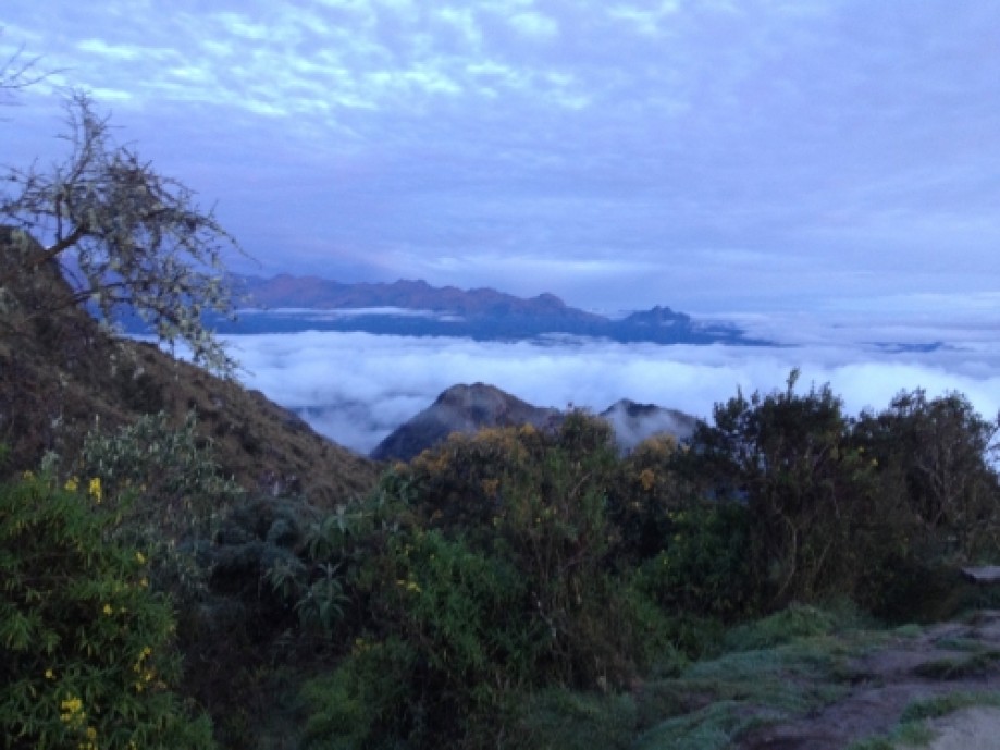
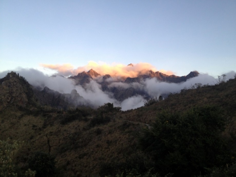
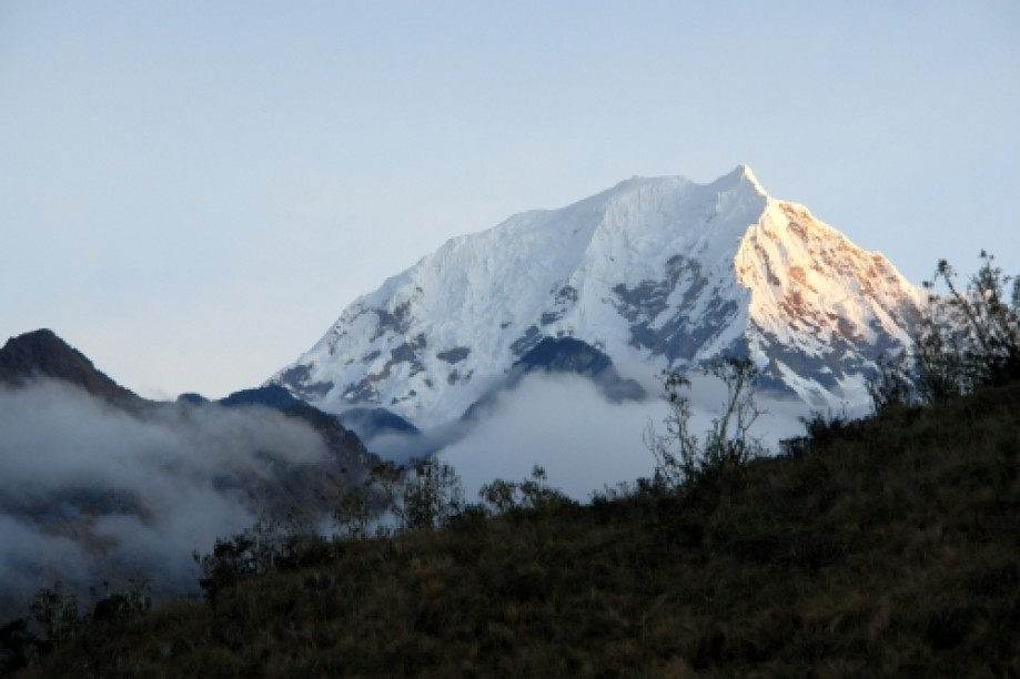
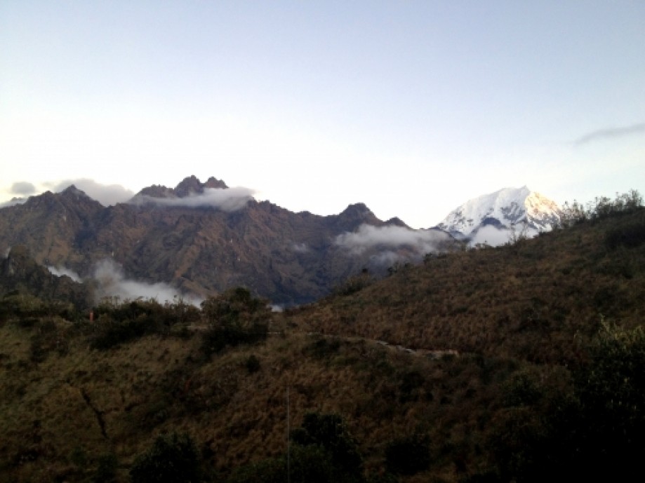
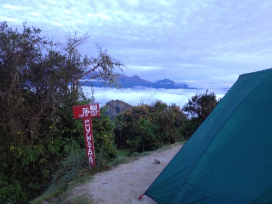
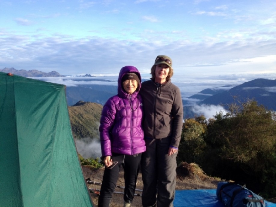
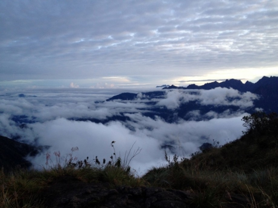
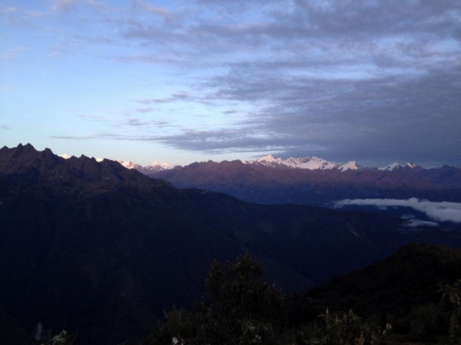
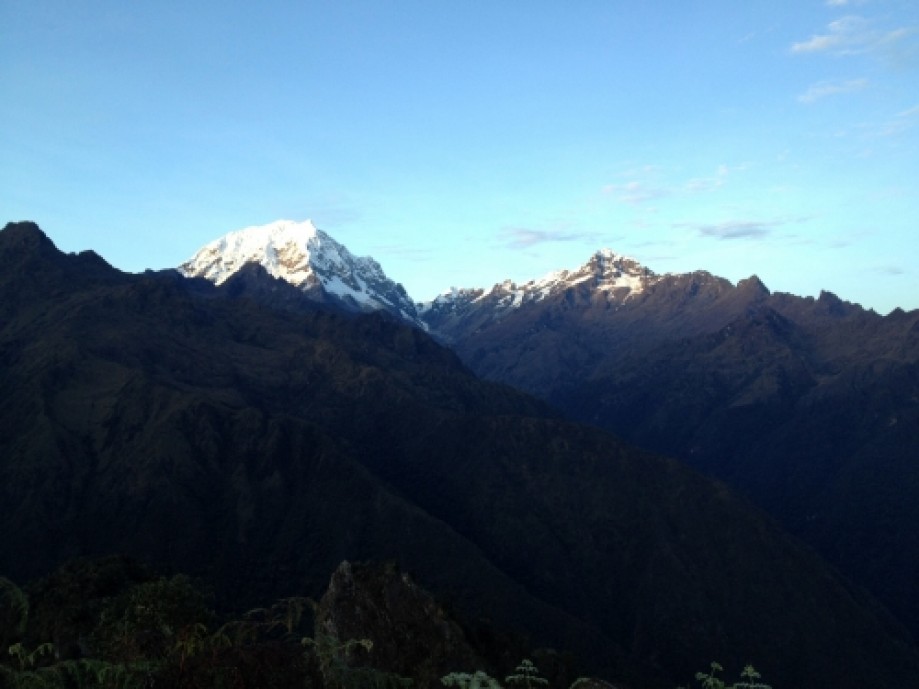
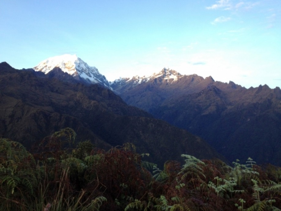
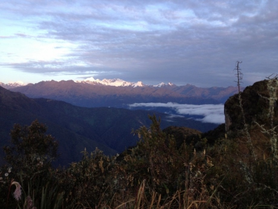
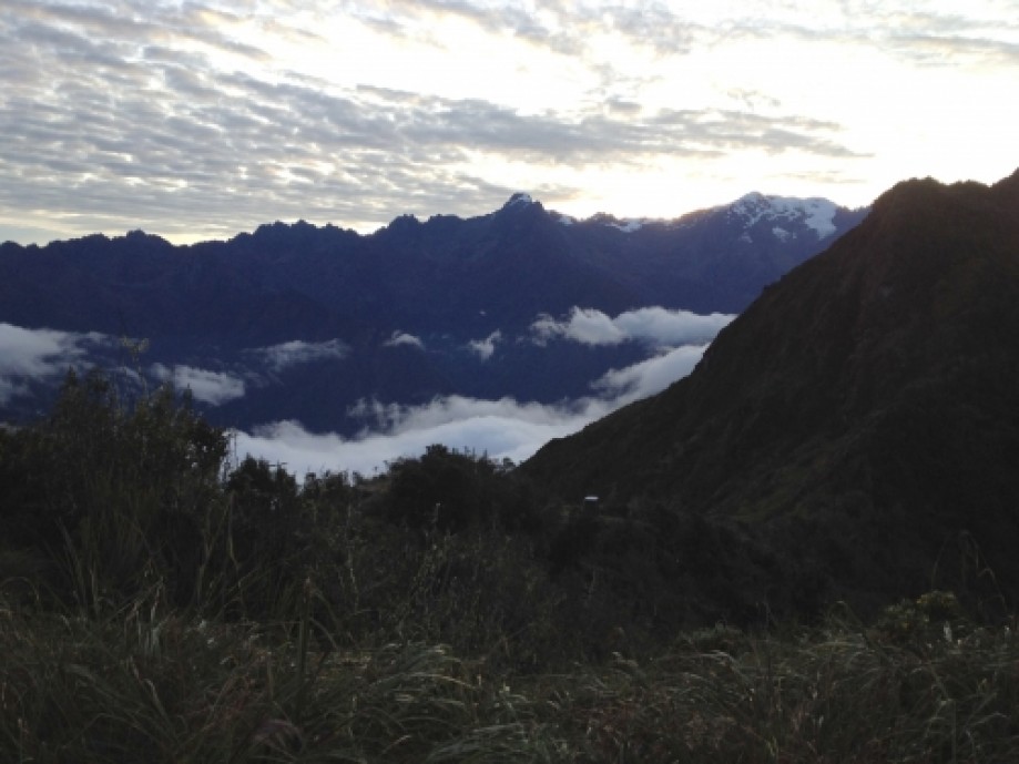
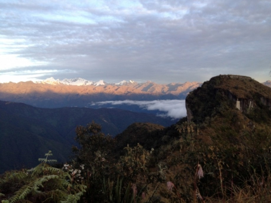
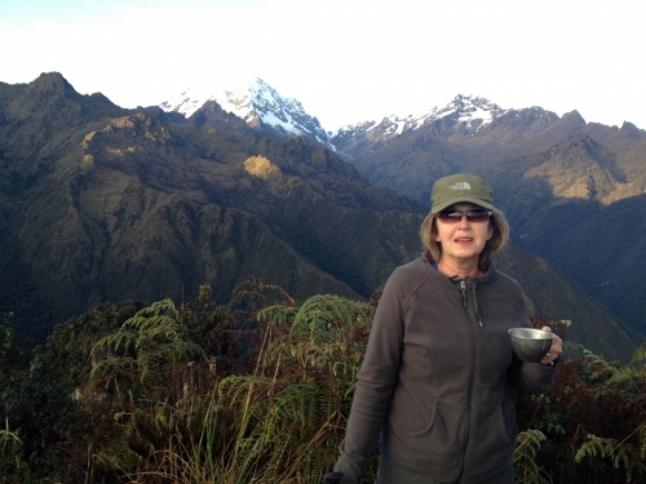
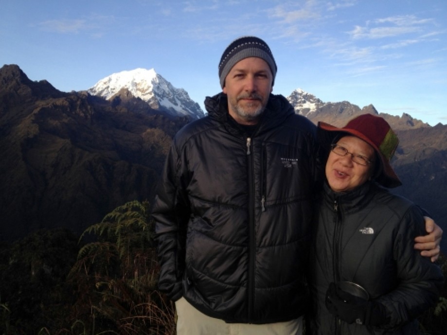
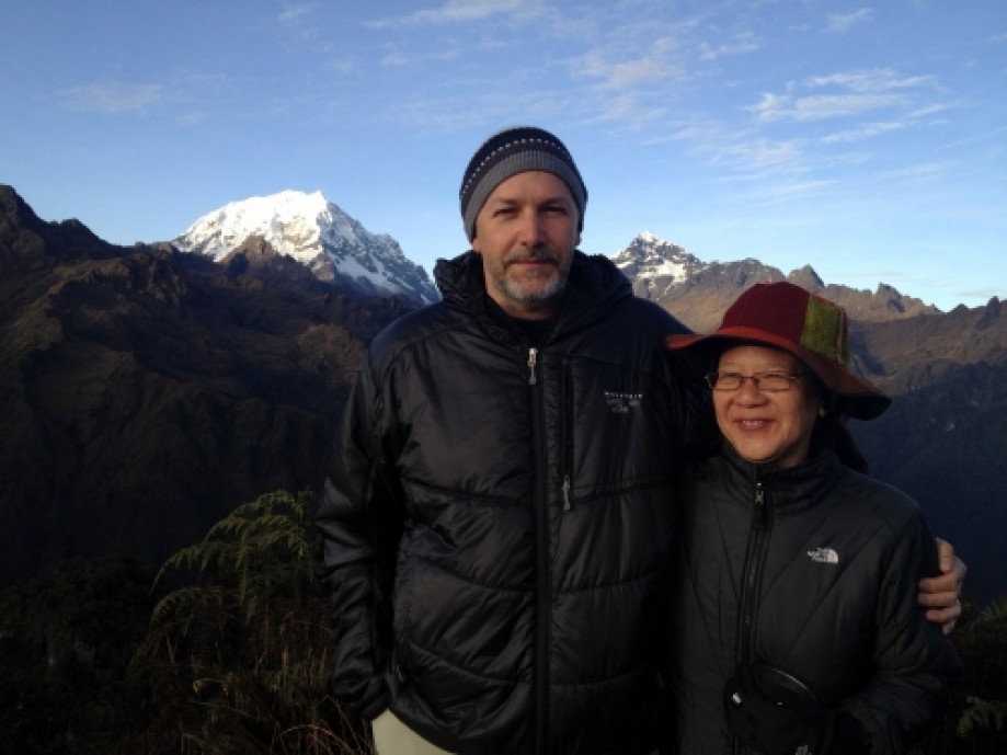
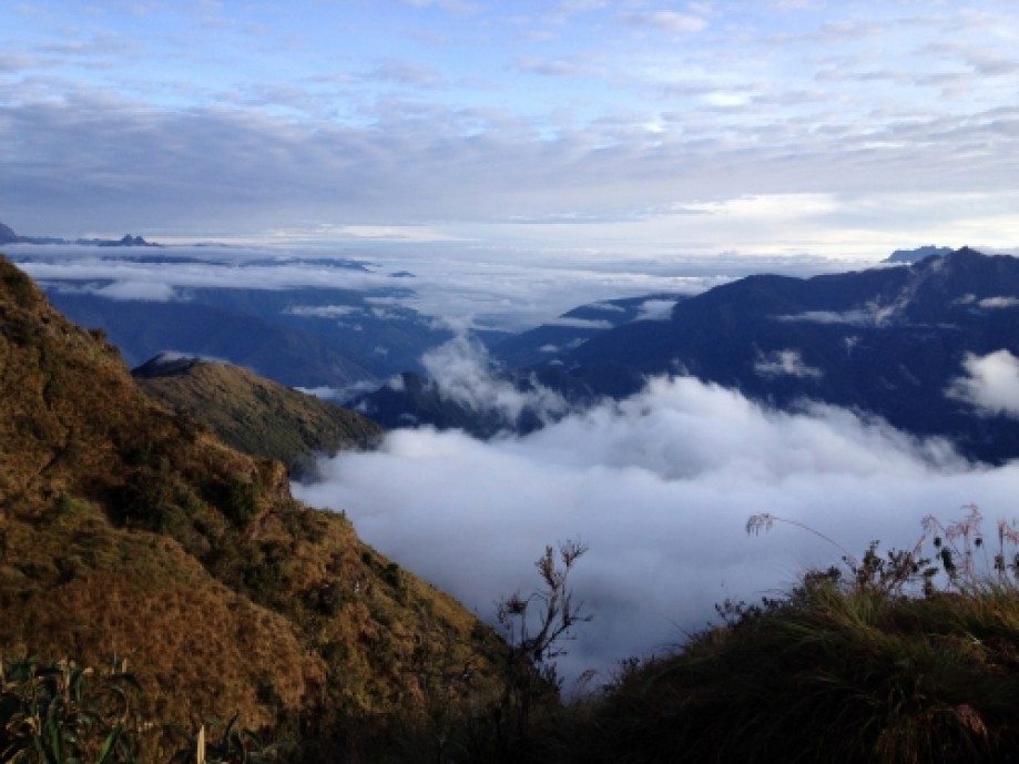
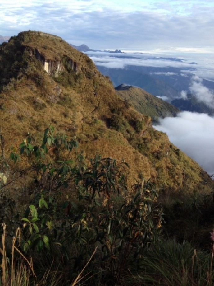
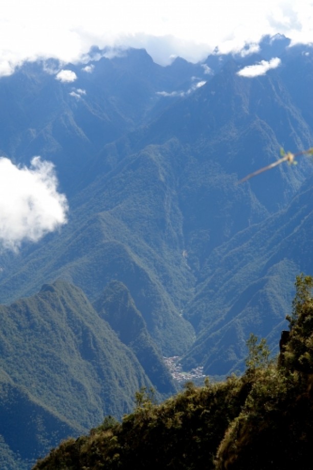
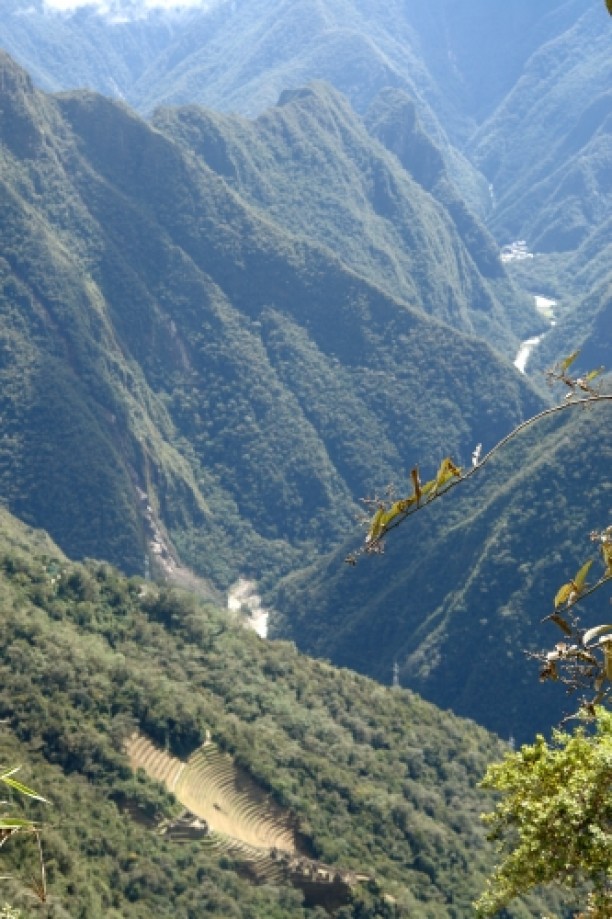
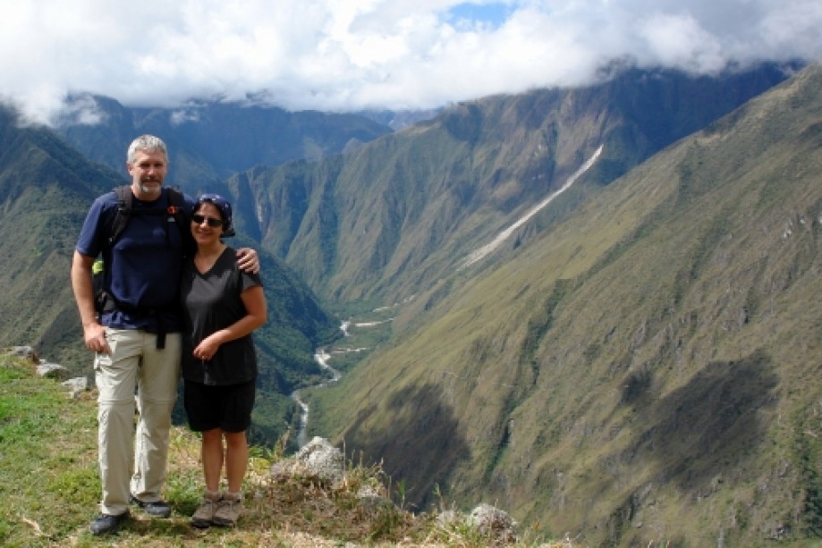
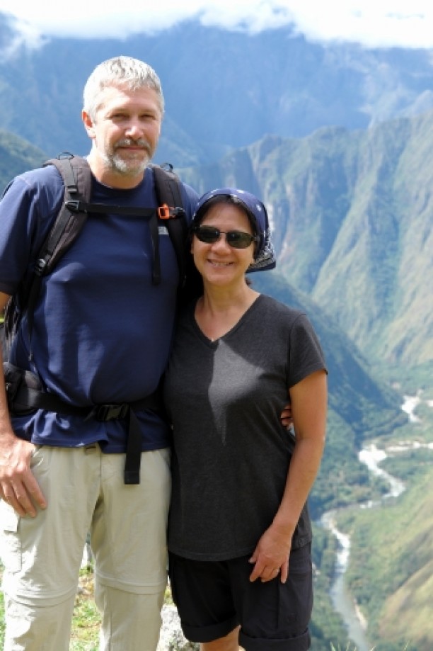
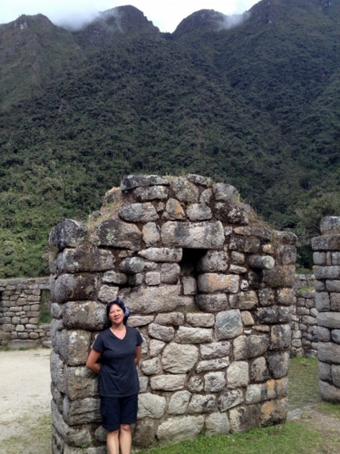
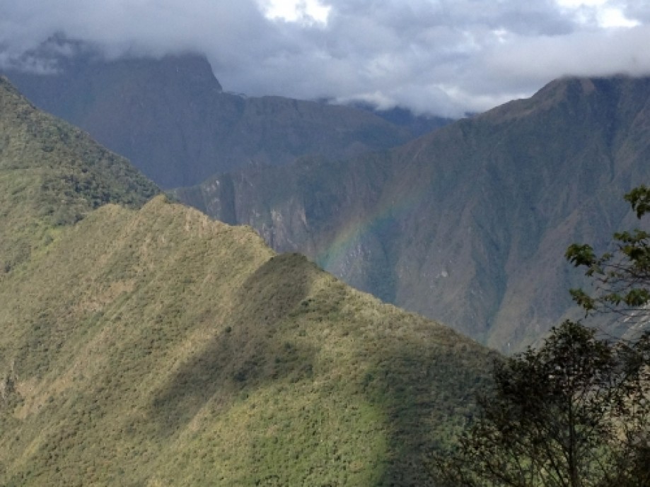
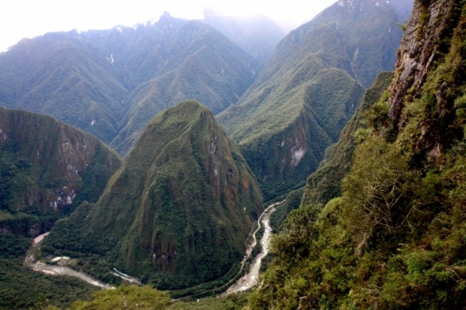
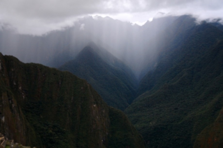
We arrived at Phuyupatamarka for the most amazing campsite and view (12,299 ft.)! We could see two glacier covered mountain peaks: Veronica at 18,872 ft. to the east, in the Urumbamba range we had been seeing along the trail, and Salkantay (the “male” mountain at 20,581 ft.) to the south. The legend has it that there are three mountains guarding Cuzco (Cuzco being the navel of the world) with the third being like a “brother” to Salkantay, named Ausengate.
Claudia told a nice story about two cousins traveling to Salkantay to ask for help. The moral being that the mountain will give you just what you need, but not more.
Jairo gave us a tour of the beautiful clear night sky and we all saw two shooting stars!
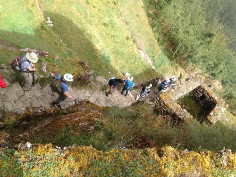
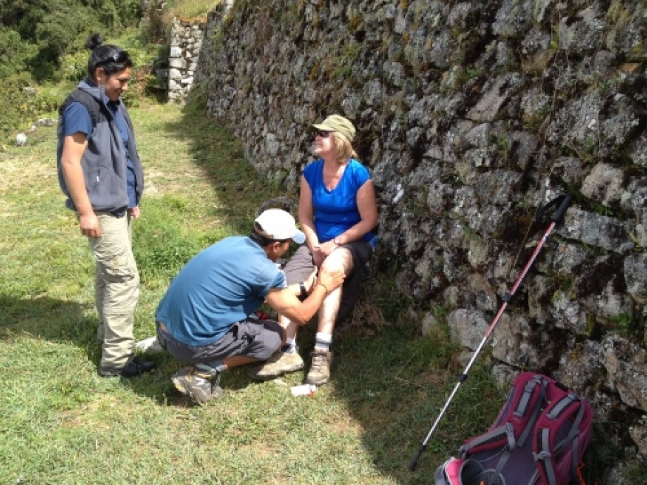
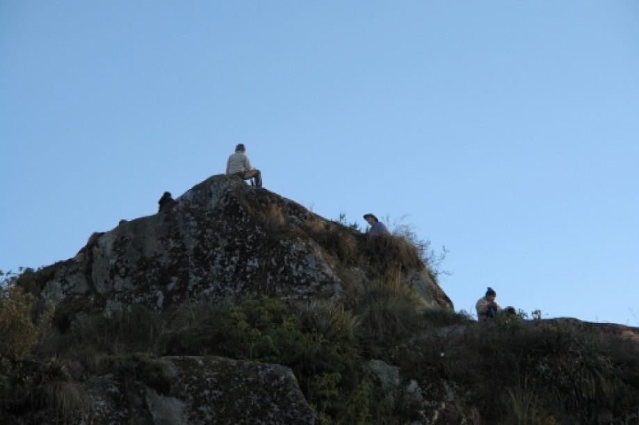
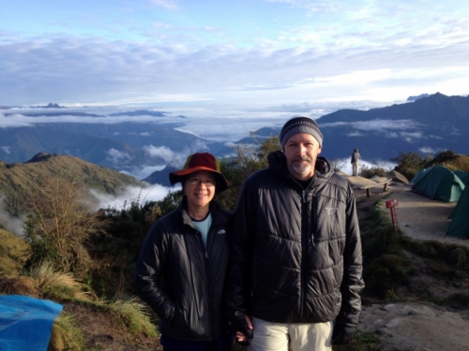
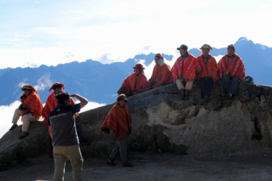
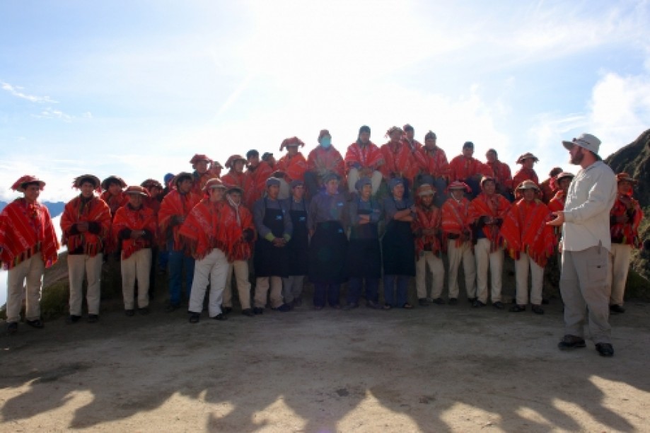
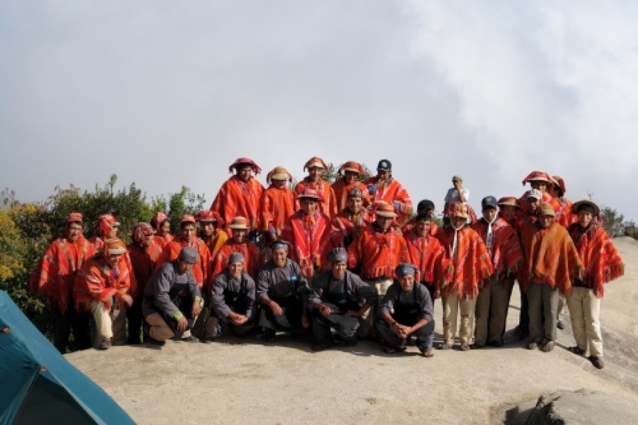
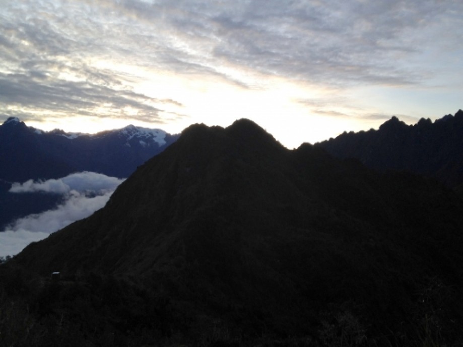
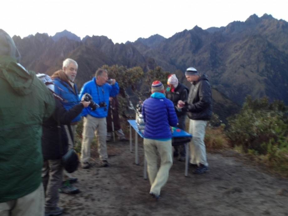
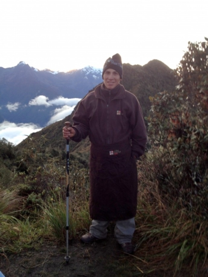
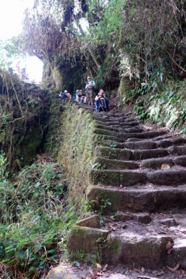
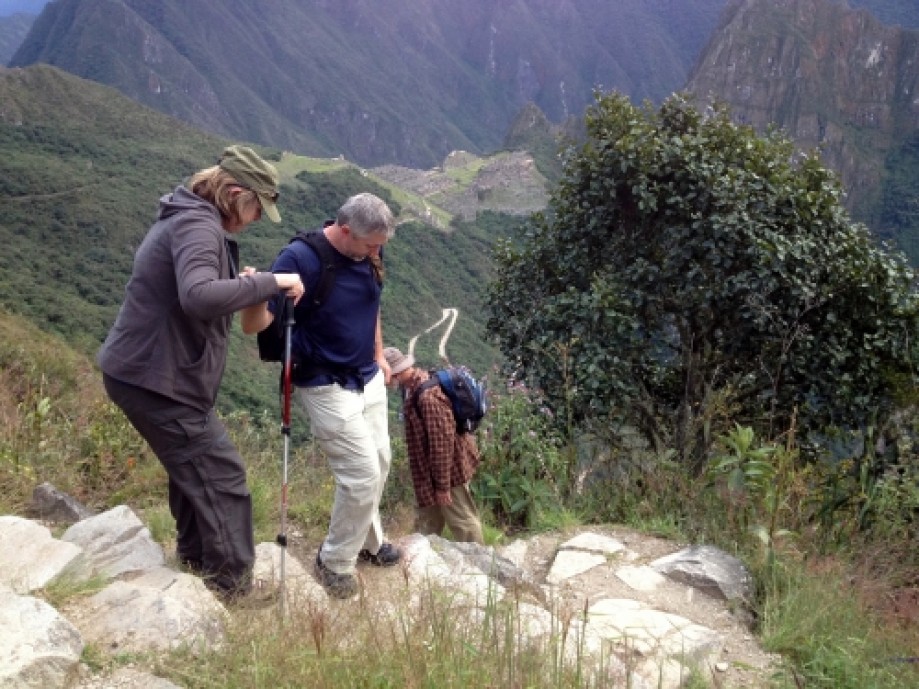
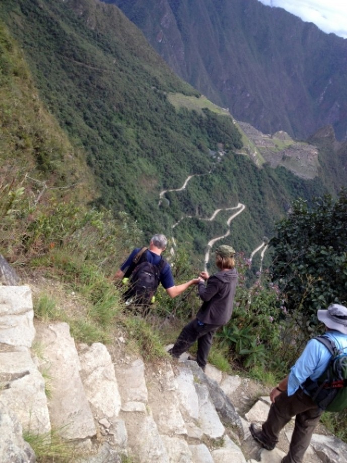
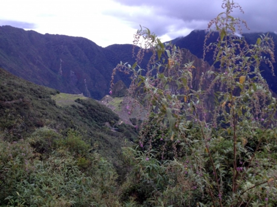
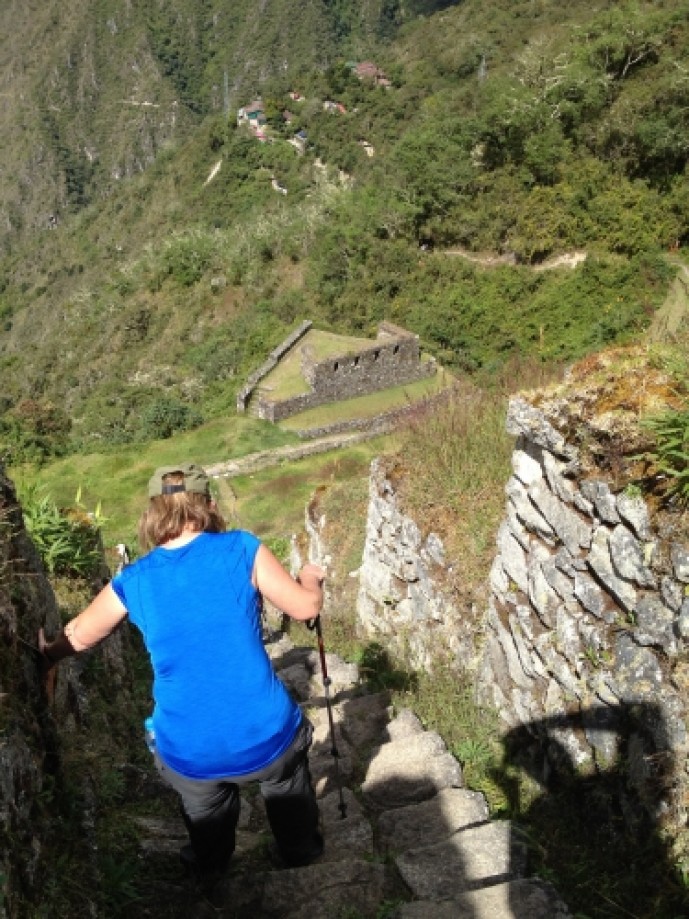
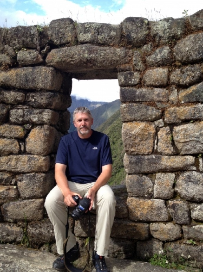
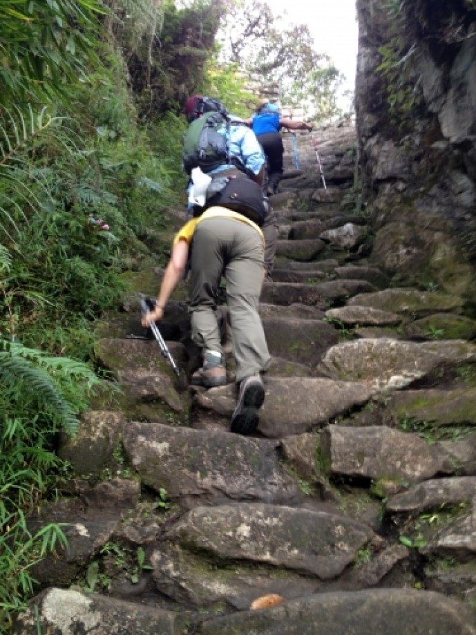
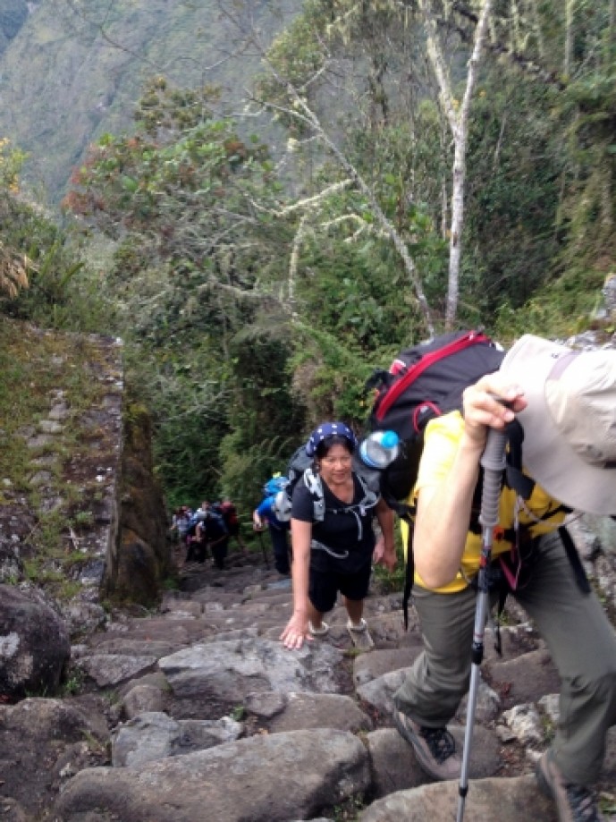
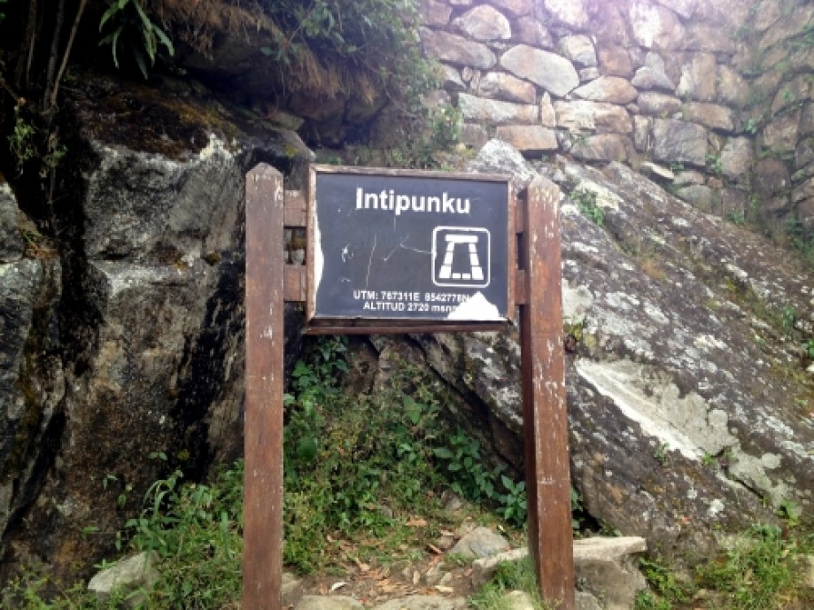
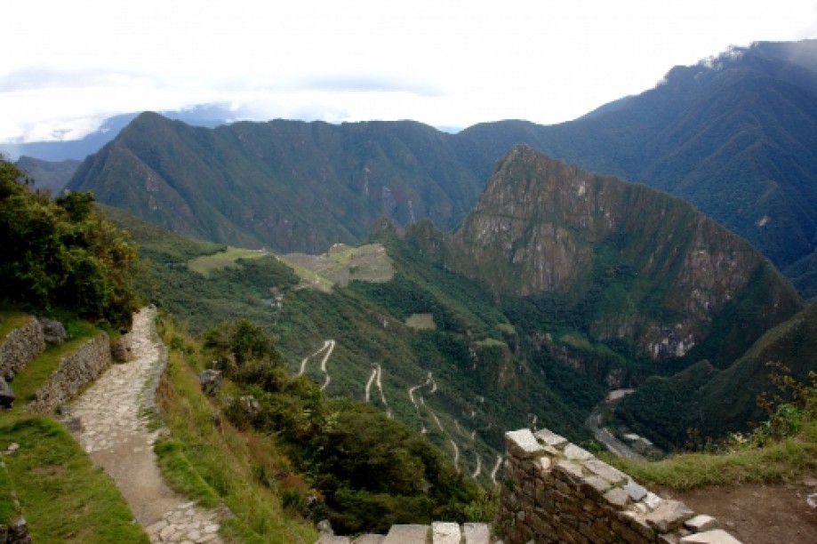
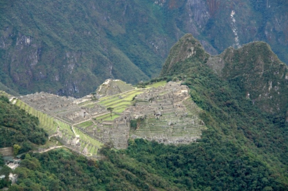
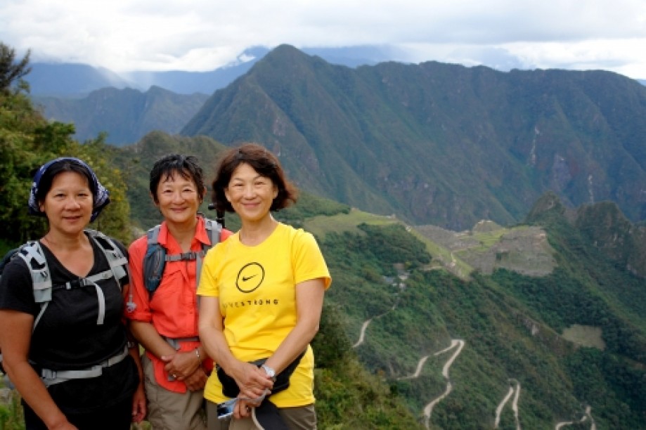
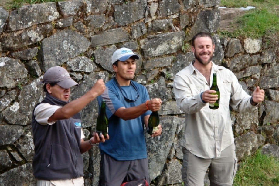
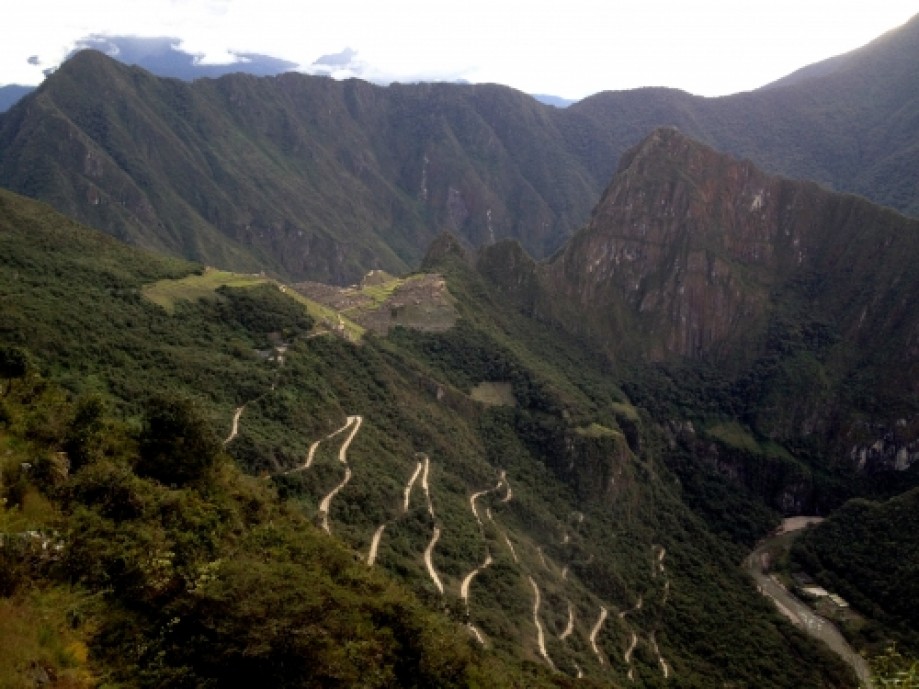
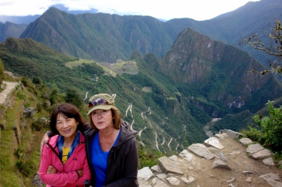
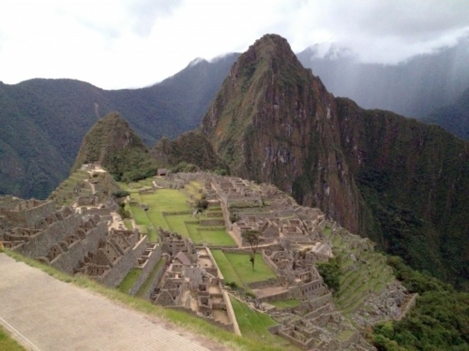
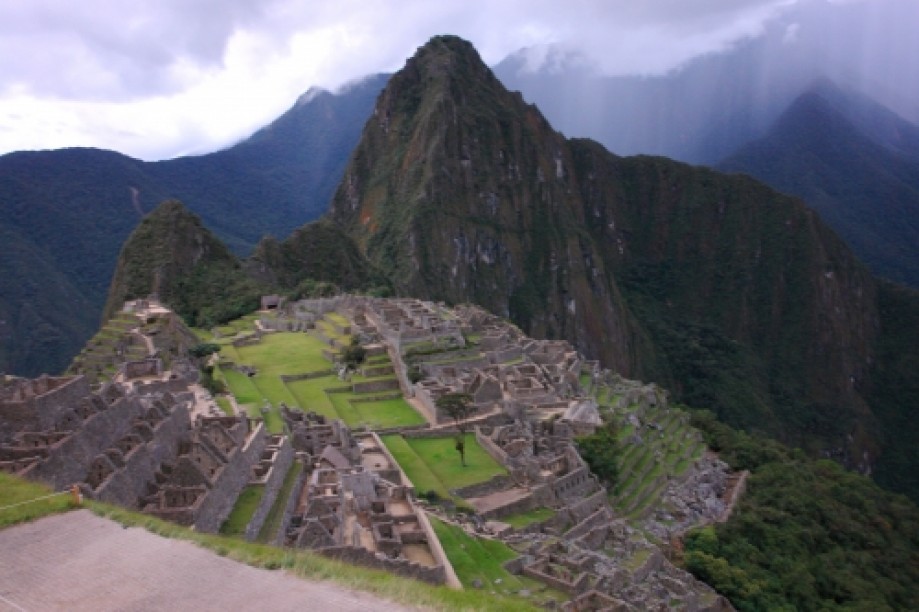
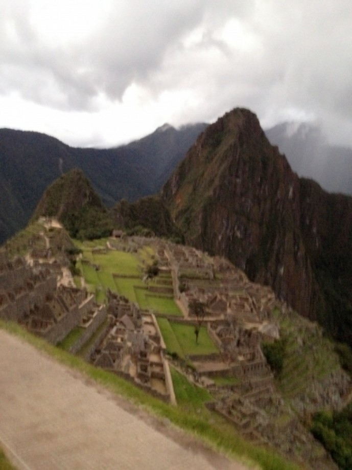
Camp at Phuyupatamarka is spectacular. Overlooks Mountains and glaciers all around. Tents over the clouds. Gorgeous.Day 4:Wake up at 5 and hike up to a plateau to see the sun rise over the Veronica range (Urubamba) with ice capped ridges to the east, the Salkantay range to the South and Machupicchu in the valley to the north. Hot drinks provided by Claudio and other porters on the ridge. We took a moment to soak in that moment and will try not to forget that peace. After breakfast we had a little ceremony to thank the porters for all their help. They all come from the same village and wear the same type of clothing. They will leave us after lunch and head back to their homes until the next trek, which may be in a few days, or in some cases, the next day. They have been invaluable and we are very appreciative! Hiked down to Winayhuayna (“forever young” named after an orchid of this name found around here), and visited this beautiful site after lunch. Unfortunately Yvonne's knee was acting up since the day before so she was moving slowly. Several people appreciated the slow pace though, myself included! Our guide Jairo wrapped her knee and Claudia carried her pack to lunch, and Piero helped her the rest of the way to the Sun Gate.The hike through the cloud forest was up and down until we approached the "gringo killers" climbing to the sun gate (Inti Punku). We rested at a small tambo (Incan “b&b”) first, then literally used all fours to climb the 50 steps of the "gringo killers" to reach the gate entrance overlooking Machu Picchu. The view in late afternoon of Machu Picchu through the Sun Gate was wonderful about 4pm. The tourists were gone and it was just us. Piero , Jairo and Darwin brought champagne and we toasted in little plastic dixie cups, after offering some first to Mother Earth, of course. Said goodbye to Jairo Bocangel and Darwin Mendoza, two of our guides. Will miss them.Bus ride to Aguas Caliente and a ..Hot shower!!! Then pisco sours!Bought a compact flash card to take more pictures, and then slept in a real bed!!
Go there!
Day 1: We checked in at the control station at Kilometer 82 of the Inca Trail. Had to stand in line for some time while they verified that everyone had a permit to hike the trail. Then we crossed the bridge over the Urubamba river, and off we went.
Rain came off and on until midday but never too much. We had our morning snack at a little “village” with a “baño” (we had to pay 1 Peruvian Sol to use the "facilities").
We had lunch in the rain in our cool orange “dining tent”, and learned how to use our portable hand washing stations and pottie tents. We learned to appreciate our porters! They always had lunch ready for us around midday and our tents set up when we got to camp. They would pass us along the trail carrying their heavy loads and on their feet they only wore rubber sandals. As they passed we would say "Sulpayki!", which is Quechuan for thank you. We camped along a rushing river near the Kusichaca bridge. The skies were beautiful and clear and saw two shooting stars.Day 2:
Wake up call with hot (well sort of) water to wash, and a hot drink to your tent. Kinda like room service?
Hiked up nearly 4000 ft to Abra Warmiwanusqa (“Dead Woman’s Pass”). (Most likely named by a man.)
A strenuous hike to say the least!! Took 4 hours to lunch then two more to the pass. Kathy, Yvonne and I were the last up with Jairo looking out for us. (Applause greeted us as we reached the summit – haha). It took another 2 hours down with Claudia guiding us to camp just before dusk.
This was the hardest day they said, and we believe it. Another cold and beautiful night for stars along a rushing stream. Saw a large “Giant hummingbird” (the largest hummingbird and only in the Andes), llamas, lots of bromeliads, royal salvias, and unca trees. Learned "kusi" which is Quechuan for "happy" and "ayi" for "yes". "Wasi" is "home" or "house".
Our porter cooks made us Popcorn before dinner!Day 3:
Passed through Abra Runkurakay (the second high pass on the trail at about 13,000 ft (the first yesterday was at 14,000 ft) and snacked at the pass. Cairns abound at the pass but here they are an offering of thanks to Mother Earth (Pachamama).
Another beautiful day! Had lunch watching llamas play fighting, and visited Sayaqmarka ruins (means "inaccessible").
Next part of the hike to camp was through a cloud forest and there was bamboo, wild orchids and prehistoric ferns. The trail goes through some” tunnels” here as well. Several waterfalls could be seen on the mountainsides as we hiked.
We arrived at Phuyupatamarka for the most amazing campsite and view (12,299 ft.)! We could see two glacier covered mountain peaks: Veronica at 18,872 ft. to the east, in the Urumbamba range we had been seeing along the trail, and Salkantay (the “male” mountain at 20,581 ft.) to the south. The legend has it that there are three mountains guarding Cuzco (Cuzco being the navel of the world) with the third being like a “brother” to Salkantay, named Ausengate.
Claudia told a nice story about two cousins traveling to Salkantay to ask for help. The moral being that the mountain will give you just what you need, but not more.
Jairo gave us a tour of the beautiful clear night sky and we all saw two shooting stars!
Camp at Phuyupatamarka is spectacular. Overlooks Mountains and glaciers all around. Tents over the clouds. Gorgeous.Day 4:Wake up at 5 and hike up to a plateau to see the sun rise over the Veronica range (Urubamba) with ice capped ridges to the east, the Salkantay range to the South and Machupicchu in the valley to the north. Hot drinks provided by Claudio and other porters on the ridge. We took a moment to soak in that moment and will try not to forget that peace. After breakfast we had a little ceremony to thank the porters for all their help. They all come from the same village and wear the same type of clothing. They will leave us after lunch and head back to their homes until the next trek, which may be in a few days, or in some cases, the next day. They have been invaluable and we are very appreciative! Hiked down to Winayhuayna (“forever young” named after an orchid of this name found around here), and visited this beautiful site after lunch. Unfortunately Yvonne's knee was acting up since the day before so she was moving slowly. Several people appreciated the slow pace though, myself included! Our guide Jairo wrapped her knee and Claudia carried her pack to lunch, and Piero helped her the rest of the way to the Sun Gate.The hike through the cloud forest was up and down until we approached the "gringo killers" climbing to the sun gate (Inti Punku). We rested at a small tambo (Incan “b&b”) first, then literally used all fours to climb the 50 steps of the "gringo killers" to reach the gate entrance overlooking Machu Picchu. The view in late afternoon of Machu Picchu through the Sun Gate was wonderful about 4pm. The tourists were gone and it was just us. Piero , Jairo and Darwin brought champagne and we toasted in little plastic dixie cups, after offering some first to Mother Earth, of course. Said goodbye to Jairo Bocangel and Darwin Mendoza, two of our guides. Will miss them.Bus ride to Aguas Caliente and a ..Hot shower!!! Then pisco sours!Bought a compact flash card to take more pictures, and then slept in a real bed!!
Go there!